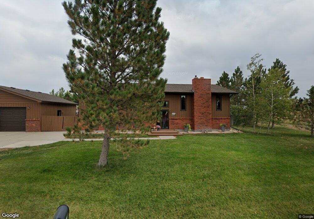
7033 Bronco Rd Shepherd, MT 59079
Estimated Value: $403,599 - $423,000
3
Beds
2
Baths
1,456
Sq Ft
$284/Sq Ft
Est. Value
About This Home
This home is located at 7033 Bronco Rd, Shepherd, MT 59079 and is currently estimated at $412,900, approximately $283 per square foot. 7033 Bronco Rd is a home located in Yellowstone County with nearby schools including Shepherd Elementary School, Shepherd Middle School, and Shepherd High School.
Create a Home Valuation Report for This Property
The Home Valuation Report is an in-depth analysis detailing your home's value as well as a comparison with similar homes in the area
Tax History
| Year | Tax Paid | Tax Assessment Tax Assessment Total Assessment is a certain percentage of the fair market value that is determined by local assessors to be the total taxable value of land and additions on the property. | Land | Improvement |
|---|---|---|---|---|
| 2025 | $3,251 | $421,600 | $64,500 | $357,100 |
| 2024 | $3,251 | $377,200 | $52,700 | $324,500 |
| 2023 | $3,307 | $377,200 | $52,700 | $324,500 |
| 2022 | $2,593 | $275,700 | $0 | $0 |
| 2021 | $2,714 | $275,700 | $0 | $0 |
| 2020 | $2,623 | $257,300 | $0 | $0 |
| 2019 | $2,177 | $257,300 | $0 | $0 |
| 2018 | $2,211 | $246,100 | $0 | $0 |
| 2017 | $2,097 | $237,300 | $0 | $0 |
| 2016 | $1,988 | $234,800 | $0 | $0 |
| 2015 | $1,978 | $234,800 | $0 | $0 |
| 2014 | $1,605 | $101,601 | $0 | $0 |
Source: Public Records
Map
Nearby Homes
- 5430 Cerkoney Ln
- 0 Shepherd Road Lot Shepherd Rd
- 0 SHepherd Road lot Shepherd Rd
- 8020 Wade St
- 5652 Bengston Rd
- 7306 Kendra Lynn Dr
- 6447 US Highway 312
- 3863 Glenn Edward Rd
- L5B4 Trumbo Cir
- L4B4 Trumbo Cir
- L3B4 Trumbo Cir
- 3835 Nellie Christine Dr
- L2B4 True Grit St
- L1B4 True Grit St
- L12B3 Molly Dr
- L11B3 High Noon Dr
- L13B2 High Noon Dr
- L13B3 Molly Dr
- L16B3 True Grit St
- L15B3 True Grit St
- 7026 Bronco Rd
- 7103 Bronco Rd
- 5406 Cerkoney Ln
- 7042 Bronco Rd
- 7110 Bronco Rd
- 7117 Bronco Rd
- 0 Bronco Rd
- 5420 Cerkoney Ln
- 5303 Percheron Rd
- 5308 Percheron Rd
- 7043 Mustang Rd
- 7131 Bronco Rd
- 7105 Mustang Rd
- 7130 Bronco Rd
- 5240 Percheron Rd
- 7028 Mustang Rd
- 7119 Mustang Rd
- 5358 Yeoman Rd
- 5460 Cerkoney Rd
- 7042 Mustang Rd
Your Personal Tour Guide
Ask me questions while you tour the home.