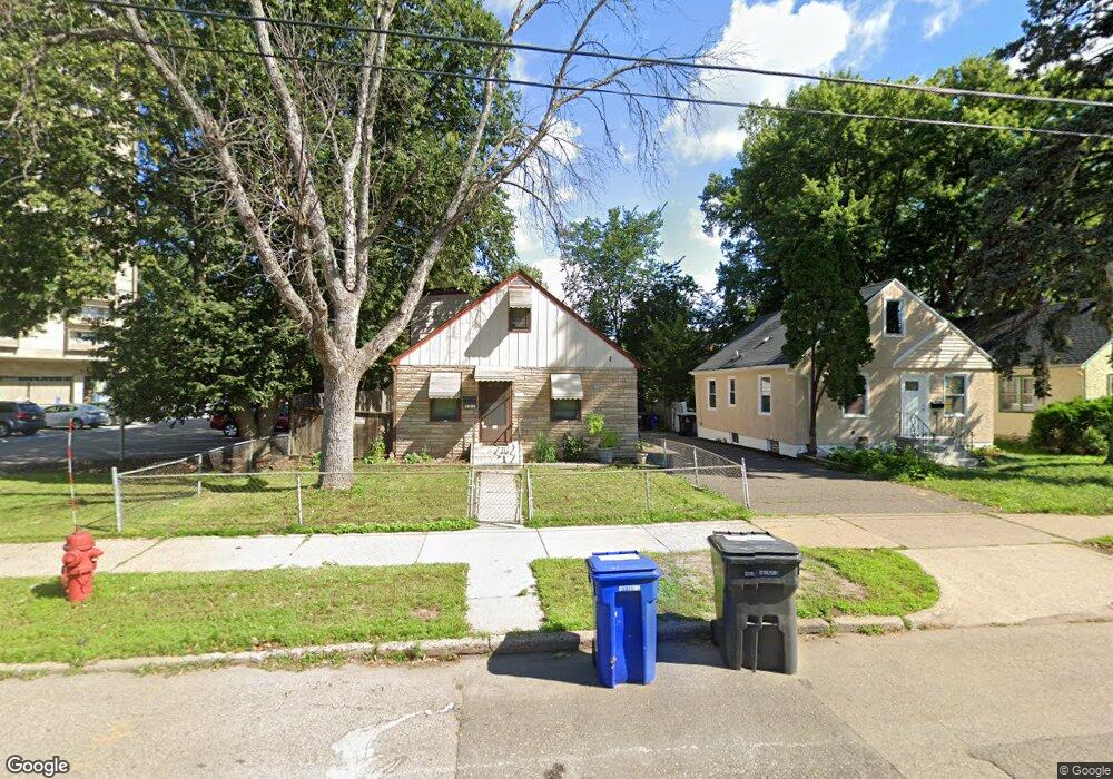
705 Front Ave Saint Paul, MN 55103
Como Park NeighborhoodEstimated Value: $265,000 - $312,000
4
Beds
2
Baths
658
Sq Ft
$446/Sq Ft
Est. Value
About This Home
This home is located at 705 Front Ave, Saint Paul, MN 55103 and is currently estimated at $293,172, approximately $445 per square foot. 705 Front Ave is a home located in Ramsey County with nearby schools including Como Park Elementary School, Murray Middle School, and Como Park Senior High School.
Ownership History
Date
Name
Owned For
Owner Type
Purchase Details
Closed on
Aug 22, 2017
Sold by
Raymond Michal and Raymond Laura
Bought by
Anderson Erwin
Current Estimated Value
Home Financials for this Owner
Home Financials are based on the most recent Mortgage that was taken out on this home.
Original Mortgage
$186,558
Outstanding Balance
$155,668
Interest Rate
3.96%
Mortgage Type
FHA
Estimated Equity
$137,504
Purchase Details
Closed on
Jul 15, 2002
Sold by
Limoseth James K and Limoseth Donna J
Bought by
Raymond Ii Michael
Create a Home Valuation Report for This Property
The Home Valuation Report is an in-depth analysis detailing your home's value as well as a comparison with similar homes in the area
Home Values in the Area
Average Home Value in this Area
Purchase History
| Date | Buyer | Sale Price | Title Company |
|---|---|---|---|
| Anderson Erwin | $190,000 | Affinity Plus Title Co | |
| Raymond Ii Michael | $168,900 | -- |
Source: Public Records
Mortgage History
| Date | Status | Borrower | Loan Amount |
|---|---|---|---|
| Open | Anderson Erwin | $186,558 |
Source: Public Records
Tax History
| Year | Tax Paid | Tax Assessment Tax Assessment Total Assessment is a certain percentage of the fair market value that is determined by local assessors to be the total taxable value of land and additions on the property. | Land | Improvement |
|---|---|---|---|---|
| 2025 | $4,930 | $274,400 | $35,000 | $239,400 |
| 2023 | $4,930 | $255,600 | $35,000 | $220,600 |
| 2022 | $4,158 | $259,900 | $35,000 | $224,900 |
| 2021 | $4,148 | $213,100 | $35,000 | $178,100 |
| 2020 | $4,046 | $218,400 | $35,000 | $183,400 |
| 2019 | $4,040 | $198,500 | $35,000 | $163,500 |
| 2018 | $3,294 | $195,400 | $35,000 | $160,400 |
| 2017 | $1,958 | $142,400 | $28,000 | $114,400 |
| 2016 | $1,896 | $0 | $0 | $0 |
| 2015 | $1,982 | $134,900 | $28,000 | $106,900 |
| 2014 | $1,666 | $0 | $0 | $0 |
Source: Public Records
Map
Nearby Homes
- 352 Como Ave
- 593 Front Ave
- 1048 Dale St N
- 989 Barrett St
- 1049 Kent St
- 951 Front Ave
- 1104 MacKubin St
- 469 Como Ave
- 671 Van Buren Ave
- 751 Van Buren Ave
- 1094 Argyle St
- 952 Western Ave N
- 644 Dale St N
- 547 Blair Ave
- 834 Blair Ave
- 827 Lafond Ave
- 366 Topping St
- 1197 Como Blvd W
- 1300 Schletti St
- 675 Edmund Ave
- 697 Front Ave
- 693 Front Ave
- 689 Front Ave
- 685 Front Ave
- 681 Front Ave
- 981 St Albans St N Unit 301
- 981 St Albans St N Unit 103
- 995 St Albans St N Unit 204
- 995 St Albans St N Unit 203
- 995 St Albans St N Unit 108
- 995 St Albans St N Unit 307
- 677 Front Ave
- 996 Grotto St N
- 675 Front Ave
- 676 Como Ave
- 671 Front Ave
- 700 Como Ave
- 672 Como Ave
- 1004 Grotto St N
- 668 Como Ave