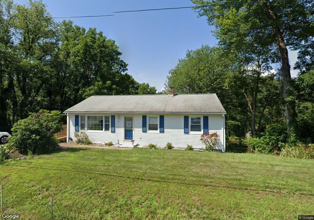
71 S Silver Ln Sunderland, MA 01375
Estimated Value: $389,000 - $484,000
3
Beds
1
Bath
1,008
Sq Ft
$417/Sq Ft
Est. Value
About This Home
This home is located at 71 S Silver Ln, Sunderland, MA 01375 and is currently estimated at $420,021, approximately $416 per square foot. 71 S Silver Ln is a home located in Franklin County with nearby schools including Sunderland Elementary School and Frontier Regional School.
Ownership History
Date
Name
Owned For
Owner Type
Purchase Details
Closed on
Apr 30, 1997
Sold by
Sandoval Rudy S and Sandoval May H
Bought by
Vona Teresa M
Current Estimated Value
Home Financials for this Owner
Home Financials are based on the most recent Mortgage that was taken out on this home.
Original Mortgage
$93,432
Interest Rate
7.85%
Mortgage Type
Purchase Money Mortgage
Purchase Details
Closed on
Aug 2, 1993
Sold by
Corson Joseph M
Bought by
Sandoval Rudy S and Sandoval May H
Purchase Details
Closed on
Aug 1, 1990
Sold by
Hassan Kamel R
Bought by
Corson Joseph M
Create a Home Valuation Report for This Property
The Home Valuation Report is an in-depth analysis detailing your home's value as well as a comparison with similar homes in the area
Home Values in the Area
Average Home Value in this Area
Purchase History
| Date | Buyer | Sale Price | Title Company |
|---|---|---|---|
| Vona Teresa M | $98,000 | -- | |
| Sandoval Rudy S | $95,000 | -- | |
| Corson Joseph M | $106,000 | -- |
Source: Public Records
Mortgage History
| Date | Status | Borrower | Loan Amount |
|---|---|---|---|
| Open | Corson Joseph M | $91,000 | |
| Closed | Corson Joseph M | $92,740 | |
| Closed | Corson Joseph M | $93,432 |
Source: Public Records
Tax History Compared to Growth
Tax History
| Year | Tax Paid | Tax Assessment Tax Assessment Total Assessment is a certain percentage of the fair market value that is determined by local assessors to be the total taxable value of land and additions on the property. | Land | Improvement |
|---|---|---|---|---|
| 2025 | $39 | $299,100 | $100,200 | $198,900 |
| 2024 | $3,930 | $299,100 | $100,200 | $198,900 |
| 2023 | $3,581 | $279,800 | $91,100 | $188,700 |
| 2022 | $3,577 | $243,300 | $78,100 | $165,200 |
| 2021 | $3,330 | $215,000 | $72,300 | $142,700 |
| 2020 | $3,320 | $215,000 | $72,300 | $142,700 |
| 2019 | $3,219 | $210,000 | $70,300 | $139,700 |
| 2018 | $3,069 | $204,600 | $67,400 | $137,200 |
| 2017 | $2,816 | $196,400 | $67,400 | $129,000 |
| 2016 | $2,818 | $192,200 | $66,100 | $126,100 |
| 2015 | $2,750 | $192,200 | $66,100 | $126,100 |
| 2014 | $2,687 | $192,200 | $66,100 | $126,100 |
Source: Public Records
Map
Nearby Homes
- 146 Old Amherst Rd
- 110 Old Amherst Rd
- 15 S Plain Rd
- 238 N Main St
- 10 Depot Rd
- Lot C Mountain Rd
- Lot A Mountain Rd
- Lot B Mountain Rd
- 15 Crestview Dr
- 33 Eastern Ave
- 73 Depot Rd
- 134 Montague Rd
- 24 Graves St
- 113 Juggler Meadow Rd
- 24 Elm St
- 3 Depot Rd
- 55 Putney Rd
- 13 Capt Lathrop Dr
- 32 Swamp Rd
- Lot 3A-3 Leverett Rd
- 70 S Silver Ln
- 67 S Silver Ln
- 77 S Silver Ln
- 76 S Silver Ln
- 63 S Silver Ln
- 64 S Silver Ln
- 80 S Silver Ln
- 81 S Silver Ln
- 60 S Silver Ln
- 59 S Silver Ln
- 83 S Silver Ln
- 84 S Silver Ln
- 55 S Silver Ln
- 54 S Silver Ln
- 87 S Silver Ln
- 279 Amherst Rd
- 279 Amherst Rd
- 50 S Silver Ln
- 49 S Silver Ln
- Lots 68/69 S Silver Ln