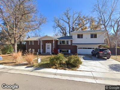
7102 S Davies St Littleton, CO 80120
Heritage NeighborhoodEstimated Value: $742,043 - $801,000
--
Bed
3
Baths
1,976
Sq Ft
$393/Sq Ft
Est. Value
About This Home
This home is located at 7102 S Davies St, Littleton, CO 80120 and is currently estimated at $776,261, approximately $392 per square foot. 7102 S Davies St is a home located in Arapahoe County with nearby schools including Moody Elementary School, Euclid Middle School, and Heritage High School.
Ownership History
Date
Name
Owned For
Owner Type
Purchase Details
Closed on
Jan 14, 2020
Sold by
Dietz Ronald P and Dietz Wanda M
Bought by
The Ron And Wanda Dietz Family Trust
Current Estimated Value
Purchase Details
Closed on
Feb 27, 1990
Sold by
Conversion Arapco
Bought by
Dietz Ronald P Dietz Wanda M
Purchase Details
Closed on
Oct 1, 1979
Sold by
Conversion Arapco
Bought by
Conversion Arapco
Purchase Details
Closed on
Jul 4, 1776
Bought by
Conversion Arapco
Create a Home Valuation Report for This Property
The Home Valuation Report is an in-depth analysis detailing your home's value as well as a comparison with similar homes in the area
Home Values in the Area
Average Home Value in this Area
Purchase History
| Date | Buyer | Sale Price | Title Company |
|---|---|---|---|
| Dietz Ronald P Dietz Wanda M | -- | -- | |
| Conversion Arapco | -- | -- | |
| Conversion Arapco | -- | -- |
Source: Public Records
Mortgage History
| Date | Status | Borrower | Loan Amount |
|---|---|---|---|
| Open | Dietz Ronald P | $185,000 | |
| Closed | Dietz Ronald P | $14,000 | |
| Closed | Dietz Ronald P | $135,500 | |
| Closed | Dietz Ronald P | $30,000 |
Source: Public Records
Tax History Compared to Growth
Tax History
| Year | Tax Paid | Tax Assessment Tax Assessment Total Assessment is a certain percentage of the fair market value that is determined by local assessors to be the total taxable value of land and additions on the property. | Land | Improvement |
|---|---|---|---|---|
| 2024 | $3,826 | $46,712 | -- | -- |
| 2023 | $3,826 | $46,712 | $0 | $0 |
| 2022 | $2,761 | $34,145 | $0 | $0 |
| 2021 | $2,753 | $34,145 | $0 | $0 |
| 2020 | $2,546 | $33,026 | $0 | $0 |
| 2019 | $2,395 | $33,026 | $0 | $0 |
| 2018 | $1,917 | $29,210 | $0 | $0 |
| 2017 | $1,776 | $29,210 | $0 | $0 |
| 2016 | $1,840 | $29,866 | $0 | $0 |
| 2015 | $1,845 | $29,866 | $0 | $0 |
| 2014 | -- | $23,195 | $0 | $0 |
| 2013 | -- | $22,960 | $0 | $0 |
Source: Public Records
Map
Nearby Homes
- 7114 S Costilla St
- 7055 S Costilla St
- 2812 W Davies Dr
- 7077 S Bryant St
- 6921 S Bryant St
- 2875 W Davies Ave
- 6906 S Sycamore St
- 6847 S Hill St
- 6705 S Santa fe Dr Unit 43
- 7411 S Curtice Ct
- 2261 W Briarwood Ave
- 6953 S Prescott St
- 2041 W Briarwood Ave
- 2418 W Euclid Ave
- 560 Front Range Rd
- 6483 S Prince St
- 7019 S Windermere St
- 2462 W Peakview Ct
- 1585 W Briarwood Ave
- 2522 W Dry Creek Ct
- 7102 S Davies St
- 7072 S Davies St
- 7132 S Davies St
- 7079 S Curtice St
- 7139 S Curtice St
- 7107 S Davies St
- 7062 S Davies St
- 7097 S Davies St
- 7069 S Curtice St
- 7137 S Davies St
- 7149 S Curtice St
- 7087 S Davies St
- 7147 S Davies St
- 7059 S Curtice St
- 7042 S Davies St
- 7100 S Curtice St
- 7077 S Davies St
- 7070 S Curtice St
- 7124 S Costilla St
- 7134 S Costilla St