Estimated Value: $234,162 - $327,000
1
Bed
1
Bath
502
Sq Ft
$592/Sq Ft
Est. Value
About This Home
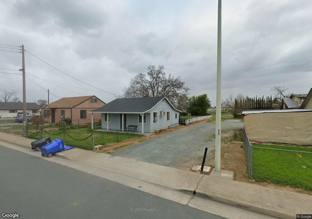
This home is located at 711 Amador Ave, Galt, CA 95632 and is currently estimated at $297,041, approximately $591 per square foot. 711 Amador Ave is a home located in Sacramento County with nearby schools including Lake Canyon Elementary School, Robert L. McCaffrey Middle School, and Galt High School.
Ownership History
Date
Name
Owned For
Owner Type
Purchase Details
Closed on
Sep 7, 2006
Sold by
Lavine A Paul and Lavine Rose M
Bought by
Lavine A Paul and Lavine Rose M
Current Estimated Value
Purchase Details
Closed on
Aug 17, 2001
Sold by
Spaans Sharon Nedda and Fernandez Family 1994 Trust
Bought by
Lavine A Paul and Lavine Rose
Home Financials for this Owner
Home Financials are based on the most recent Mortgage that was taken out on this home.
Original Mortgage
$150,000
Outstanding Balance
$58,682
Interest Rate
7.19%
Mortgage Type
Seller Take Back
Estimated Equity
$238,359
Purchase Details
Closed on
Apr 22, 1998
Sold by
Fernandez Family 1994 Trust and Goldie F
Bought by
Fernandez Albert and Fernandez Goldie F
Create a Home Valuation Report for This Property
The Home Valuation Report is an in-depth analysis detailing your home's value as well as a comparison with similar homes in the area
Home Values in the Area
Average Home Value in this Area
Purchase History
| Date | Buyer | Sale Price | Title Company |
|---|---|---|---|
| Lavine A Paul | -- | None Available | |
| Lavine A Paul | $150,000 | Financial Title Company | |
| Fernandez Albert | -- | -- |
Source: Public Records
Mortgage History
| Date | Status | Borrower | Loan Amount |
|---|---|---|---|
| Open | Lavine A Paul | $150,000 |
Source: Public Records
Tax History Compared to Growth
Tax History
| Year | Tax Paid | Tax Assessment Tax Assessment Total Assessment is a certain percentage of the fair market value that is determined by local assessors to be the total taxable value of land and additions on the property. | Land | Improvement |
|---|---|---|---|---|
| 2025 | $1,056 | $95,999 | $59,078 | $36,921 |
| 2024 | $1,056 | $94,118 | $57,920 | $36,198 |
| 2023 | $1,039 | $92,274 | $56,785 | $35,489 |
| 2022 | $997 | $90,466 | $55,672 | $34,794 |
| 2021 | $998 | $88,693 | $54,581 | $34,112 |
| 2020 | $990 | $87,785 | $54,022 | $33,763 |
| 2019 | $965 | $86,064 | $52,963 | $33,101 |
| 2018 | $964 | $84,377 | $51,925 | $32,452 |
| 2017 | $926 | $82,723 | $50,907 | $31,816 |
| 2016 | $890 | $81,102 | $49,909 | $31,193 |
| 2015 | $859 | $79,885 | $49,160 | $30,725 |
| 2014 | $857 | $78,322 | $48,198 | $30,124 |
Source: Public Records
Map
Nearby Homes
- 409 N Lincoln Way
- 604 Pringle Ave Unit 94
- 604 Pringle Ave Unit 99
- 604 Pringle Ave Unit 121
- 604 Pringle Ave Unit 87
- 350 Palin Ave
- 326 Oak Ave
- 605 Pringle Ave Unit 41
- 605 Pringle Ave Unit 9
- 10183 Pringle Ave
- 820 N Lincoln Way Unit 73
- 820 N Lincoln Way Unit 42
- 820 N Lincoln Way Unit 78
- 0 Pringle Ave Unit 225089282
- 0 Pringle Ave Unit 225119777
- 246 Oak Ave
- 650 Nathaniel Ave
- 614 Myrtle St
- 809 Ashboro Ln
- 131 Oak Ave
- 717 Amador Ave
- 707 Amador Ave
- 723 Amador Ave
- 641 Amador Ave
- 727 Amador Ave
- 731 Amador Ave
- 432 Sunset Dr
- 436 Sunset Dr
- 440 Sunset Dr
- 428 Sunset Dr
- 429 Palin Ave
- 444 Sunset Dr
- 737 Amador Ave
- 750 Spaans Dr
- 424 Sunset Dr
- 520 N Lincoln Way
- 425 Palin Ave
- 435 Sunset Dr
- 448 Sunset Dr
- N N Lincoln Way Unit 44