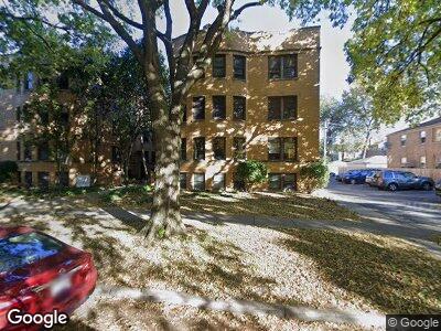
715 Mulford St Unit 7153D Evanston, IL 60202
Estimated Value: $193,538 - $299,000
2
Beds
--
Bath
1,000
Sq Ft
$226/Sq Ft
Est. Value
About This Home
This home is located at 715 Mulford St Unit 7153D, Evanston, IL 60202 and is currently estimated at $225,635, approximately $225 per square foot. 715 Mulford St Unit 7153D is a home located in Cook County with nearby schools including Oakton Elementary School, Chute Middle School, and Evanston Township High School.
Ownership History
Date
Name
Owned For
Owner Type
Purchase Details
Closed on
Oct 28, 2005
Sold by
Tasco Thc Llc
Bought by
Cohn Howard D
Current Estimated Value
Home Financials for this Owner
Home Financials are based on the most recent Mortgage that was taken out on this home.
Original Mortgage
$202,410
Interest Rate
6.3%
Mortgage Type
Fannie Mae Freddie Mac
Create a Home Valuation Report for This Property
The Home Valuation Report is an in-depth analysis detailing your home's value as well as a comparison with similar homes in the area
Home Values in the Area
Average Home Value in this Area
Purchase History
| Date | Buyer | Sale Price | Title Company |
|---|---|---|---|
| Cohn Howard D | $225,000 | Cti |
Source: Public Records
Mortgage History
| Date | Status | Borrower | Loan Amount |
|---|---|---|---|
| Open | Cohn Howard D | $146,400 | |
| Previous Owner | Cohn Howard D | $202,410 |
Source: Public Records
Tax History Compared to Growth
Tax History
| Year | Tax Paid | Tax Assessment Tax Assessment Total Assessment is a certain percentage of the fair market value that is determined by local assessors to be the total taxable value of land and additions on the property. | Land | Improvement |
|---|---|---|---|---|
| 2024 | $2,484 | $13,979 | $1,406 | $12,573 |
| 2023 | $2,484 | $13,979 | $1,406 | $12,573 |
| 2022 | $2,484 | $13,979 | $1,406 | $12,573 |
| 2021 | $1,866 | $10,269 | $1,110 | $9,159 |
| 2020 | $1,901 | $10,269 | $1,110 | $9,159 |
| 2019 | $1,895 | $11,413 | $1,110 | $10,303 |
| 2018 | $1,739 | $9,699 | $925 | $8,774 |
| 2017 | $1,709 | $9,699 | $925 | $8,774 |
| 2016 | $1,846 | $9,699 | $925 | $8,774 |
| 2015 | $1,616 | $8,567 | $777 | $7,790 |
| 2014 | $1,616 | $8,567 | $777 | $7,790 |
| 2013 | $1,562 | $8,567 | $777 | $7,790 |
Source: Public Records
Map
Nearby Homes
- 719 Mulford St Unit 2F
- 819 Brummel St Unit 2S
- 417 Custer Ave Unit 3W
- 727 Dobson St
- 250 Ridge Ave Unit 3F
- 250 Ridge Ave Unit 4L
- 626 Oakton St Unit 3
- 121 Custer Ave Unit 2S
- 346 Ridge Ave Unit 2
- 820 Oakton St Unit 3A
- 336 Ridge Ave Unit 1
- 623 Oakton St
- 1007 Dobson St
- 1029 Hull Terrace
- 7501 N Damen Ave Unit AG
- 7553 N Ridge Ave Unit 2N
- 7524 N Winchester Ave Unit 3E
- 7515 N Damen Ave Unit EG
- 811 South Blvd
- 7540 N Ridge Blvd Unit 5D
- 715 Mulford St Unit 2C
- 715 Mulford St Unit 7153D
- 715 Mulford St Unit 7152D
- 715 Mulford St Unit 7151D
- 715 Mulford St Unit 7153C
- 715 Mulford St Unit 7152C
- 715 Mulford St Unit 7151C
- 715 Mulford St Unit 3C
- 715 Mulford St Unit 2D
- 715 Mulford St Unit 1D
- 715 Mulford St Unit 1C
- 713 Mulford St Unit 1B
- 713 Mulford St Unit 7133B
- 713 Mulford St Unit 7131A
- 713 Mulford St Unit 7132B
- 713 Mulford St Unit 7131B
- 713 Mulford St Unit 713GDN
- 713 Mulford St Unit 7133A
- 713 Mulford St Unit 7132A
- 713 Mulford St Unit 2B