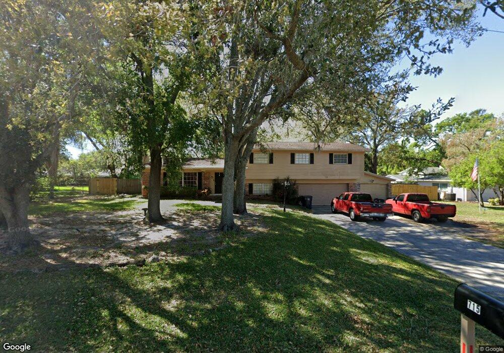
715 Westwood Dr Brandon, FL 33511
Estimated Value: $414,906 - $463,000
4
Beds
3
Baths
2,126
Sq Ft
$204/Sq Ft
Est. Value
About This Home
This home is located at 715 Westwood Dr, Brandon, FL 33511 and is currently estimated at $434,227, approximately $204 per square foot. 715 Westwood Dr is a home located in Hillsborough County with nearby schools including Yates Elementary School, Mclane Middle School, and Brandon High School.
Ownership History
Date
Name
Owned For
Owner Type
Purchase Details
Closed on
Apr 24, 1998
Sold by
Kalashian Paul A and Kalashian M
Bought by
Stiles Earl and Stiles Linda
Current Estimated Value
Home Financials for this Owner
Home Financials are based on the most recent Mortgage that was taken out on this home.
Original Mortgage
$100,000
Outstanding Balance
$18,966
Interest Rate
7.09%
Mortgage Type
VA
Estimated Equity
$415,261
Purchase Details
Closed on
Mar 31, 1995
Sold by
Sorensen Henry Royal and Sorensen Betty J
Bought by
Kalashian Paul A and Kalashian Elizabeth M
Home Financials for this Owner
Home Financials are based on the most recent Mortgage that was taken out on this home.
Original Mortgage
$96,300
Interest Rate
8.86%
Create a Home Valuation Report for This Property
The Home Valuation Report is an in-depth analysis detailing your home's value as well as a comparison with similar homes in the area
Home Values in the Area
Average Home Value in this Area
Purchase History
| Date | Buyer | Sale Price | Title Company |
|---|---|---|---|
| Stiles Earl | $119,800 | -- | |
| Kalashian Paul A | $107,000 | -- |
Source: Public Records
Mortgage History
| Date | Status | Borrower | Loan Amount |
|---|---|---|---|
| Open | Stiles Earl | $100,000 | |
| Previous Owner | Kalashian Paul A | $96,300 |
Source: Public Records
Tax History Compared to Growth
Tax History
| Year | Tax Paid | Tax Assessment Tax Assessment Total Assessment is a certain percentage of the fair market value that is determined by local assessors to be the total taxable value of land and additions on the property. | Land | Improvement |
|---|---|---|---|---|
| 2024 | $1,540 | $116,332 | -- | -- |
| 2023 | $1,459 | $112,944 | $0 | $0 |
| 2022 | $1,479 | $109,654 | $0 | $0 |
| 2021 | $1,443 | $106,460 | $0 | $0 |
| 2020 | $1,368 | $104,990 | $0 | $0 |
| 2019 | $1,282 | $102,630 | $0 | $0 |
| 2018 | $1,265 | $100,716 | $0 | $0 |
| 2017 | $1,234 | $152,711 | $0 | $0 |
| 2016 | $1,203 | $96,615 | $0 | $0 |
| 2015 | $1,330 | $95,943 | $0 | $0 |
| 2014 | $1,306 | $95,182 | $0 | $0 |
| 2013 | -- | $93,775 | $0 | $0 |
Source: Public Records
Map
Nearby Homes
- 707 Westwood Ln
- 708 Westwood Cir
- 514 Ole Plantation Dr
- 410 Larrie Ellen Way
- 605 Chippenham Blvd
- 780 Spring Flowers Trail
- 778 Spring Flowers Trail
- 1214 Mitchell St
- 832 S Parsons Ave
- 704 Oakgrove Dr Unit 117D
- 809 Russell Ln Unit 321
- 107 Caldwell Dr Unit 178M
- 107 Caldwell Dr Unit 291
- 122 N Kings Ave Unit 101
- 703 Sailfish Dr
- 1007 Morfield Ln
- 638 Golden Raintree Place
- 624 Golden Raintree Place
- 562 Golden Raintree Place Unit 562
- 534 Golden Raintree Place Unit 8
- 715 Westwood Dr
- 717 Westwood Dr
- 717 Westwood Dr
- 714 Debra Lynne Dr
- 711 Westwood Dr
- 711 Westwood Dr
- 716 Debra Lynne Dr
- 712 Debra Lynne Dr
- 716 Westwood Dr
- 716 Westwood Dr
- 719 Westwood Dr
- 719 Westwood Dr
- 718 Westwood Dr
- 718 Westwood Dr
- 718 Debra Lynne Dr
- 714 Westwood Dr
- 710 Debra Lynne Dr
- 712 Westwood Dr
- 721 Westwood Dr
- 707 Westwood Dr