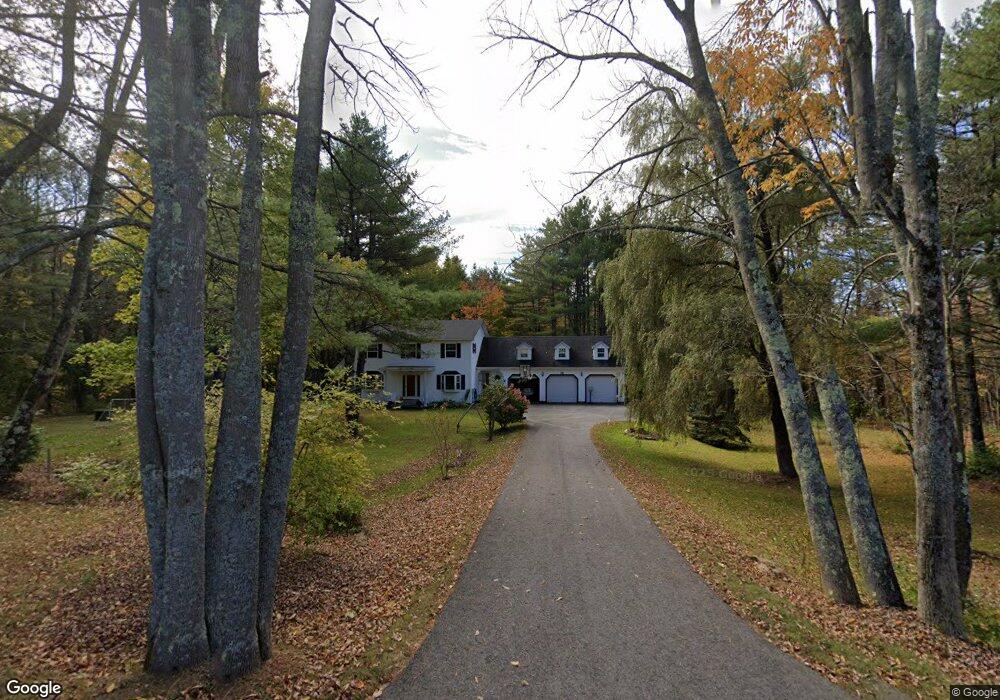
72 Watson Mill Rd Saco, ME 04072
North Saco NeighborhoodEstimated Value: $500,000 - $685,000
3
Beds
2
Baths
2,176
Sq Ft
$276/Sq Ft
Est. Value
About This Home
This home is located at 72 Watson Mill Rd, Saco, ME 04072 and is currently estimated at $600,446, approximately $275 per square foot. 72 Watson Mill Rd is a home located in York County with nearby schools including C K Burns School and Saco Middle School.
Ownership History
Date
Name
Owned For
Owner Type
Purchase Details
Closed on
Aug 4, 2016
Sold by
Chaisson Roger J and Chaisson Catherine M
Bought by
Pahigian Joshua R and Pahigian Heather J
Current Estimated Value
Home Financials for this Owner
Home Financials are based on the most recent Mortgage that was taken out on this home.
Original Mortgage
$160,000
Outstanding Balance
$101,136
Interest Rate
3.56%
Mortgage Type
New Conventional
Estimated Equity
$499,310
Create a Home Valuation Report for This Property
The Home Valuation Report is an in-depth analysis detailing your home's value as well as a comparison with similar homes in the area
Home Values in the Area
Average Home Value in this Area
Purchase History
| Date | Buyer | Sale Price | Title Company |
|---|---|---|---|
| Pahigian Joshua R | -- | -- |
Source: Public Records
Mortgage History
| Date | Status | Borrower | Loan Amount |
|---|---|---|---|
| Open | Pahigian Joshua R | $160,000 |
Source: Public Records
Tax History
| Year | Tax Paid | Tax Assessment Tax Assessment Total Assessment is a certain percentage of the fair market value that is determined by local assessors to be the total taxable value of land and additions on the property. | Land | Improvement |
|---|---|---|---|---|
| 2024 | $6,783 | $482,800 | $161,200 | $321,600 |
| 2023 | $7,121 | $482,800 | $161,200 | $321,600 |
| 2022 | $6,331 | $345,400 | $122,800 | $222,600 |
| 2021 | $6,055 | $320,700 | $111,500 | $209,200 |
| 2020 | $5,728 | $291,200 | $98,100 | $193,100 |
| 2019 | $5,643 | $291,200 | $98,100 | $193,100 |
| 2018 | $5,471 | $282,300 | $89,200 | $193,100 |
| 2017 | $5,409 | $279,100 | $82,200 | $196,900 |
| 2016 | $5,117 | $263,500 | $67,200 | $196,300 |
| 2015 | $4,907 | $255,300 | $65,900 | $189,400 |
| 2014 | $4,754 | $255,300 | $65,900 | $189,400 |
| 2013 | $4,743 | $255,300 | $65,900 | $189,400 |
Source: Public Records
Map
Nearby Homes
- Lot 1 & 2 Memory Ln
- 181 Watson Mill Rd
- 3 Trapper John Rd
- 130 Heath Rd
- 4 Lebanon Rd
- 5 Moose Creek Ln
- 153 Mckenney Rd
- 91 C Broadturn Rd
- 8 Peaceful Ln
- 75 Ash Swamp Rd
- 1 Shamrock Dr
- 3 Dunn Estates Dr
- Lot 72 Martell Way
- 00 Miso Way
- 0 Simpson Rd
- 213 Burnham Rd
- 12 Maple Dr
- 6 Leah Ln
- 4 Primrose Ln
- 64 Maple Dr
- 70 Watson Mill Rd
- 78 Watson Mill Rd
- 68 Watson Mill Rd
- 73 Watson Mill Rd
- 79 Watson Mill Rd
- 62 Watson Mill Rd
- 86 Watson Mill Rd
- 56 Watson Mill Rd
- 54 Mast Hill Rd
- 93 Watson Mill Rd
- 61 Watson Mill Rd
- 5 Grace Ln
- 69 Watson Mill Rd
- 4 Nonesuch Rd
- 55 Watson Mill Rd
- 66 Mast Hill Rd
- 58 Mast Hill Rd
- 72 Mast Hill Rd
- 4 Grace Ln
- 112 Watson Mill Rd
Your Personal Tour Guide
Ask me questions while you tour the home.