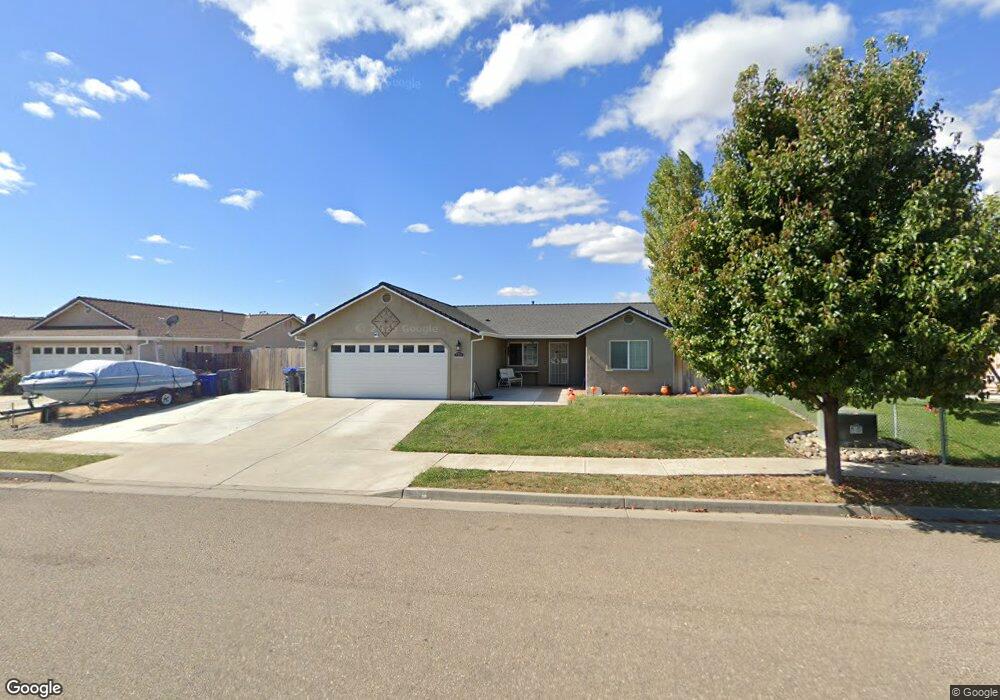
720 Larie Ln Red Bluff, CA 96080
Estimated Value: $343,000 - $380,000
4
Beds
2
Baths
1,453
Sq Ft
$248/Sq Ft
Est. Value
About This Home
This home is located at 720 Larie Ln, Red Bluff, CA 96080 and is currently estimated at $360,104, approximately $247 per square foot. 720 Larie Ln is a home located in Tehama County with nearby schools including Bidwell Elementary School, Vista Preparatory Academy, and Red Bluff High School.
Ownership History
Date
Name
Owned For
Owner Type
Purchase Details
Closed on
Jun 12, 2018
Sold by
Hoofard Nicola M and Murray Nicola M
Bought by
Mcdonald Kenneth and Mcdonald Natalie
Current Estimated Value
Home Financials for this Owner
Home Financials are based on the most recent Mortgage that was taken out on this home.
Original Mortgage
$230,644
Outstanding Balance
$202,708
Interest Rate
5.25%
Mortgage Type
FHA
Estimated Equity
$157,396
Purchase Details
Closed on
Sep 15, 2011
Sold by
Self Help Home Improvement Project
Bought by
Murray Nicola M
Home Financials for this Owner
Home Financials are based on the most recent Mortgage that was taken out on this home.
Original Mortgage
$177,000
Interest Rate
4.26%
Mortgage Type
Purchase Money Mortgage
Purchase Details
Closed on
Apr 13, 2010
Sold by
Lassen View Development Llc
Bought by
Coastline Re Holdings Corp
Purchase Details
Closed on
Jan 4, 2007
Sold by
Rhs Norcal Investments Llc
Bought by
Lassen View Development Llc
Create a Home Valuation Report for This Property
The Home Valuation Report is an in-depth analysis detailing your home's value as well as a comparison with similar homes in the area
Home Values in the Area
Average Home Value in this Area
Purchase History
| Date | Buyer | Sale Price | Title Company |
|---|---|---|---|
| Mcdonald Kenneth | $235,000 | Fidelity National Title | |
| Murray Nicola M | $60,000 | Northern California Title Co | |
| Coastline Re Holdings Corp | $998,791 | Accommodation | |
| Lassen View Development Llc | -- | None Available |
Source: Public Records
Mortgage History
| Date | Status | Borrower | Loan Amount |
|---|---|---|---|
| Open | Mcdonald Kenneth | $230,644 | |
| Previous Owner | Murray Nicola M | $177,000 |
Source: Public Records
Tax History Compared to Growth
Tax History
| Year | Tax Paid | Tax Assessment Tax Assessment Total Assessment is a certain percentage of the fair market value that is determined by local assessors to be the total taxable value of land and additions on the property. | Land | Improvement |
|---|---|---|---|---|
| 2025 | $3,232 | $333,796 | $56,889 | $276,907 |
| 2023 | $2,895 | $285,655 | $54,681 | $230,974 |
| 2022 | $2,580 | $251,966 | $53,609 | $198,357 |
| 2021 | $2,474 | $247,026 | $52,558 | $194,468 |
| 2020 | $2,525 | $244,494 | $52,020 | $192,474 |
| 2019 | $2,540 | $239,700 | $51,000 | $188,700 |
| 2018 | $1,940 | $195,387 | $55,193 | $140,194 |
| 2017 | $1,956 | $191,557 | $54,111 | $137,446 |
| 2016 | $1,826 | $187,801 | $53,050 | $134,751 |
| 2015 | $1,796 | $184,981 | $52,254 | $132,727 |
| 2014 | $1,769 | $181,359 | $51,231 | $130,128 |
Source: Public Records
Map
Nearby Homes
- 2093 Stonybrook Dr
- 1530 Carmel Way
- 1530 Elva Ave
- 1435 Garryana Dr
- 1865 Douglass St
- 1815 Park Ave
- 1450 Bulkeley St
- 1720 Luning St
- 1805 Walbridge St
- 1455 Acacia St
- 1359 2nd St
- 1846 Walbridge St
- 1800 Walbridge St
- 1048 Franklin St
- 1555 Acacia St
- 1514 Walbridge St
- 1209 Aloha St
- 1565 Carl Ct
- 1940 Gentry Way
- 1160 Orange St