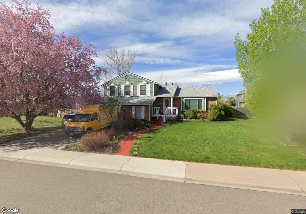
725 Blue Mesa Ave Fort Collins, CO 80526
Woodwest NeighborhoodEstimated Value: $567,065 - $635,000
3
Beds
4
Baths
1,840
Sq Ft
$330/Sq Ft
Est. Value
About This Home
This home is located at 725 Blue Mesa Ave, Fort Collins, CO 80526 and is currently estimated at $607,266, approximately $330 per square foot. 725 Blue Mesa Ave is a home located in Larimer County with nearby schools including Beattie Elementary School, Blevins Middle School, and Rocky Mountain High School.
Ownership History
Date
Name
Owned For
Owner Type
Purchase Details
Closed on
Jul 25, 1996
Sold by
Broyles Michael L Jennifer R
Bought by
Bennett John H and Bennett Kathleen
Current Estimated Value
Home Financials for this Owner
Home Financials are based on the most recent Mortgage that was taken out on this home.
Original Mortgage
$85,450
Outstanding Balance
$6,827
Interest Rate
8.33%
Estimated Equity
$600,439
Purchase Details
Closed on
May 1, 1994
Sold by
Elder Joyce E
Bought by
Broyles Michael L
Create a Home Valuation Report for This Property
The Home Valuation Report is an in-depth analysis detailing your home's value as well as a comparison with similar homes in the area
Home Values in the Area
Average Home Value in this Area
Purchase History
| Date | Buyer | Sale Price | Title Company |
|---|---|---|---|
| Bennett John H | $147,000 | Land Title | |
| Broyles Michael L | $144,900 | -- |
Source: Public Records
Mortgage History
| Date | Status | Borrower | Loan Amount |
|---|---|---|---|
| Open | Bennett John H | $85,450 |
Source: Public Records
Tax History Compared to Growth
Tax History
| Year | Tax Paid | Tax Assessment Tax Assessment Total Assessment is a certain percentage of the fair market value that is determined by local assessors to be the total taxable value of land and additions on the property. | Land | Improvement |
|---|---|---|---|---|
| 2025 | $2,740 | $38,940 | $3,015 | $35,925 |
| 2024 | $2,607 | $38,940 | $3,015 | $35,925 |
| 2022 | $2,076 | $28,933 | $3,128 | $25,805 |
| 2021 | $2,098 | $29,766 | $3,218 | $26,548 |
| 2020 | $1,873 | $27,171 | $3,218 | $23,953 |
| 2019 | $2,074 | $29,223 | $3,218 | $26,005 |
| 2018 | $1,509 | $23,760 | $3,240 | $20,520 |
| 2017 | $1,504 | $23,760 | $3,240 | $20,520 |
| 2016 | $1,242 | $21,564 | $3,582 | $17,982 |
| 2015 | $1,233 | $21,560 | $3,580 | $17,980 |
| 2014 | $1,067 | $19,660 | $3,580 | $16,080 |
Source: Public Records
Map
Nearby Homes
- 630 Homestead Ct
- 3113 Colony Dr
- 3378 Gunnison Dr
- 600 Republic Dr
- 3001 Worthington Ave
- 3024 Placer Ct
- 3031 Placer Ct
- 3036 Rustic Ct
- 3440 Windmill Dr Unit 5-2
- 3440 Windmill Dr Unit 3-4
- 3106 Lymen St
- 3225 Eagle Dr
- 3565 Windmill Dr Unit 1
- 3565 Windmill Dr Unit N3
- 1115 W Swallow Rd Unit 20
- 431 W Swallow Rd
- 720 Arbor Ave Unit 6
- 814 Arbor Ave Unit C
- 1213 W Swallow Rd Unit 213
- 1231 W Swallow Rd Unit 323
- 731 Blue Mesa Ave
- 719 Blue Mesa Ave
- 3212 Fairplay Ct
- 3206 Fairplay Ct
- 3218 Fairplay Ct
- 3136 Longhorn Ct
- 737 Blue Mesa Ave
- 718 Blue Mesa Ave
- 3200 Fairplay Ct
- 3137 Longhorn Ct
- 3130 Longhorn Ct
- 3213 Gunnison Dr
- 3230 Gunnison Dr
- 3200 Silverthorne Dr
- 3236 Gunnison Dr
- 3213 Fairplay Ct
- 3255 Gunnison Dr
- 3131 Longhorn Ct
- 3106 Silverthorne Dr
- 3242 Gunnison Dr