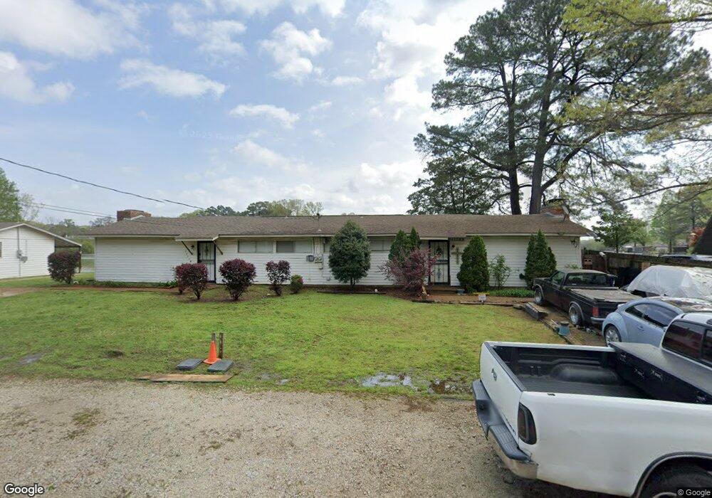
7260 Sylvan Ln Olive Branch, MS 38654
Estimated Value: $197,779 - $281,000
--
Bed
--
Bath
1,660
Sq Ft
$144/Sq Ft
Est. Value
About This Home
This home is located at 7260 Sylvan Ln, Olive Branch, MS 38654 and is currently estimated at $239,695, approximately $144 per square foot. 7260 Sylvan Ln is a home located in DeSoto County with nearby schools including Olive Branch Elementary School, Chickasaw Elementary School, and Olive Branch Middle School.
Ownership History
Date
Name
Owned For
Owner Type
Purchase Details
Closed on
Sep 15, 2020
Sold by
Forrester Adrian Nicole Oxner
Bought by
Oxner Donald L
Current Estimated Value
Home Financials for this Owner
Home Financials are based on the most recent Mortgage that was taken out on this home.
Original Mortgage
$70,800
Outstanding Balance
$43,935
Interest Rate
2.8%
Mortgage Type
Credit Line Revolving
Estimated Equity
$195,760
Purchase Details
Closed on
Sep 18, 2008
Sold by
Pass Sibs Llc
Bought by
Oxner Rickey G
Create a Home Valuation Report for This Property
The Home Valuation Report is an in-depth analysis detailing your home's value as well as a comparison with similar homes in the area
Home Values in the Area
Average Home Value in this Area
Purchase History
| Date | Buyer | Sale Price | Title Company |
|---|---|---|---|
| Oxner Donald L | -- | None Available | |
| Oxner Rickey G | -- | None Available |
Source: Public Records
Mortgage History
| Date | Status | Borrower | Loan Amount |
|---|---|---|---|
| Open | Oxner Donald L | $70,800 |
Source: Public Records
Tax History Compared to Growth
Tax History
| Year | Tax Paid | Tax Assessment Tax Assessment Total Assessment is a certain percentage of the fair market value that is determined by local assessors to be the total taxable value of land and additions on the property. | Land | Improvement |
|---|---|---|---|---|
| 2024 | $1,756 | $12,869 | $3,000 | $9,869 |
| 2023 | $1,756 | $12,869 | $0 | $0 |
| 2022 | $1,756 | $12,869 | $3,000 | $9,869 |
| 2021 | $1,756 | $12,869 | $3,000 | $9,869 |
| 2020 | $625 | $12,080 | $3,000 | $9,080 |
| 2019 | $625 | $12,080 | $3,000 | $9,080 |
| 2017 | $617 | $20,988 | $11,994 | $8,994 |
| 2016 | $617 | $11,994 | $3,000 | $8,994 |
| 2015 | $1,646 | $20,988 | $11,994 | $8,994 |
| 2014 | $609 | $11,938 | $0 | $0 |
| 2013 | $591 | $11,938 | $0 | $0 |
Source: Public Records
Map
Nearby Homes
- 7975 Crescent Cir
- 7356 Mockingbird Ln
- 7305 Redbud Ln
- 7843 Ferndale Dr
- 7826 Ferndale Dr
- 7759 Ferndale Dr
- 7721 Ferndale Dr
- 7736 Ferndale Dr
- 7384 Woodland Dr
- 7880 Allenwood Ln
- 7888 Allenwood Ln
- 7859 Gardendale Dr
- 784 Arrow Cove
- 7867 Gardendale Dr
- 7188 Larkfield Cove
- 7875 Gardendale Dr
- 7881 Gardendale Dr
- 7899 Gardendale Dr
- 7905 Gardendale Dr
- 8484 Goodman Rd