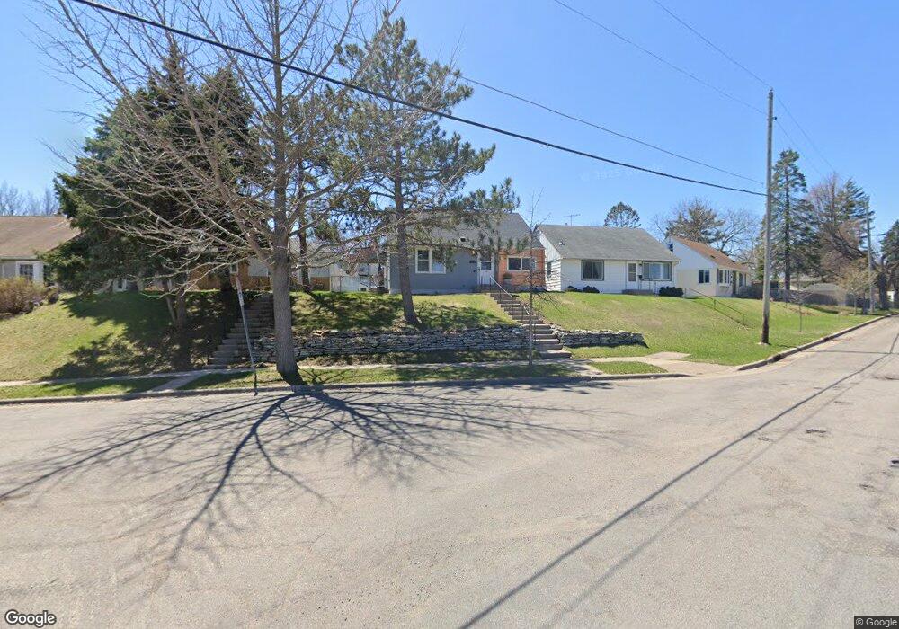
728 Edgar Ave Saint Paul, MN 55117
Como Park NeighborhoodEstimated Value: $266,000 - $305,000
3
Beds
1
Bath
1,584
Sq Ft
$183/Sq Ft
Est. Value
About This Home
This home is located at 728 Edgar Ave, Saint Paul, MN 55117 and is currently estimated at $289,820, approximately $182 per square foot. 728 Edgar Ave is a home located in Ramsey County with nearby schools including Como Park Elementary School, Murray Middle School, and Como Park Senior High School.
Ownership History
Date
Name
Owned For
Owner Type
Purchase Details
Closed on
Feb 25, 2022
Sold by
John Mccarthy Steven
Bought by
Lukas Brian
Current Estimated Value
Purchase Details
Closed on
Sep 14, 2018
Sold by
West Michael E and West Jenni S
Bought by
Mccarthy Steven John
Home Financials for this Owner
Home Financials are based on the most recent Mortgage that was taken out on this home.
Original Mortgage
$142,500
Interest Rate
4.5%
Mortgage Type
New Conventional
Purchase Details
Closed on
Mar 15, 2000
Sold by
Iverson Justin D and Iverson Valerie J
Bought by
Ticknor Ii Frank D
Purchase Details
Closed on
Aug 18, 1998
Sold by
Iverson Jonathan D and Iverson Theresa M
Bought by
Iverson Justin D
Purchase Details
Closed on
Jul 20, 1995
Sold by
Statsman Dale R
Bought by
Iverson Jonathan D and Iverson Theresa M
Create a Home Valuation Report for This Property
The Home Valuation Report is an in-depth analysis detailing your home's value as well as a comparison with similar homes in the area
Home Values in the Area
Average Home Value in this Area
Purchase History
| Date | Buyer | Sale Price | Title Company |
|---|---|---|---|
| Lukas Brian | $250,000 | Results Title | |
| Mccarthy Steven John | $190,000 | Arden Title Llc | |
| Ticknor Ii Frank D | $117,000 | -- | |
| Iverson Justin D | $107,000 | -- | |
| Iverson Jonathan D | $76,000 | -- |
Source: Public Records
Mortgage History
| Date | Status | Borrower | Loan Amount |
|---|---|---|---|
| Previous Owner | Mccarthy Steven John | $142,500 |
Source: Public Records
Tax History Compared to Growth
Tax History
| Year | Tax Paid | Tax Assessment Tax Assessment Total Assessment is a certain percentage of the fair market value that is determined by local assessors to be the total taxable value of land and additions on the property. | Land | Improvement |
|---|---|---|---|---|
| 2025 | $3,628 | $268,100 | $40,700 | $227,400 |
| 2024 | $3,628 | $252,800 | $40,700 | $212,100 |
| 2023 | $3,628 | $243,500 | $40,700 | $202,800 |
| 2022 | $3,334 | $229,200 | $40,700 | $188,500 |
| 2021 | $3,208 | $203,200 | $40,700 | $162,500 |
| 2020 | $3,142 | $202,700 | $40,700 | $162,000 |
| 2019 | $2,504 | $184,300 | $40,700 | $143,600 |
| 2018 | $2,330 | $161,200 | $40,700 | $120,500 |
| 2017 | $2,424 | $151,500 | $32,500 | $119,000 |
| 2016 | $2,454 | $0 | $0 | $0 |
| 2015 | $2,234 | $148,600 | $32,500 | $116,100 |
| 2014 | $2,078 | $0 | $0 | $0 |
Source: Public Records
Map
Nearby Homes
- 1063 Dale St N
- 705 Como Ave
- 1049 Kent St
- 740 Como Ave
- 569 Hatch Ave
- 352 Como Ave
- 1104 MacKubin St
- 1241 Maywood St
- 766 Maryland Ave W
- 1165 Norton St
- 552 Burgess St
- 989 Barrett St
- 1176 Norton St
- 1005 Como Blvd E
- 1175 Arundel St
- tbd MacKubin St
- 1040 Cumberland St
- 1222 Como Blvd E
- 1038 Colne St
- 1083 Western Ave N
- 672 Jessamine Ave W
- 724 Edgar Ave
- 720 Edgar Ave
- 680 Jessamine Ave W
- 716 Edgar Ave
- 727 Simon Ave
- 731 Simon Ave
- 725 Simon Ave
- 735 Simon Ave
- 721 Simon Ave
- 715 Edgar Ave
- 710 Edgar Ave
- 741 Simon Ave
- 717 Simon Ave
- 671 Jessamine Ave W
- 665 Jessamine Ave W
- 675 Jessamine Ave W
- 659 Jessamine Ave W
- 745 Simon Ave
- 715 Simon Ave