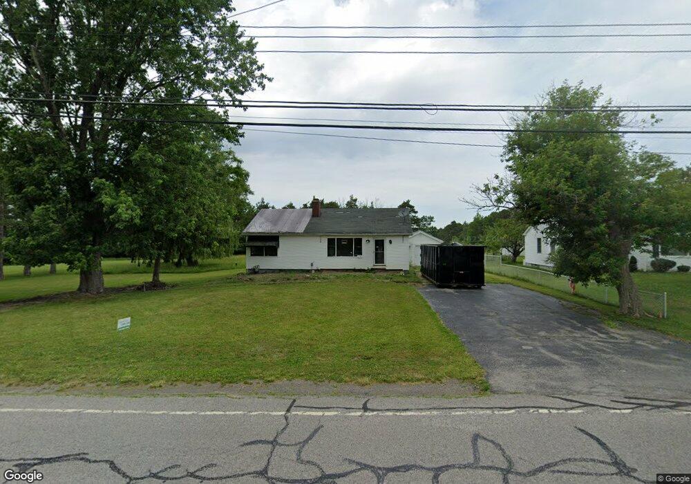
7294 Michael Rd Orchard Park, NY 14127
Estimated Value: $271,760 - $346,000
3
Beds
1
Bath
1,484
Sq Ft
$206/Sq Ft
Est. Value
About This Home
This home is located at 7294 Michael Rd, Orchard Park, NY 14127 and is currently estimated at $305,940, approximately $206 per square foot. 7294 Michael Rd is a home located in Erie County with nearby schools including Windom Elementary School, Orchard Park Middle School, and Orchard Park High School.
Ownership History
Date
Name
Owned For
Owner Type
Purchase Details
Closed on
Feb 7, 2025
Sold by
Roberto Charles W and U S Bank Trust National Association
Bought by
Zimmerman Ellen
Current Estimated Value
Purchase Details
Closed on
Sep 20, 2019
Sold by
Roberto Wendy E
Bought by
Roberto Charles W
Purchase Details
Closed on
Dec 17, 2010
Sold by
Zubricky Diane M and Musial Alfred A
Bought by
Roberto Charles W and Roberto Wendy E
Home Financials for this Owner
Home Financials are based on the most recent Mortgage that was taken out on this home.
Original Mortgage
$125,312
Interest Rate
4.23%
Mortgage Type
FHA
Create a Home Valuation Report for This Property
The Home Valuation Report is an in-depth analysis detailing your home's value as well as a comparison with similar homes in the area
Home Values in the Area
Average Home Value in this Area
Purchase History
| Date | Buyer | Sale Price | Title Company |
|---|---|---|---|
| Zimmerman Ellen | $180,000 | None Available | |
| Zimmerman Ellen | $180,000 | None Available | |
| Roberto Charles W | -- | None Available | |
| Roberto Charles W | -- | None Available | |
| Roberto Charles W | $127,000 | Stewart Title Insurance Co | |
| Roberto Charles W | $127,000 | Stewart Title Insurance Co |
Source: Public Records
Mortgage History
| Date | Status | Borrower | Loan Amount |
|---|---|---|---|
| Previous Owner | Roberto Charles W | $125,312 |
Source: Public Records
Tax History Compared to Growth
Tax History
| Year | Tax Paid | Tax Assessment Tax Assessment Total Assessment is a certain percentage of the fair market value that is determined by local assessors to be the total taxable value of land and additions on the property. | Land | Improvement |
|---|---|---|---|---|
| 2024 | $5,189 | $72,100 | $20,100 | $52,000 |
| 2023 | $5,041 | $72,100 | $20,100 | $52,000 |
| 2022 | $4,909 | $72,100 | $20,100 | $52,000 |
| 2021 | $4,952 | $72,100 | $20,100 | $52,000 |
| 2020 | $4,780 | $72,100 | $20,100 | $52,000 |
| 2019 | $4,321 | $72,100 | $20,100 | $52,000 |
| 2018 | $4,590 | $72,100 | $20,100 | $52,000 |
| 2017 | $1,877 | $72,100 | $20,100 | $52,000 |
| 2016 | $4,350 | $72,100 | $20,100 | $52,000 |
| 2015 | -- | $72,100 | $20,100 | $52,000 |
| 2014 | -- | $72,100 | $20,100 | $52,000 |
Source: Public Records
Map
Nearby Homes
- 3105 Baker Rd
- 30 Hastings Dr
- 3217 Baker Rd
- 0 V L Angle Rd Unit B1624839
- 2931 Southwestern Blvd
- 914 Reserve Rd
- 81 Carla Ln
- 73 Southwick Dr
- 269 Oakbrook Dr
- 3310 Angle Rd
- 80 Greenspring Ct
- 11 Bradwood Rd
- Heritage II Plan at Greenspring Reserve
- Patio C Plan at Greenspring Reserve
- Advantage IX Plan at Greenspring Reserve
- Discovery IX Plan at Greenspring Reserve
- Advantage X Plan at Greenspring Reserve
- Discovery XIV Plan at Greenspring Reserve
- Patio B Plan at Greenspring Reserve
- Discovery XI Plan at Greenspring Reserve
- 7304 Michael Rd
- 7274 Michael Rd
- 7318 Michael Rd
- 7303 Michael Rd
- 7283 Michael Rd
- 7317 Michael Rd
- 7264 Michael Rd
- 7330 Michael Rd
- 7273 Michael Rd
- 7329 Michael Rd
- 7344 Michael Rd
- 7255 Michael Rd
- 7244 Michael Rd
- 7345 Michael Rd
- 7233 Michael Rd
- 16 Chisholm Trail
- 7361 Michael Rd
- 18 Chisholm Trail
- 14 Chisholm Trail
- 7366 Michael Rd