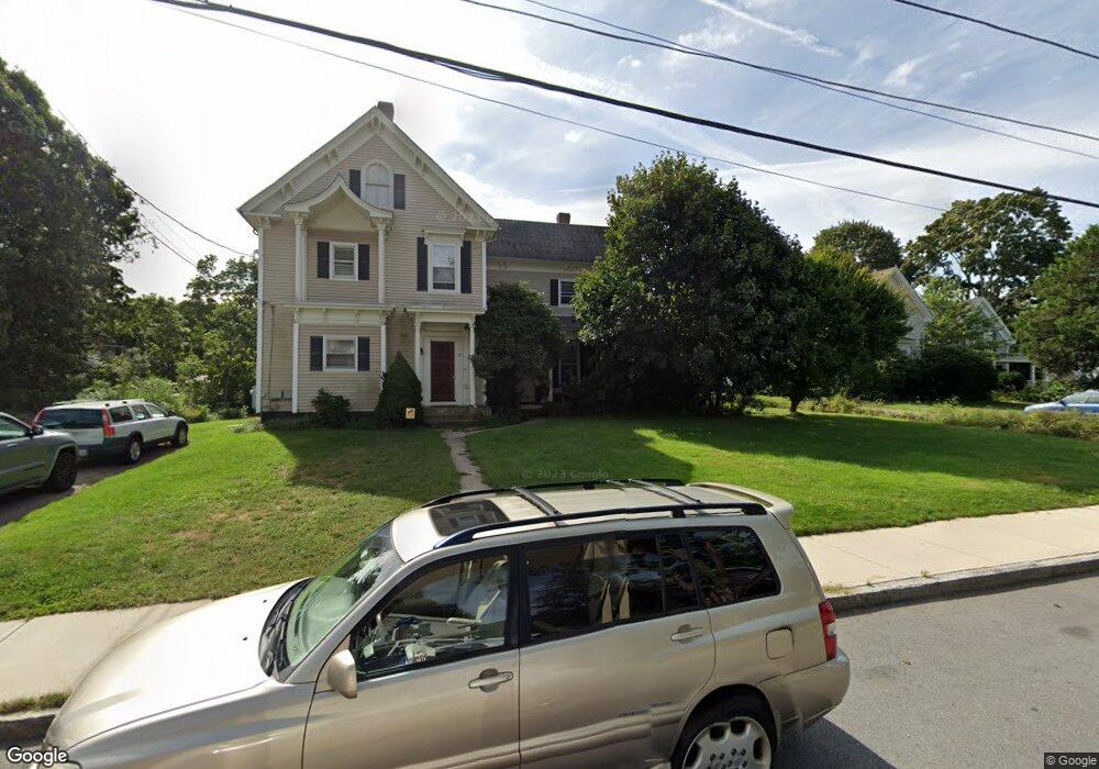
73 Dean Ave Franklin, MA 02038
Downtown Franklin NeighborhoodEstimated Value: $692,000 - $914,000
6
Beds
3
Baths
3,939
Sq Ft
$204/Sq Ft
Est. Value
About This Home
This home is located at 73 Dean Ave, Franklin, MA 02038 and is currently estimated at $804,715, approximately $204 per square foot. 73 Dean Ave is a home located in Norfolk County with nearby schools including Helen Keller Elementary School, Annie Sullivan Middle School, and Franklin High School.
Ownership History
Date
Name
Owned For
Owner Type
Purchase Details
Closed on
Mar 6, 2012
Sold by
Dinh Linh and Le Hanh T
Bought by
73-77 Dean Avenue Llc
Current Estimated Value
Purchase Details
Closed on
Mar 23, 1998
Sold by
Durning James E
Bought by
Le Hanh T
Home Financials for this Owner
Home Financials are based on the most recent Mortgage that was taken out on this home.
Original Mortgage
$137,900
Interest Rate
6.92%
Mortgage Type
Purchase Money Mortgage
Purchase Details
Closed on
Feb 28, 1996
Sold by
Gianetti Dominic A and Gianetti Virginia
Bought by
Durning James E
Home Financials for this Owner
Home Financials are based on the most recent Mortgage that was taken out on this home.
Original Mortgage
$133,000
Interest Rate
7.02%
Mortgage Type
Purchase Money Mortgage
Create a Home Valuation Report for This Property
The Home Valuation Report is an in-depth analysis detailing your home's value as well as a comparison with similar homes in the area
Home Values in the Area
Average Home Value in this Area
Purchase History
| Date | Buyer | Sale Price | Title Company |
|---|---|---|---|
| 73-77 Dean Avenue Llc | -- | -- | |
| Le Hanh T | $172,400 | -- | |
| Durning James E | $140,000 | -- |
Source: Public Records
Mortgage History
| Date | Status | Borrower | Loan Amount |
|---|---|---|---|
| Previous Owner | Durning James E | $137,900 | |
| Previous Owner | Durning James E | $133,000 |
Source: Public Records
Tax History
| Year | Tax Paid | Tax Assessment Tax Assessment Total Assessment is a certain percentage of the fair market value that is determined by local assessors to be the total taxable value of land and additions on the property. | Land | Improvement |
|---|---|---|---|---|
| 2025 | $9,060 | $779,700 | $223,700 | $556,000 |
| 2024 | $7,784 | $660,200 | $223,700 | $436,500 |
| 2023 | $6,939 | $551,600 | $206,900 | $344,700 |
| 2022 | $7,171 | $510,400 | $186,400 | $324,000 |
| 2021 | $6,897 | $470,800 | $175,100 | $295,700 |
| 2020 | $6,415 | $442,100 | $202,000 | $240,100 |
| 2019 | $5,590 | $381,300 | $171,700 | $209,600 |
| 2018 | $5,315 | $362,800 | $178,400 | $184,400 |
| 2017 | $5,016 | $344,000 | $168,300 | $175,700 |
| 2016 | $5,081 | $350,400 | $182,000 | $168,400 |
| 2015 | $5,047 | $340,100 | $156,900 | $183,200 |
| 2014 | $4,553 | $315,100 | $131,900 | $183,200 |
Source: Public Records
Map
Nearby Homes
- 90 E Central St Unit 103
- 90 E Central St Unit 106
- 90 E Central St Unit 304
- 90 E Central St Unit 202
- 90 E Central St Unit 105
- 90 E Central St Unit 301
- 88 Crescent St
- 30 Longobardi Dr Unit 30
- 99 Summer St
- 120 Union St Unit 1
- 62 Uncas Ave
- 14 Pleasant St Unit B
- 64 Uncas Ave
- 76 Uncas Ave
- 66 Uncas Ave
- 68 Uncas Ave
- 80 Uncas Ave
- 82 Uncas Ave
- 82 Uncas Ave Unit 1
- 139 King St Unit 306
- 73 Dean Ave Unit 73
- 75 Dean Ave Unit 75
- 77 Dean Ave Unit 77
- 75 Dean Ave
- 77 Dean Ave
- 67 Dean Ave Unit 2
- 67 Dean Ave
- 67 Dean Ave Unit 1
- 67 Dean Ave Unit 67A
- 67A Dean Ave
- 83 Dean Ave
- 63 Dean Ave
- 72 Dean Ave
- Phase III Brandywine Rd Unit Model "D"
- 59 Dean Ave
- 89 Dean Ave Unit B
- 89 Dean Ave Unit A
- 91 Dean Ave Unit 91B
- 89 Dean Ave Unit 1
- 91 Dean Ave Unit B
Your Personal Tour Guide
Ask me questions while you tour the home.