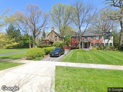
735 Grove St Glencoe, IL 60022
Estimated Value: $1,609,079 - $2,320,000
4
Beds
4
Baths
4,160
Sq Ft
$467/Sq Ft
Est. Value
About This Home
This home is located at 735 Grove St, Glencoe, IL 60022 and is currently estimated at $1,943,020, approximately $467 per square foot. 735 Grove St is a home located in Cook County with nearby schools including South Elementary School, Central School, and West School.
Ownership History
Date
Name
Owned For
Owner Type
Purchase Details
Closed on
Oct 13, 2012
Sold by
Breakstone Barbara R
Bought by
Breakstone Barbara R and Donalds Breakstone 1999 Trust
Current Estimated Value
Purchase Details
Closed on
Jun 12, 2008
Sold by
Breakstone Donald S and Breakstone Barbara R
Bought by
Breakstone Donald S and The Donald S Breakstone 1999 Trust
Purchase Details
Closed on
Oct 23, 2004
Sold by
Breakstone Donald S and Brandfonbrener Eric D
Bought by
Breakstone Donald S and Breakstone Barbara
Create a Home Valuation Report for This Property
The Home Valuation Report is an in-depth analysis detailing your home's value as well as a comparison with similar homes in the area
Home Values in the Area
Average Home Value in this Area
Purchase History
| Date | Buyer | Sale Price | Title Company |
|---|---|---|---|
| Breakstone Barbara R | -- | None Available | |
| Breakstone Donald S | -- | None Available | |
| Breakstone Donald S | -- | -- |
Source: Public Records
Mortgage History
| Date | Status | Borrower | Loan Amount |
|---|---|---|---|
| Closed | Breakstone Donald S | $250,000 | |
| Closed | Breakstone Donald S | $300,000 |
Source: Public Records
Tax History Compared to Growth
Tax History
| Year | Tax Paid | Tax Assessment Tax Assessment Total Assessment is a certain percentage of the fair market value that is determined by local assessors to be the total taxable value of land and additions on the property. | Land | Improvement |
|---|---|---|---|---|
| 2024 | $24,887 | $112,245 | $25,410 | $86,835 |
| 2023 | $24,887 | $112,245 | $25,410 | $86,835 |
| 2022 | $24,887 | $112,245 | $25,410 | $86,835 |
| 2021 | $26,721 | $96,534 | $20,790 | $75,744 |
| 2020 | $26,006 | $96,534 | $20,790 | $75,744 |
| 2019 | $25,101 | $104,929 | $20,790 | $84,139 |
| 2018 | $25,442 | $103,520 | $17,325 | $86,195 |
| 2017 | $24,733 | $103,520 | $17,325 | $86,195 |
| 2016 | $23,425 | $103,520 | $17,325 | $86,195 |
| 2015 | $24,417 | $95,848 | $14,437 | $81,411 |
| 2014 | $23,828 | $95,848 | $14,437 | $81,411 |
| 2013 | $22,714 | $95,848 | $14,437 | $81,411 |
Source: Public Records
Map
Nearby Homes
- 794 Greenwood Ave
- 406 Forest Edge Dr
- 509 Washington Ave
- 606 Green Bay Rd Unit 2A
- 595 Lincoln Ave
- 420 Washington Ave
- 608 Stonegate Terrace
- 626 Greenleaf Ave
- 677 Greenleaf Ave
- 687 Birch Rd
- 1 Briar Ln
- 494 Greenleaf Ave
- 379 Jefferson Ave
- 759 Strawberry Hill Dr
- 494 Sheridan Rd
- 399 Grove St
- 426 Madison Ave
- 416 Madison Ave
- 505 Jackson Ave
- 1124 Old Elm Ln