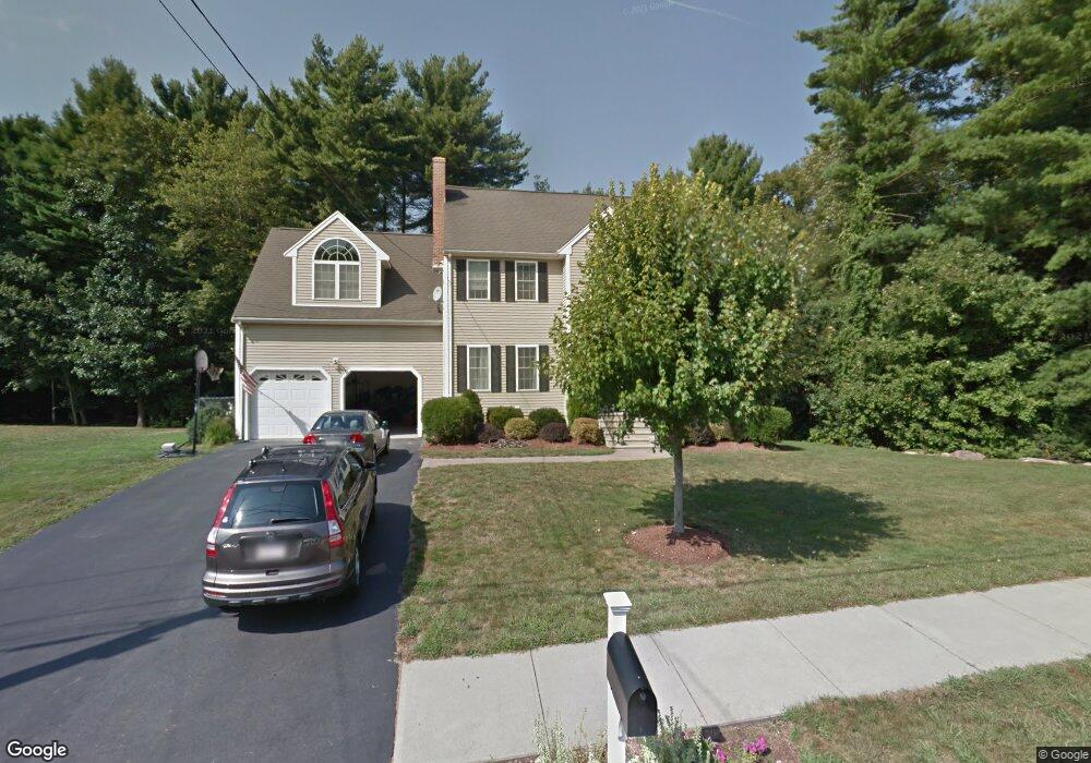
74 Meadowbrook Rd Franklin, MA 02038
Estimated Value: $888,000 - $1,056,000
4
Beds
3
Baths
2,718
Sq Ft
$354/Sq Ft
Est. Value
About This Home
This home is located at 74 Meadowbrook Rd, Franklin, MA 02038 and is currently estimated at $961,422, approximately $353 per square foot. 74 Meadowbrook Rd is a home located in Norfolk County with nearby schools including Oak Street Elementary School, Horace Mann Middle School, and Franklin High School.
Ownership History
Date
Name
Owned For
Owner Type
Purchase Details
Closed on
May 28, 2014
Sold by
Clifford Christina D
Bought by
Clifford Rt
Current Estimated Value
Purchase Details
Closed on
Dec 21, 2010
Sold by
Clifford Robert B and Clifford Christina D
Bought by
Clifford Christina D
Home Financials for this Owner
Home Financials are based on the most recent Mortgage that was taken out on this home.
Original Mortgage
$300,000
Interest Rate
4.23%
Purchase Details
Closed on
Sep 23, 2003
Sold by
Maple Sands Corp
Bought by
Clifford Robert B and Clifford Christina
Home Financials for this Owner
Home Financials are based on the most recent Mortgage that was taken out on this home.
Original Mortgage
$322,700
Interest Rate
6.31%
Mortgage Type
Purchase Money Mortgage
Create a Home Valuation Report for This Property
The Home Valuation Report is an in-depth analysis detailing your home's value as well as a comparison with similar homes in the area
Home Values in the Area
Average Home Value in this Area
Purchase History
| Date | Buyer | Sale Price | Title Company |
|---|---|---|---|
| Clifford Rt | -- | -- | |
| Clifford Christina D | -- | -- | |
| Clifford Robert B | $537,500 | -- |
Source: Public Records
Mortgage History
| Date | Status | Borrower | Loan Amount |
|---|---|---|---|
| Previous Owner | Clifford Christina D | $300,000 | |
| Previous Owner | Clifford Robert B | $322,700 |
Source: Public Records
Tax History Compared to Growth
Tax History
| Year | Tax Paid | Tax Assessment Tax Assessment Total Assessment is a certain percentage of the fair market value that is determined by local assessors to be the total taxable value of land and additions on the property. | Land | Improvement |
|---|---|---|---|---|
| 2025 | $9,252 | $796,200 | $328,400 | $467,800 |
| 2024 | $8,900 | $754,900 | $328,400 | $426,500 |
| 2023 | $8,953 | $711,700 | $285,200 | $426,500 |
| 2022 | $8,273 | $588,800 | $216,100 | $372,700 |
| 2021 | $9,073 | $619,300 | $240,100 | $379,200 |
| 2020 | $8,490 | $585,100 | $224,300 | $360,800 |
| 2019 | $8,462 | $577,200 | $216,300 | $360,900 |
| 2018 | $7,861 | $536,600 | $212,400 | $324,200 |
| 2017 | $7,621 | $522,700 | $198,500 | $324,200 |
| 2016 | $7,465 | $514,800 | $201,200 | $313,600 |
| 2015 | $7,562 | $509,600 | $196,000 | $313,600 |
| 2014 | $7,017 | $485,600 | $172,000 | $313,600 |
Source: Public Records
Map
Nearby Homes
- 37 Daniels St
- 33 Daniels St
- 70 Daniels St
- 204 Lincoln St
- 324 Pleasant St
- 266 Pleasant St
- 2 Kayla Dr
- 10 Silver Fox Rd
- 91 Oliver Pond Cir Unit 3
- 83 Oliver Pond Cir Unit 7
- 312 Eagles Nest Way Unit 312
- 48 Leanne Way Unit 48
- 48 Pinehurst St
- 17 Longhill Rd
- 99 Leland Rd
- 336 Maple St
- 41 Kimberlee Ave
- 24 Shayne Rd Unit 219
- 10 Populatic Street Extension
- 732 Lincoln St
- 101 Brook St
- 101 Brook St Unit 101
- 70 Meadowbrook Rd
- 649 Old Farm Rd
- 73 Meadowbrook Rd
- 81 Brook St
- 105 Brook St
- 646 Old Farm Rd
- 69 Meadowbrook Rd
- 641 Old Farm Rd
- 66 Meadowbrook Rd
- 107 Brook St
- 98 Brook St
- 98 Brook St
- 61 Meadowbrook Rd
- 79 Brook St
- 22 Eisenhower Dr
- 82 Brook St
- 102 Brook St
- 637 Old Farm Rd