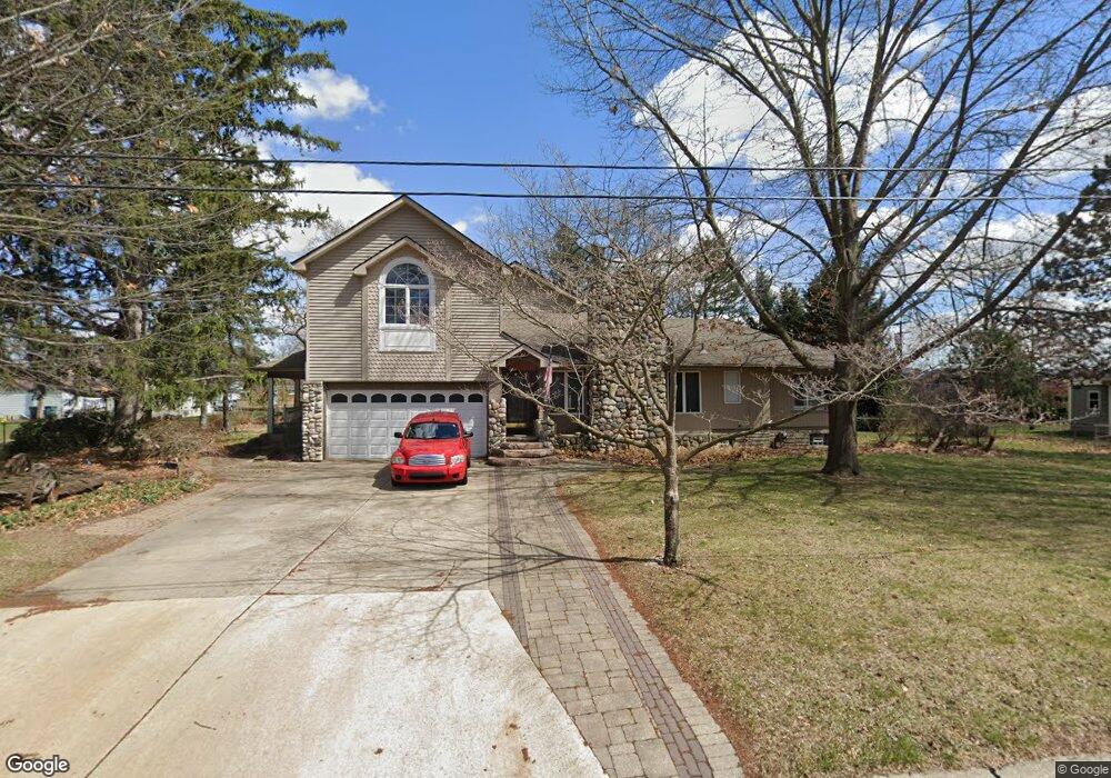
745 S Batchewana Ave Clawson, MI 48017
Estimated Value: $356,000 - $487,000
3
Beds
3
Baths
2,375
Sq Ft
$182/Sq Ft
Est. Value
About This Home
This home is located at 745 S Batchewana Ave, Clawson, MI 48017 and is currently estimated at $432,079, approximately $181 per square foot. 745 S Batchewana Ave is a home located in Oakland County with nearby schools including Clawson Middle School, Clawson High School, and Japhet School.
Ownership History
Date
Name
Owned For
Owner Type
Purchase Details
Closed on
Jul 11, 2014
Sold by
Douglas Joan L and Douglas James H
Bought by
Douglas James H and Douglas Joan L
Current Estimated Value
Create a Home Valuation Report for This Property
The Home Valuation Report is an in-depth analysis detailing your home's value as well as a comparison with similar homes in the area
Home Values in the Area
Average Home Value in this Area
Purchase History
| Date | Buyer | Sale Price | Title Company |
|---|---|---|---|
| Douglas James H | -- | None Available |
Source: Public Records
Tax History Compared to Growth
Tax History
| Year | Tax Paid | Tax Assessment Tax Assessment Total Assessment is a certain percentage of the fair market value that is determined by local assessors to be the total taxable value of land and additions on the property. | Land | Improvement |
|---|---|---|---|---|
| 2024 | $5,163 | $229,950 | $0 | $0 |
| 2023 | $4,950 | $222,490 | $0 | $0 |
| 2022 | $4,990 | $206,560 | $0 | $0 |
| 2021 | $4,887 | $196,590 | $0 | $0 |
| 2020 | $4,735 | $183,610 | $0 | $0 |
| 2019 | $4,893 | $179,350 | $0 | $0 |
| 2018 | $4,858 | $156,260 | $0 | $0 |
| 2017 | $4,829 | $151,260 | $0 | $0 |
| 2016 | $4,876 | $141,200 | $0 | $0 |
| 2015 | -- | $120,370 | $0 | $0 |
| 2014 | -- | $105,180 | $0 | $0 |
| 2011 | -- | $94,140 | $0 | $0 |
Source: Public Records
Map
Nearby Homes
- 1500 Normandy Rd Unit 216
- 4227 Crooks Rd
- 4345 Crooks Rd Unit 26
- 515 S Webik Ave
- 4101 Devon Rd
- 1928 Cresthill Ave
- 1807 Samoset Rd
- 4102 Woodland Ave
- 232 S Manitou Ave
- 2011 Nakota Rd
- 4010 Linwood Ave
- 4514 Thorncroft Ave
- 3601 Durham Rd
- 3532 Woodland Ave
- 3515 Durham Rd
- 3535 Woodland Ave
- 3327 Nell Rose Ct
- 1418 W 13 Mile Rd
- 4921 Crooks Rd Unit M-10
- 4909 Crooks Rd Unit C7
- 811 S Batchewana Ave
- 744 S Webik Ave
- 1249 Massoit Rd
- 734 S Webik Ave
- 724 S Webik Ave
- 806 S Webik Ave
- 744 S Batchewana Ave
- 829 S Batchewana Ave
- 738 S Batchewana Ave
- 1221 Massoit Rd
- 1209 Massoit Rd
- 1604 Michael Ct
- 720 S Batchewana Ave
- 1672 Michael Ct Unit 12
- 1700 Alyssa Ln
- 1670 Normandy Rd
- 1650 Normandy Rd Unit 8
- 1640 Normandy Rd
- 1630 Normandy Rd Unit 6
- 1620 Normandy Rd Unit 5