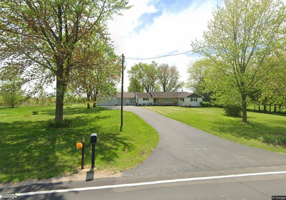
7485 E Brannick Rd Minooka, IL 60447
Estimated Value: $332,000 - $465,980
About This Home
This home is located at 7485 E Brannick Rd, Minooka, IL 60447 and is currently estimated at $406,745, approximately $423 per square foot. 7485 E Brannick Rd is a home with nearby schools including Minooka Primary Center, Minooka Elementary School, and Minooka Junior High School.
Ownership History
We collect this data history from publicly available records. To have your information removed, we recommend requesting removal directly through your county’s website.
Purchase Details
Purchase Details
Purchase Details
Purchase History
We collect this data history from publicly available records. To have your information removed, we recommend requesting removal directly through your county’s website.
| Date | Buyer | Sale Price | Title Company |
|---|---|---|---|
| -- | None Listed On Document | ||
| -- | None Available | ||
| -- | -- |
Mortgage History
We collect this data history from publicly available records. To have your information removed, we recommend requesting removal directly through your county’s website.
| Date | Status | Borrower | Loan Amount |
|---|---|---|---|
| Closed | $130,000 | ||
| Closed | $100,000 | ||
| Closed | $150,000 |
Tax History
We collect this data history from publicly available records. To have your information removed, we recommend requesting removal directly through your county’s website.
| Year | Tax Paid | Tax Assessment Tax Assessment Total Assessment is a certain percentage of the fair market value that is determined by local assessors to be the total taxable value of land and additions on the property. | Land | Improvement |
|---|---|---|---|---|
| 2025 | $9,800 | $132,230 | $15,911 | $116,319 |
| 2024 | $9,292 | $125,372 | $15,086 | $110,286 |
| 2023 | $8,469 | $114,276 | $13,751 | $100,525 |
| 2022 | $7,059 | $106,254 | $12,786 | $93,468 |
| 2021 | $6,290 | $100,581 | $12,103 | $88,478 |
| 2020 | $4,189 | $96,215 | $11,578 | $84,637 |
| 2019 | $4,119 | $89,088 | $10,720 | $78,368 |
| 2018 | $4,825 | $96,813 | $10,600 | $86,213 |
| 2017 | $4,573 | $87,267 | $10,122 | $77,145 |
| 2016 | $3,706 | $51,596 | $9,502 | $42,094 |
| 2015 | $1,713 | $46,901 | $8,637 | $38,264 |
| 2014 | $1,445 | $44,313 | $8,160 | $36,153 |
| 2013 | $1,474 | $44,910 | $8,270 | $36,640 |
Map
- 807 High Grove Dr
- 713 Clifford Dr
- 610 High Grove Dr
- 804 Feeney Dr
- 604 Mahoney Dr
- 1012 Redwood Ln
- 1016 Redwood Ln
- 1020 Redwood Ln
- 1217 Clifton Dr
- 1221 Clifton Dr
- 1225 Clifton Dr
- 1206 Clifton Dr
- 702 Longwood Ct
- 1316 Sherborn Ct N
- 607 Flanagan Dr Unit B
- 1138 Coneflower Ct
- 1403 Sherborn Ct S
- 1308 Burns Ct
- 414 Flanagan Cir Unit B
- 336 Clover Cir
- 810 Joanne Dr
- 814 High Grove Dr
- 904 Joanne Dr
- 808 Joanne Dr
- 807 Long Ridge Trail
- 00 E Brannick Rd
- 906 Joanne Dr
- 812 High Grove Dr
- 7405 E Brannick Rd
- 806 Joanne Dr
- 810 High Grove Dr
- 805 Long Ridge Trail
- 903 Joanne Dr
- 808 High Grove Dr
- 804 Joanne Dr
- 905 Joanne Dr
- 803 Long Ridge Trail
- 910 Casey Dr
- 907 Joanne Dr
- 806 High Grove Dr
Ask me questions while you tour the home.