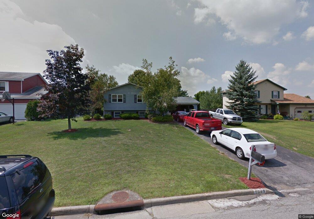
7549 Buchanan Dr Youngstown, OH 44512
Estimated Value: $242,000 - $303,000
3
Beds
2
Baths
2,240
Sq Ft
$124/Sq Ft
Est. Value
About This Home
This home is located at 7549 Buchanan Dr, Youngstown, OH 44512 and is currently estimated at $278,764, approximately $124 per square foot. 7549 Buchanan Dr is a home located in Mahoning County with nearby schools including Robinwood Lane Elementary School, Boardman Glenwood Junior High School, and Boardman High School.
Ownership History
Date
Name
Owned For
Owner Type
Purchase Details
Closed on
Nov 8, 2005
Sold by
Byus William Michael and Byus Joni S
Bought by
Blake Sharon D
Current Estimated Value
Home Financials for this Owner
Home Financials are based on the most recent Mortgage that was taken out on this home.
Original Mortgage
$127,775
Outstanding Balance
$67,904
Interest Rate
6.04%
Mortgage Type
Fannie Mae Freddie Mac
Estimated Equity
$210,860
Purchase Details
Closed on
Feb 6, 2001
Sold by
Connors E Brian
Bought by
Byus William M
Purchase Details
Closed on
Nov 3, 2000
Sold by
Connors E Brian
Bought by
Byus William
Purchase Details
Closed on
Dec 21, 1995
Sold by
Grostefon Ronald R
Bought by
Byus William M and Byus Joni S
Home Financials for this Owner
Home Financials are based on the most recent Mortgage that was taken out on this home.
Original Mortgage
$80,000
Interest Rate
6.94%
Mortgage Type
New Conventional
Purchase Details
Closed on
Apr 7, 1992
Bought by
Grostefon Ronald R and N S
Create a Home Valuation Report for This Property
The Home Valuation Report is an in-depth analysis detailing your home's value as well as a comparison with similar homes in the area
Home Values in the Area
Average Home Value in this Area
Purchase History
| Date | Buyer | Sale Price | Title Company |
|---|---|---|---|
| Blake Sharon D | $134,500 | -- | |
| Byus William M | $13,000 | -- | |
| Byus William | $14,000 | -- | |
| Byus William M | $102,000 | -- | |
| Grostefon Ronald R | $81,000 | -- |
Source: Public Records
Mortgage History
| Date | Status | Borrower | Loan Amount |
|---|---|---|---|
| Open | Blake Sharon D | $127,775 | |
| Previous Owner | Byus William M | $80,000 |
Source: Public Records
Tax History
| Year | Tax Paid | Tax Assessment Tax Assessment Total Assessment is a certain percentage of the fair market value that is determined by local assessors to be the total taxable value of land and additions on the property. | Land | Improvement |
|---|---|---|---|---|
| 2025 | $3,905 | $78,160 | $13,780 | $64,380 |
| 2024 | $3,995 | $78,160 | $13,780 | $64,380 |
| 2023 | $3,941 | $78,160 | $13,780 | $64,380 |
| 2022 | $3,651 | $55,310 | $10,610 | $44,700 |
| 2021 | $3,653 | $55,310 | $10,610 | $44,700 |
| 2020 | $3,672 | $55,310 | $10,610 | $44,700 |
| 2019 | $3,322 | $44,020 | $9,640 | $34,380 |
| 2018 | $2,886 | $44,020 | $9,640 | $34,380 |
| 2017 | $2,695 | $44,020 | $9,640 | $34,380 |
| 2016 | $2,555 | $39,210 | $10,680 | $28,530 |
| 2015 | $2,505 | $39,210 | $10,680 | $28,530 |
| 2014 | $2,512 | $39,210 | $10,680 | $28,530 |
| 2013 | $2,481 | $39,210 | $10,680 | $28,530 |
Source: Public Records
Map
Nearby Homes
- 7708 Buchanan Dr
- 675 Presidential Dr
- 901 Pearson Cir Unit 3
- 930 Pearson Cir
- 852 Pearson Cir Unit 3
- 929 Auburn Hills Dr Unit 1
- 7357 Eisenhower Dr Unit 6
- 7362 Eisenhower Dr Unit 5
- 681 Saddlebrook Dr
- 7374 Eisenhower Dr Unit 3
- 8002 Sigle Ln
- 810 Kentwood Dr Unit 3
- 7863 Walnut St Unit A
- 0 Wood Ave Unit 5196661
- 0 Wood Ave Unit 5196668
- 0 Wood Ave Unit 5196664
- 0 Wood Ave Unit 5196670
- 8129 South Ave
- 1860 Massachusetts Ave Unit 2
- 218 Boardman Blvd
- 7553 Buchanan Dr
- 7545 Buchanan Dr
- 7557 Buchanan Dr
- 7541 Buchanan Dr
- 7629 Buchanan Dr
- 7621 Buchanan Dr
- 7637 Buchanan Dr
- 7613 Buchanan Dr
- 7645 Buchanan Dr
- 7548 Buchanan Dr
- 7544 Buchanan Dr
- 7552 Buchanan Dr
- 7535 Buchanan Dr
- 7561 Buchanan Dr
- 7556 Buchanan Dr
- 7653 Buchanan Dr
- 7540 Buchanan Dr
- 7605 Buchanan Dr
- 7534 Buchanan Dr
- 7530 Buchanan Dr
Your Personal Tour Guide
Ask me questions while you tour the home.