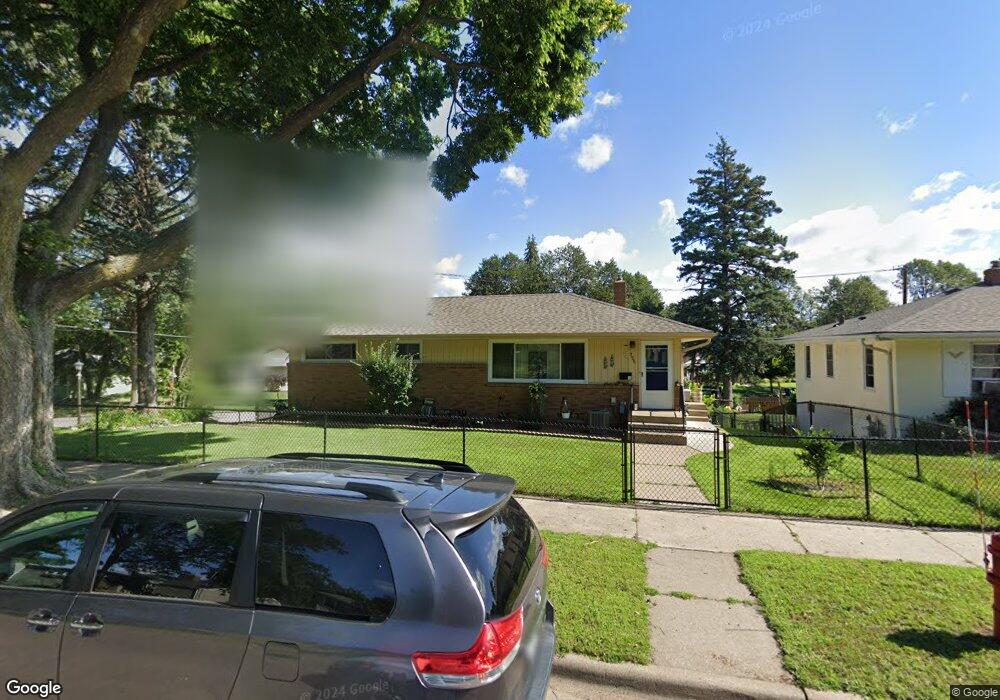
755 Simon Ave Saint Paul, MN 55117
Como Park NeighborhoodEstimated Value: $310,855 - $345,000
3
Beds
2
Baths
1,056
Sq Ft
$309/Sq Ft
Est. Value
About This Home
This home is located at 755 Simon Ave, Saint Paul, MN 55117 and is currently estimated at $326,464, approximately $309 per square foot. 755 Simon Ave is a home located in Ramsey County with nearby schools including Como Park Elementary School, Murray Middle School, and Como Park Senior High School.
Ownership History
Date
Name
Owned For
Owner Type
Purchase Details
Closed on
Dec 29, 2017
Sold by
Curtis Robert and Curtis Kathleen A
Bought by
Flower Susan
Current Estimated Value
Home Financials for this Owner
Home Financials are based on the most recent Mortgage that was taken out on this home.
Original Mortgage
$110,000
Outstanding Balance
$91,932
Interest Rate
3.93%
Mortgage Type
New Conventional
Estimated Equity
$234,532
Purchase Details
Closed on
Jan 19, 2015
Sold by
Curtis Robert A
Bought by
Curtis Robert A and Curtis Robert
Home Financials for this Owner
Home Financials are based on the most recent Mortgage that was taken out on this home.
Original Mortgage
$173,980
Interest Rate
4.5%
Mortgage Type
FHA
Purchase Details
Closed on
Jul 26, 2014
Sold by
Curtis Robert A and White Cara E
Bought by
Curtis Robert A
Purchase Details
Closed on
Mar 30, 2000
Sold by
Reamer Charles L and Reamer Maxine M
Bought by
Mccabe Sullivan David and Mccabe Sullivan Sheila
Create a Home Valuation Report for This Property
The Home Valuation Report is an in-depth analysis detailing your home's value as well as a comparison with similar homes in the area
Home Values in the Area
Average Home Value in this Area
Purchase History
| Date | Buyer | Sale Price | Title Company |
|---|---|---|---|
| Flower Susan | $220,000 | Burnet Title | |
| Curtis Robert A | $515 | National Advantage Settlemen | |
| Curtis Robert A | $515 | Fidelity National Title Grou | |
| Mccabe Sullivan David | $126,000 | -- |
Source: Public Records
Mortgage History
| Date | Status | Borrower | Loan Amount |
|---|---|---|---|
| Open | Flower Susan | $110,000 | |
| Previous Owner | Curtis Robert A | $173,980 |
Source: Public Records
Tax History
| Year | Tax Paid | Tax Assessment Tax Assessment Total Assessment is a certain percentage of the fair market value that is determined by local assessors to be the total taxable value of land and additions on the property. | Land | Improvement |
|---|---|---|---|---|
| 2025 | $4,990 | $306,900 | $63,900 | $243,000 |
| 2023 | $4,294 | $284,400 | $63,900 | $220,500 |
| 2022 | $3,734 | $269,000 | $64,000 | $205,000 |
| 2021 | $3,782 | $241,900 | $64,000 | $177,900 |
| 2020 | $3,678 | $252,800 | $64,000 | $188,800 |
| 2019 | $3,164 | $231,200 | $64,000 | $167,200 |
| 2018 | $3,236 | $200,200 | $64,000 | $136,200 |
| 2017 | $3,444 | $184,400 | $51,200 | $133,200 |
| 2016 | $3,134 | $0 | $0 | $0 |
| 2015 | $3,000 | $181,600 | $51,200 | $130,400 |
| 2014 | $2,580 | $0 | $0 | $0 |
Source: Public Records
Map
Nearby Homes
- 1070 Dale St N
- 1048 Dale St N
- 1187 Dale St N
- 1049 Kent St
- 352 Como Ave
- 1245 Dale St N
- 593 Front Ave
- 989 Barrett St
- 1104 MacKubin St
- 1300 Schletti St
- 1083 Chatsworth St N
- 1094 Argyle St
- 870 Lakeview Ave
- 1041 Western Ave N
- 585 Cottage Ave W
- 469 Como Ave
- 1120 Virginia St
- 952 Western Ave N
- 1406 Schletti St
- 1151 Farrington St
- 749 Simon Ave
- 745 Simon Ave
- 699 Jessamine Ave W
- 693 Jessamine Ave W
- 693 W Jessamine Ave
- 705 Jessamine Ave W
- 754 Simon Ave
- 741 Simon Ave
- 760 Simon Ave
- 746 Simon Ave
- 744 Simon Ave
- 687 Jessamine Ave W
- 735 Simon Ave
- 680 Jessamine Ave W
- 740 Simon Ave
- 681 Jessamine Ave W
- 97 Maywood Place
- 89 Maywood Place
- 731 Simon Ave
- 714 Jessamine Ave W
Your Personal Tour Guide
Ask me questions while you tour the home.