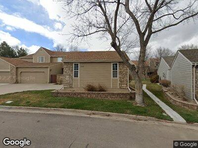
7623 W Euclid Dr Littleton, CO 80123
Dutch Creek Village NeighborhoodEstimated Value: $470,000 - $554,000
5
Beds
3
Baths
1,530
Sq Ft
$332/Sq Ft
Est. Value
About This Home
This home is located at 7623 W Euclid Dr, Littleton, CO 80123 and is currently estimated at $508,428, approximately $332 per square foot. 7623 W Euclid Dr is a home located in Jefferson County with nearby schools including Leawood Elementary School, Ken Caryl Middle School, and Columbine High School.
Ownership History
Date
Name
Owned For
Owner Type
Purchase Details
Closed on
Apr 14, 2025
Sold by
Larson Babette and Larson Babette A
Bought by
Corporate Properties Inc
Current Estimated Value
Purchase Details
Closed on
Jun 2, 2021
Sold by
The Babette A Larson Trust
Bought by
Larson Babette A
Purchase Details
Closed on
Apr 28, 2009
Sold by
Larson Babette A
Bought by
The Babette A Larson Trust
Purchase Details
Closed on
Dec 3, 1998
Sold by
Larson Lillian E
Bought by
Larson Lillian E and Larson Babette A
Purchase Details
Closed on
Dec 2, 1998
Sold by
Lillian E Larson Trust and Lillian E
Bought by
Larson Lillian E
Create a Home Valuation Report for This Property
The Home Valuation Report is an in-depth analysis detailing your home's value as well as a comparison with similar homes in the area
Home Values in the Area
Average Home Value in this Area
Purchase History
| Date | Buyer | Sale Price | Title Company |
|---|---|---|---|
| Corporate Properties Inc | $305,000 | None Listed On Document | |
| Larson Babette A | -- | None Available | |
| The Babette A Larson Trust | -- | None Available | |
| Larson Lillian E | -- | -- | |
| Larson Lillian E | -- | -- |
Source: Public Records
Tax History Compared to Growth
Tax History
| Year | Tax Paid | Tax Assessment Tax Assessment Total Assessment is a certain percentage of the fair market value that is determined by local assessors to be the total taxable value of land and additions on the property. | Land | Improvement |
|---|---|---|---|---|
| 2024 | $2,259 | $30,790 | $6,030 | $24,760 |
| 2023 | $2,259 | $30,790 | $6,030 | $24,760 |
| 2022 | $1,942 | $27,259 | $4,170 | $23,089 |
| 2021 | $1,971 | $28,043 | $4,290 | $23,753 |
| 2020 | $1,798 | $26,274 | $4,290 | $21,984 |
| 2019 | $1,774 | $26,274 | $4,290 | $21,984 |
| 2018 | $1,718 | $25,151 | $3,600 | $21,551 |
| 2017 | $1,542 | $25,151 | $3,600 | $21,551 |
| 2016 | $1,258 | $22,081 | $3,184 | $18,897 |
| 2015 | $857 | $22,081 | $3,184 | $18,897 |
| 2014 | $857 | $16,963 | $2,229 | $14,734 |
Source: Public Records
Map
Nearby Homes
- 6602 S Vance St
- 7450 W Coal Mine Ave Unit D
- 7490 W Coal Mine Ave Unit A
- 7906 W Walker Dr
- 7825 W Walker Dr
- 8029 W Hoover Place
- 7600 W Coal Mine Ave Unit B
- 7314 W Walker Place
- 6809 S Webster St Unit F
- 7814 W Ontario Place
- 8150 W Calhoun Dr
- 6819 S Webster St Unit E
- 6825 S Webster St Unit A
- 6930 S Yukon Way
- 6845 S Webster St Unit G
- 7822 W Ottawa Place
- 6924 W Euclid Place Unit A
- 7753 W Plymouth Place
- 6617 S Reed Way Unit C
- 6606 S Reed Way Unit B
- 7623 W Euclid Dr
- 7633 W Euclid Dr
- 7643 W Euclid Dr
- 7613 W Euclid Dr
- 6646 S Yukon Way
- 6640 S Yukon Way
- 7653 W Euclid Dr
- 7603 W Euclid Dr
- 6636 S Yukon Way
- 6630 S Yukon Way
- 6626 S Yukon Way
- 7563 W Euclid Dr
- 7663 W Euclid Dr
- 7634 W Euclid Dr
- 7644 W Euclid Dr
- 7604 W Euclid Dr
- 6620 S Yukon Way
- 7654 W Euclid Dr
- 7673 W Euclid Dr
- 7584 W Euclid Dr