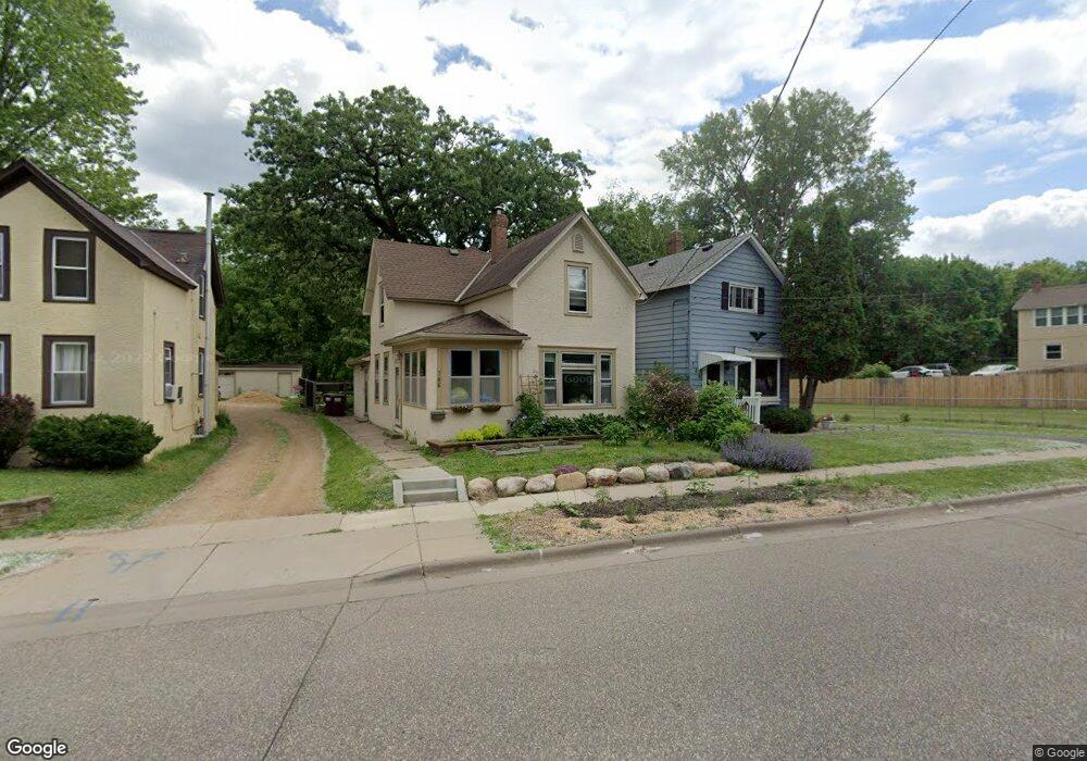
766 Dodd Rd Saint Paul, MN 55118
Estimated Value: $262,000 - $300,861
3
Beds
1
Bath
1,323
Sq Ft
$216/Sq Ft
Est. Value
About This Home
This home is located at 766 Dodd Rd, Saint Paul, MN 55118 and is currently estimated at $286,215, approximately $216 per square foot. 766 Dodd Rd is a home located in Dakota County with nearby schools including Somerset Elementary School, Heritage E-STEM Magnet School, and Two Rivers High School.
Ownership History
Date
Name
Owned For
Owner Type
Purchase Details
Closed on
Jun 8, 2012
Sold by
Tcf National Bank
Bought by
Cunnien Kari Denissen and Cunnien Keith
Current Estimated Value
Home Financials for this Owner
Home Financials are based on the most recent Mortgage that was taken out on this home.
Original Mortgage
$94,905
Outstanding Balance
$65,896
Interest Rate
3.87%
Mortgage Type
New Conventional
Estimated Equity
$220,319
Create a Home Valuation Report for This Property
The Home Valuation Report is an in-depth analysis detailing your home's value as well as a comparison with similar homes in the area
Home Values in the Area
Average Home Value in this Area
Purchase History
| Date | Buyer | Sale Price | Title Company |
|---|---|---|---|
| Cunnien Kari Denissen | $99,900 | Ancona Title Services |
Source: Public Records
Mortgage History
| Date | Status | Borrower | Loan Amount |
|---|---|---|---|
| Open | Cunnien Kari Denissen | $94,905 |
Source: Public Records
Tax History Compared to Growth
Tax History
| Year | Tax Paid | Tax Assessment Tax Assessment Total Assessment is a certain percentage of the fair market value that is determined by local assessors to be the total taxable value of land and additions on the property. | Land | Improvement |
|---|---|---|---|---|
| 2024 | $3,508 | $275,600 | $65,200 | $210,400 |
| 2023 | $3,508 | $292,500 | $69,100 | $223,400 |
| 2022 | $2,936 | $263,600 | $68,800 | $194,800 |
| 2021 | $2,838 | $236,600 | $59,800 | $176,800 |
| 2020 | $2,696 | $228,200 | $57,000 | $171,200 |
| 2019 | $2,627 | $212,700 | $54,300 | $158,400 |
| 2018 | $2,257 | $199,100 | $50,700 | $148,400 |
| 2017 | $2,130 | $181,600 | $48,300 | $133,300 |
| 2016 | $2,086 | $166,800 | $43,900 | $122,900 |
| 2015 | $2,085 | $141,520 | $37,192 | $104,328 |
| 2014 | -- | $136,942 | $34,278 | $102,664 |
| 2013 | -- | $126,369 | $31,066 | $95,303 |
Source: Public Records
Map
Nearby Homes
- 206 Winona St W
- 116 Page St W
- 867 Winslow Ave
- 259 Curtice St W
- 908 Bellows St
- 15 Belvidere St W
- 1517 Timberwood Ln
- 272 Baker St W
- 950 Bellows St
- 110 King St W
- 31 Annapolis St E
- 822 Smith Ave S
- 1016 Bidwell St
- 693 Smith Ave S
- 517 Bidwell St
- 71 George St W
- 767 Robert St S
- 632 Smith Ave S
- 663 Smith Ave S
- 301 George St W
- 762 Dodd Rd
- 768 Dodd Rd
- 154 Sidney St W
- 766 766 Dodd Rd
- 762 762 Dodd-Road-
- 762 762 Dodd Rd
- 144 Sidney St W
- 144 Sidney St W
- 780 Dodd Rd
- 138 Sidney St W
- 13X Sidney St W
- 130 Sidney St W
- 166 Sidney St W
- 763 Dodd Rd
- 780 780 Dodd Rd
- 151 Belvidere St W
- 130 130 W Sidney-Street-
- 130 130 W Sidney St
- 130 130 Sidney-Street-w
- 782 Dodd Rd