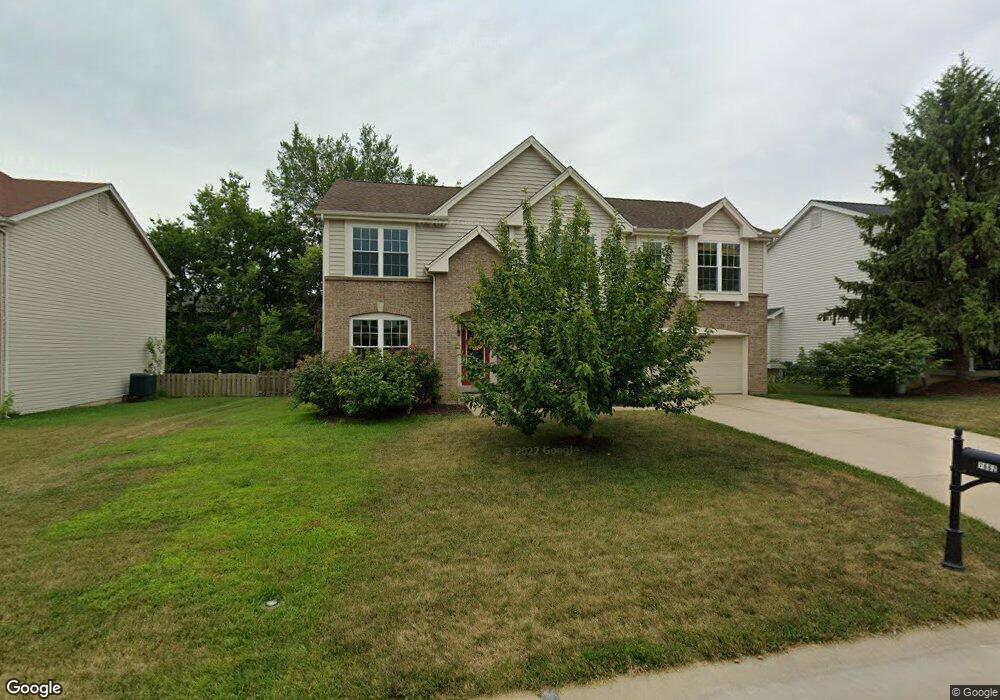
7662 Pierside Dr O Fallon, MO 63368
Estimated Value: $419,000 - $479,000
4
Beds
3
Baths
3,036
Sq Ft
$151/Sq Ft
Est. Value
About This Home
This home is located at 7662 Pierside Dr, O Fallon, MO 63368 and is currently estimated at $458,141, approximately $150 per square foot. 7662 Pierside Dr is a home located in St. Charles County with nearby schools including Crossroads Elementary School, Frontier Middle School, and Liberty High School.
Ownership History
Date
Name
Owned For
Owner Type
Purchase Details
Closed on
Jun 11, 1998
Sold by
The Jones Company Custom Homes Inc
Bought by
Brummer Terry L and Brummer Cynthia R
Current Estimated Value
Home Financials for this Owner
Home Financials are based on the most recent Mortgage that was taken out on this home.
Original Mortgage
$151,750
Outstanding Balance
$30,676
Interest Rate
7.17%
Estimated Equity
$427,465
Create a Home Valuation Report for This Property
The Home Valuation Report is an in-depth analysis detailing your home's value as well as a comparison with similar homes in the area
Home Values in the Area
Average Home Value in this Area
Purchase History
| Date | Buyer | Sale Price | Title Company |
|---|---|---|---|
| Brummer Terry L | $168,644 | -- |
Source: Public Records
Mortgage History
| Date | Status | Borrower | Loan Amount |
|---|---|---|---|
| Open | Brummer Terry L | $151,750 |
Source: Public Records
Tax History Compared to Growth
Tax History
| Year | Tax Paid | Tax Assessment Tax Assessment Total Assessment is a certain percentage of the fair market value that is determined by local assessors to be the total taxable value of land and additions on the property. | Land | Improvement |
|---|---|---|---|---|
| 2025 | $4,932 | $76,135 | -- | -- |
| 2023 | $4,932 | $76,343 | $0 | $0 |
| 2022 | $4,671 | $67,398 | $0 | $0 |
| 2021 | $4,676 | $67,398 | $0 | $0 |
| 2020 | $3,567 | $49,218 | $0 | $0 |
| 2019 | $3,317 | $49,218 | $0 | $0 |
| 2018 | $3,694 | $52,295 | $0 | $0 |
| 2017 | $3,693 | $52,295 | $0 | $0 |
| 2016 | $3,464 | $46,953 | $0 | $0 |
| 2015 | $3,391 | $46,953 | $0 | $0 |
| 2014 | $2,749 | $40,782 | $0 | $0 |
Source: Public Records
Map
Nearby Homes
- 7767 Boatside Dr
- 7797 Boatside Dr
- 6998 Route N
- 733 Thayer Ct
- 702 Balcarra Dr
- 10 Pine Cone Ct
- 701 Balcarra Dr
- 258 Chestnut Hill Dr
- 318 Copper Tree Ct
- 243 Chestnut Hill Dr
- 7339 the Cedars Dr
- 612 Thornridge Dr
- 7253 Highway N
- 1306 Feise Rd
- 7333 Watsons Parish Dr
- 236 Kerry Downs Dr
- 242 Kerry Downs Dr
- 1723 Monet Dr
- 3 Jura Ct
- 0 Unknown Unit MIS22064590
- 7672 Pierside Dr
- 7652 Pierside Dr
- 661 Hawk Run Dr
- 663 Hawk Run Dr
- 663 Hawk Run Dr Unit 32A
- 659 Hawk Run Dr
- 659 Hawk Run Dr Unit 30A
- 657 Hawk Run Dr
- 655 Hawk Run Dr
- 7682 Pierside Dr
- 7642 Pierside Dr
- 7657 Pierside Dr
- 665 Hawk Run Dr
- 653 Hawk Run Dr
- 7647 Pierside Dr
- 651 Hawk Run Dr
- 667 Hawk Run Dr
- 667 Hawk Run Dr Unit 34A
- 7692 Pierside Dr
- 2207 Harborside Dr