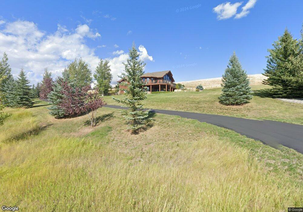
767 Triple Tree Rd Bozeman, MT 59715
Estimated Value: $2,095,780 - $2,328,000
4
Beds
3
Baths
2,493
Sq Ft
$896/Sq Ft
Est. Value
About This Home
This home is located at 767 Triple Tree Rd, Bozeman, MT 59715 and is currently estimated at $2,232,695, approximately $895 per square foot. 767 Triple Tree Rd is a home located in Gallatin County with nearby schools including Morning Star School, Sacajawea Middle School, and Bozeman High School.
Ownership History
Date
Name
Owned For
Owner Type
Purchase Details
Closed on
Jan 28, 2021
Sold by
Lifson Holly Ann
Bought by
Lifson Holly Ann and Lifson Michael Sanford
Current Estimated Value
Purchase Details
Closed on
May 16, 2007
Sold by
Lifson Michael S
Bought by
Lifson Holly A
Create a Home Valuation Report for This Property
The Home Valuation Report is an in-depth analysis detailing your home's value as well as a comparison with similar homes in the area
Purchase History
| Date | Buyer | Sale Price | Title Company |
|---|---|---|---|
| Lifson Holly Ann | -- | Accommodation | |
| Lifson Holly A | -- | Accommodation |
Source: Public Records
Tax History
| Year | Tax Paid | Tax Assessment Tax Assessment Total Assessment is a certain percentage of the fair market value that is determined by local assessors to be the total taxable value of land and additions on the property. | Land | Improvement |
|---|---|---|---|---|
| 2025 | $7,421 | $1,649,400 | $0 | $0 |
| 2024 | $10,552 | $2,007,400 | $0 | $0 |
| 2023 | $10,831 | $2,007,400 | $0 | $0 |
| 2022 | $7,832 | $1,197,215 | $0 | $0 |
| 2021 | $8,557 | $1,197,215 | $0 | $0 |
| 2020 | $9,315 | $1,180,581 | $0 | $0 |
| 2019 | $9,175 | $1,180,581 | $0 | $0 |
| 2018 | $8,981 | $1,058,646 | $0 | $0 |
| 2017 | $8,366 | $1,058,646 | $0 | $0 |
| 2016 | $7,257 | $846,912 | $0 | $0 |
| 2015 | $7,533 | $846,912 | $0 | $0 |
| 2014 | $8,360 | $561,627 | $0 | $0 |
Source: Public Records
Map
Nearby Homes
- TBD Jack Leg Ln
- 150 Wintergreen Ln
- 370 Star Ridge Rd
- 240 Horsetail Rd
- Lot 5 Francham Trail
- Lot 26 Nash Rd
- Lot 22 Nash Rd
- NHN Trooper Trail
- 8373 Goldenstein Ln
- 1903 Mount Ellis Ln
- 3751 Sourdough Rd
- 4235 Graf St
- 8050 Leverich Rd
- 131 Erik Dr
- 2375 Mount Ellis Ln
- 101 Painted Ridge Rd
- 101 Painted Ridge
- TBD Lot 17 Boreal Way
- 3726 Bungalow Ln
- Lot 129 Graf St
- 713 Triple Tree Rd
- 760 Triple Tree Rd
- 663 Triple Tree Rd
- 706 Triple Tree Rd
- 89 Columbine Ct
- Lot 4 S Columbine Ln
- 656 Triple Tree Rd
- 659 Triple Tree Rd
- 144 Heather Ln
- 600 Triple Tree Rd
- - Triple Tree Rd
- L9, B1 Triple Tree Rd
- L6 B2 Triple Tree Rd
- L4, B1 Triple Tree Rd
- 80 Heather Ln
- TBD Columbine Ct
- 60 Columbine Ct
- 188 Heather Ln
- 234 Heather Ln
- 552 Triple Tree Rd
Your Personal Tour Guide
Ask me questions while you tour the home.