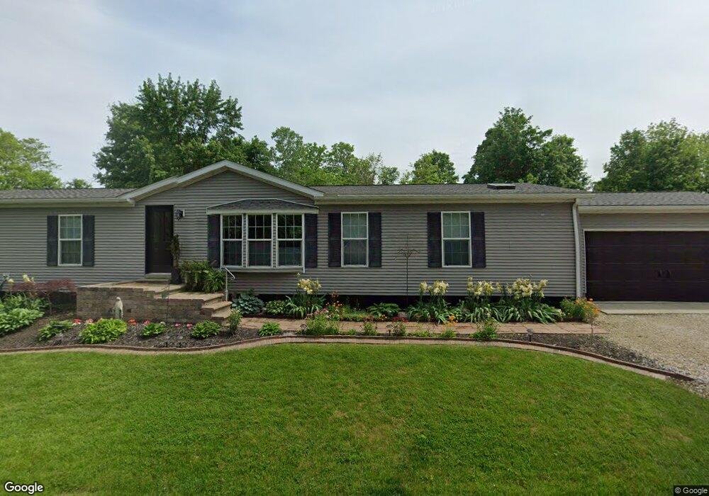
77 E Mohawk Dr Powell, OH 43065
Concord NeighborhoodEstimated Value: $309,000 - $466,000
3
Beds
2
Baths
1,836
Sq Ft
$220/Sq Ft
Est. Value
About This Home
This home is located at 77 E Mohawk Dr, Powell, OH 43065 and is currently estimated at $403,582, approximately $219 per square foot. 77 E Mohawk Dr is a home located in Delaware County with nearby schools including Eli Pinney Elementary School, Willard Grizzell Middle School, and Dublin Jerome High School.
Ownership History
Date
Name
Owned For
Owner Type
Purchase Details
Closed on
Sep 2, 2011
Sold by
Deascentis Joan H and Carter Brent
Bought by
Fabbre Robert and Fabbre Stacy
Current Estimated Value
Home Financials for this Owner
Home Financials are based on the most recent Mortgage that was taken out on this home.
Original Mortgage
$116,958
Outstanding Balance
$81,942
Interest Rate
4.75%
Mortgage Type
FHA
Estimated Equity
$321,640
Purchase Details
Closed on
Dec 31, 2007
Sold by
Deascentis Joan H
Bought by
Deascentis Joan H and Carter Brent
Home Financials for this Owner
Home Financials are based on the most recent Mortgage that was taken out on this home.
Original Mortgage
$215,687
Interest Rate
6.17%
Mortgage Type
FHA
Purchase Details
Closed on
Jun 17, 2003
Sold by
Tilin Corp
Bought by
Deascentis Joan H
Home Financials for this Owner
Home Financials are based on the most recent Mortgage that was taken out on this home.
Original Mortgage
$165,113
Interest Rate
5.51%
Mortgage Type
FHA
Create a Home Valuation Report for This Property
The Home Valuation Report is an in-depth analysis detailing your home's value as well as a comparison with similar homes in the area
Home Values in the Area
Average Home Value in this Area
Purchase History
| Date | Buyer | Sale Price | Title Company |
|---|---|---|---|
| Fabbre Robert | $120,000 | Northwest Title | |
| Deascentis Joan H | $94,200 | Attorney | |
| Deascentis Joan H | $33,000 | Lawyers Title Agency Of Dela |
Source: Public Records
Mortgage History
| Date | Status | Borrower | Loan Amount |
|---|---|---|---|
| Open | Fabbre Robert | $116,958 | |
| Previous Owner | Deascentis Joan H | $215,687 | |
| Previous Owner | Deascentis Joan H | $165,113 |
Source: Public Records
Tax History
| Year | Tax Paid | Tax Assessment Tax Assessment Total Assessment is a certain percentage of the fair market value that is determined by local assessors to be the total taxable value of land and additions on the property. | Land | Improvement |
|---|---|---|---|---|
| 2024 | $5,678 | $96,920 | $31,500 | $65,420 |
| 2023 | $5,647 | $96,920 | $31,500 | $65,420 |
| 2022 | $4,115 | $65,280 | $23,700 | $41,580 |
| 2021 | $4,182 | $65,280 | $23,700 | $41,580 |
| 2020 | $4,195 | $65,280 | $23,700 | $41,580 |
| 2019 | $3,737 | $53,270 | $19,740 | $33,530 |
| 2018 | $3,771 | $53,270 | $19,740 | $33,530 |
| 2017 | $3,186 | $43,540 | $16,380 | $27,160 |
| 2016 | $2,970 | $43,540 | $16,380 | $27,160 |
| 2015 | $2,956 | $43,540 | $16,380 | $27,160 |
| 2014 | $2,988 | $43,540 | $16,380 | $27,160 |
| 2013 | $2,945 | $42,000 | $16,380 | $25,620 |
Source: Public Records
Map
Nearby Homes
- 110 E Pawnee Dr
- 9501 Shawnee Trail
- 0 Dublin Rd Unit 225011118
- 0 N Park Place W Unit 225035823
- 0 Glick Rd Unit 225037914
- 0 Sunset Dr
- 5431 Rosalind Blvd
- 5690 Duddingston Dr
- 9338 Deer Path Ct
- 8455 Dunsinane Dr
- 5208 Rosalind Blvd
- 5515 Aryshire Ct Unit 23
- 8565 Dunsinane Dr
- 9196 McDowall Dr
- 6278 Cook Rd
- 5839 Rothesay Ct
- 7499 Hazy Gate Ln
- 7620 Hazy Gate
- 10669 Riverside Dr
- 8613 Kirkhill Ct
- 63 E Mohawk Dr
- 105 E Mohawk Dr
- 92 E Cherokee Dr
- 95 E Pawnee Dr
- 59 E Mohawk Dr
- 86 E Cherokee Dr
- 0 E Pawnee Dr
- 134 E Pawnee Dr
- 59 E Pawnee Dr
- 68 E Cherokee Dr
- 95 E Riverview Dr
- 55 E Pawnee Dr
- 123 E Mohawk Dr
- 100 E Pawnee Dr
- 0 E Cherokee Dr
- 85 E Cherokee Dr
- 49 E Pawnee Dr
- 46 E Cherokee Dr
- 40 E Mohawk Dr
- 36 E Riverview Dr
Your Personal Tour Guide
Ask me questions while you tour the home.