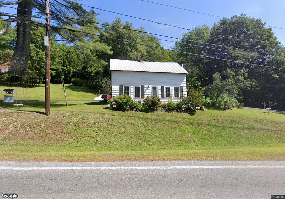
77 Trues Brook Rd West Lebanon, NH 03784
Estimated Value: $312,313 - $366,000
2
Beds
1
Bath
810
Sq Ft
$427/Sq Ft
Est. Value
About This Home
This home is located at 77 Trues Brook Rd, West Lebanon, NH 03784 and is currently estimated at $346,078, approximately $427 per square foot. 77 Trues Brook Rd is a home located in Grafton County with nearby schools including Mt. Lebanon School, Lebanon Middle School, and Lebanon High School.
Ownership History
Date
Name
Owned For
Owner Type
Purchase Details
Closed on
Aug 27, 2008
Sold by
Englund Jessica M
Bought by
Lino Glenda A
Current Estimated Value
Home Financials for this Owner
Home Financials are based on the most recent Mortgage that was taken out on this home.
Original Mortgage
$123,200
Interest Rate
6.29%
Mortgage Type
Purchase Money Mortgage
Create a Home Valuation Report for This Property
The Home Valuation Report is an in-depth analysis detailing your home's value as well as a comparison with similar homes in the area
Home Values in the Area
Average Home Value in this Area
Purchase History
| Date | Buyer | Sale Price | Title Company |
|---|---|---|---|
| Lino Glenda A | $154,000 | -- |
Source: Public Records
Mortgage History
| Date | Status | Borrower | Loan Amount |
|---|---|---|---|
| Open | Lino Glenda A | $112,750 | |
| Closed | Lino Glenda A | $123,200 |
Source: Public Records
Tax History Compared to Growth
Tax History
| Year | Tax Paid | Tax Assessment Tax Assessment Total Assessment is a certain percentage of the fair market value that is determined by local assessors to be the total taxable value of land and additions on the property. | Land | Improvement |
|---|---|---|---|---|
| 2024 | $5,364 | $204,100 | $78,300 | $125,800 |
| 2023 | $4,956 | $204,100 | $78,300 | $125,800 |
| 2022 | $4,707 | $204,300 | $78,500 | $125,800 |
| 2021 | $3,845 | $142,500 | $39,600 | $102,900 |
| 2019 | $3,647 | $120,100 | $39,600 | $80,500 |
| 2018 | $3,569 | $120,100 | $39,600 | $80,500 |
| 2017 | $3,493 | $120,100 | $39,600 | $80,500 |
| 2016 | $3,378 | $120,100 | $39,600 | $80,500 |
| 2015 | $3,317 | $120,100 | $39,600 | $80,500 |
| 2014 | $3,349 | $127,500 | $54,400 | $73,100 |
| 2013 | $2,944 | $115,400 | $41,300 | $74,100 |
Source: Public Records
Map
Nearby Homes
- 266 Poverty Ln Unit 1A
- 25 Maxfield Ln
- 6 Rockwood St
- 15 Old Pine Tree Cemetery Rd
- 00 Willow Brook Rd Unit 5
- 00 Willow Brook Rd
- 561 Neal Rd
- 3 Maple St
- 149 Old County Rd
- 4 Black Bear Ct
- 36-48 S Main St
- 13 Bullard St Unit 15
- 27 Ash St
- 48 Fairview Terrace
- 35 Railroad Row Unit C3-2
- 722 Fairview Terrace
- 00 Nh Route 12a Unit 7
- 1049 N Main St
- 11 Rock Ridge Blvd
- 25 Marshall Ave
- 83 Trues Brook Rd
- 10 Hall Rd
- 14 Hall Rd
- 84 Trues Brook Rd
- 89 Trues Brook Rd
- 16 Hall Rd
- 17 Hall Rd
- 90 Trues Brook Rd
- 91 Trues Brook Rd
- 3 Hall Rd
- 97 Trues Brook Rd
- 94 Trues Brook Rd
- 98 Trues Brook Rd
- 48 Trues Brook Rd
- 99 Trues Brook Rd
- 20 Chelsea Cir
- 105 Trues Brook Rd
- 53 Trues Brook Rd
- 44 Trues Brook Rd
- 106 Trues Brook Rd