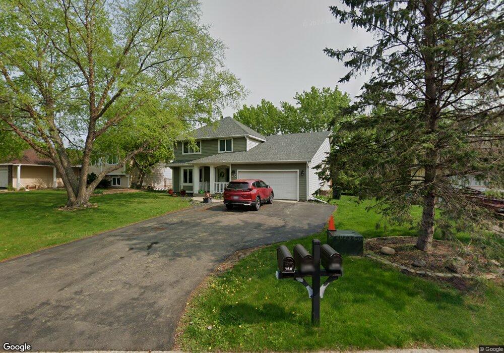
770 Mill Run Path Saint Paul, MN 55123
Estimated Value: $580,000 - $621,000
5
Beds
4
Baths
2,432
Sq Ft
$250/Sq Ft
Est. Value
About This Home
This home is located at 770 Mill Run Path, Saint Paul, MN 55123 and is currently estimated at $607,319, approximately $249 per square foot. 770 Mill Run Path is a home located in Dakota County with nearby schools including Woodland Elementary School, Dakota Hills Middle School, and Eagan Senior High School.
Ownership History
Date
Name
Owned For
Owner Type
Purchase Details
Closed on
Sep 26, 2016
Sold by
Lokensgard Steve Jon
Bought by
Kahn Mark E and Kahn Colleen
Current Estimated Value
Home Financials for this Owner
Home Financials are based on the most recent Mortgage that was taken out on this home.
Original Mortgage
$379,900
Outstanding Balance
$304,271
Interest Rate
3.43%
Mortgage Type
New Conventional
Estimated Equity
$303,048
Purchase Details
Closed on
Dec 21, 2001
Sold by
Roberts Kenneth S and Roberts Sue Ellen
Bought by
Lokensgard Steven J and Lokensgard Amy T
Create a Home Valuation Report for This Property
The Home Valuation Report is an in-depth analysis detailing your home's value as well as a comparison with similar homes in the area
Home Values in the Area
Average Home Value in this Area
Purchase History
| Date | Buyer | Sale Price | Title Company |
|---|---|---|---|
| Kahn Mark E | $399,900 | Edina Realty Title Inc | |
| Lokensgard Steven J | $274,350 | -- |
Source: Public Records
Mortgage History
| Date | Status | Borrower | Loan Amount |
|---|---|---|---|
| Open | Kahn Mark E | $379,900 |
Source: Public Records
Tax History Compared to Growth
Tax History
| Year | Tax Paid | Tax Assessment Tax Assessment Total Assessment is a certain percentage of the fair market value that is determined by local assessors to be the total taxable value of land and additions on the property. | Land | Improvement |
|---|---|---|---|---|
| 2024 | $6,332 | $578,200 | $128,100 | $450,100 |
| 2023 | $6,332 | $570,400 | $128,500 | $441,900 |
| 2022 | $5,520 | $549,500 | $128,100 | $421,400 |
| 2021 | $5,192 | $491,000 | $111,400 | $379,600 |
| 2020 | $5,256 | $450,600 | $106,100 | $344,500 |
| 2019 | $4,930 | $443,900 | $101,000 | $342,900 |
| 2018 | $4,492 | $438,400 | $96,200 | $342,200 |
| 2017 | $4,584 | $388,100 | $91,700 | $296,400 |
| 2016 | $4,802 | $378,100 | $87,300 | $290,800 |
| 2015 | $4,828 | $377,941 | $86,622 | $291,319 |
| 2014 | -- | $386,116 | $84,401 | $301,715 |
| 2013 | -- | $339,246 | $75,726 | $263,520 |
Source: Public Records
Map
Nearby Homes
- 785 Canter Glen Cir
- 3902 Canter Glen Dr
- 3806 Bridgewater Dr
- 826 Hidden Meadow Trail
- 4027 Camberwell Dr N
- 711 Stonebridge Cir
- 4080 Camberwell Dr N
- 4001 Haven Woods Ct
- 680 Brockton Curve
- 3998 Haven Woods Ct
- 3726 Wescott Hills Dr
- 3675 Woodland Trail
- 4125 Pennsylvania Ave
- 790 Summerbrooke Ct
- 782 Summerbrooke Ct
- 995 Stony Point Rd
- 999 Northview Park Rd
- 4358 Yorktown Dr
- 977 Greensboro Ln
- 593 Coventry Pkwy
- 774 Mill Run Path
- 766 Bridle Ridge Rd
- 778 Mill Run Path
- 775 Mill Run Path
- 3875 Canter Glen Dr
- 3879 Canter Glen Dr
- 767 Bridle Ridge Rd
- 782 Mill Run Path
- 3871 Canter Glen Dr
- 3883 Canter Glen Dr
- 779 Mill Run Path
- 754 Bridle Ridge Rd
- 771 Bridle Ridge Rd
- 786 Mill Run Path
- 776 Bridle Ridge Rd
- 777 Canter Glen Cir
- 773 Canter Glen Cir
- 783 Mill Run Path
- 750 Bridle Ridge Rd
- 3846 Mill Run Ln