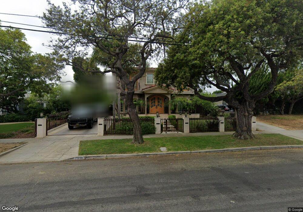
7719 Osage Ave Los Angeles, CA 90045
Westchester NeighborhoodEstimated Value: $1,367,000 - $3,356,000
3
Beds
2
Baths
3,626
Sq Ft
$667/Sq Ft
Est. Value
About This Home
This home is located at 7719 Osage Ave, Los Angeles, CA 90045 and is currently estimated at $2,420,232, approximately $667 per square foot. 7719 Osage Ave is a home located in Los Angeles County with nearby schools including Westport Heights Elementary, Wright Middle School STEAM Magnet, and Westchester Enriched Sciences Magnets.
Ownership History
Date
Name
Owned For
Owner Type
Purchase Details
Closed on
Oct 2, 2020
Sold by
Block Randy L and Block Emily M
Bought by
Block Family Living Trust and Block
Current Estimated Value
Home Financials for this Owner
Home Financials are based on the most recent Mortgage that was taken out on this home.
Original Mortgage
$990,000
Interest Rate
2.75%
Mortgage Type
New Conventional
Purchase Details
Closed on
Sep 8, 2020
Sold by
Markham Daniel and Markham Michelle
Bought by
Block Randy L and Block Emily M
Home Financials for this Owner
Home Financials are based on the most recent Mortgage that was taken out on this home.
Original Mortgage
$990,000
Interest Rate
2.75%
Mortgage Type
New Conventional
Purchase Details
Closed on
Dec 5, 2012
Sold by
Markham Terence B and Markham Audrey
Bought by
Markham Daniel and Markham Michelle
Home Financials for this Owner
Home Financials are based on the most recent Mortgage that was taken out on this home.
Original Mortgage
$600,000
Interest Rate
3.37%
Mortgage Type
New Conventional
Purchase Details
Closed on
Apr 18, 2008
Sold by
Markham Audrey M
Bought by
Markham Terrence B
Purchase Details
Closed on
Apr 17, 2008
Sold by
Wpc Properties Llc
Bought by
Markham Terence B
Purchase Details
Closed on
Mar 13, 2008
Sold by
Fernandez Paul
Bought by
Wpc Properties Llc and 7719 Osage Trust
Purchase Details
Closed on
Nov 20, 2007
Sold by
Playford Maurice P and Playford Christopher C
Bought by
Fernandez Paul
Home Financials for this Owner
Home Financials are based on the most recent Mortgage that was taken out on this home.
Original Mortgage
$436,000
Interest Rate
6.37%
Mortgage Type
Purchase Money Mortgage
Purchase Details
Closed on
Nov 15, 2004
Sold by
Playford Maurice P and Playford Trust Of 1993
Bought by
Playford Maurice P and Playford Christopher C
Create a Home Valuation Report for This Property
The Home Valuation Report is an in-depth analysis detailing your home's value as well as a comparison with similar homes in the area
Home Values in the Area
Average Home Value in this Area
Purchase History
| Date | Buyer | Sale Price | Title Company |
|---|---|---|---|
| Block Family Living Trust | -- | None Listed On Document | |
| Block Randy L | $1,600,000 | Stewart Title Company | |
| Markham Daniel | $750,000 | Fatcola | |
| Markham Terrence B | -- | None Available | |
| Markham Terence B | -- | Financial Title Company | |
| Wpc Properties Llc | -- | Accommodation | |
| Fernandez Paul | -- | Financial Title Company | |
| Playford Maurice P | -- | -- |
Source: Public Records
Mortgage History
| Date | Status | Borrower | Loan Amount |
|---|---|---|---|
| Previous Owner | Block Randy L | $990,000 | |
| Previous Owner | Markham Daniel | $600,000 | |
| Previous Owner | Fernandez Paul | $436,000 |
Source: Public Records
Tax History Compared to Growth
Tax History
| Year | Tax Paid | Tax Assessment Tax Assessment Total Assessment is a certain percentage of the fair market value that is determined by local assessors to be the total taxable value of land and additions on the property. | Land | Improvement |
|---|---|---|---|---|
| 2025 | $20,757 | $1,731,890 | $1,039,134 | $692,756 |
| 2024 | $20,757 | $1,697,932 | $1,018,759 | $679,173 |
| 2023 | $20,356 | $1,664,640 | $998,784 | $665,856 |
| 2022 | $19,411 | $1,632,000 | $979,200 | $652,800 |
| 2021 | $19,244 | $1,600,000 | $960,000 | $640,000 |
| 2020 | $10,571 | $844,481 | $641,807 | $202,674 |
| 2019 | $10,159 | $827,923 | $629,223 | $198,700 |
| 2018 | $10,033 | $811,690 | $616,886 | $194,804 |
| 2016 | $9,569 | $780,174 | $592,933 | $187,241 |
| 2015 | $9,431 | $768,456 | $584,027 | $184,429 |
| 2014 | $9,467 | $753,404 | $572,587 | $180,817 |
Source: Public Records
Map
Nearby Homes
- 5600 W 78th St
- 7701 Toland Ave
- 5467 W 76th St
- 7803 Flight Ave
- 8130 Grimsby Ave
- 7701 Hindry Ave
- 5529 W 79th St
- 7706 Hindry Ave
- 7559 Midfield Ave
- 5723 W 74th St
- 7562 Midfield Ave
- 5400 Thornburn St
- 5516 W 82nd St
- 5858 Abernathy Dr
- 5530 Thornburn St Unit 102
- 5506 Thornburn St
- 5401 Thornburn St
- 5503 Thornburn St
- 7137 Ramsgate Ave
- 7860 Hindry Ave
- 7725 Osage Ave
- 7711 Osage Ave
- 7731 Osage Ave
- 5625 W 78th St
- 5633 W 78th St
- 5606 W 77th St
- 7701 Osage Ave
- 5612 W 77th St
- 5639 W 78th St
- 5615 W 78th St
- 5645 W 78th St
- 5618 W 77th St
- 5601 W 78th St Unit 11
- 5601 W 78th St
- 5651 W 78th St
- 5607 W 77th St
- 5630 W 78th St
- 5624 W 78th St
- 5601 W 77th St
- 5623 W 77th St