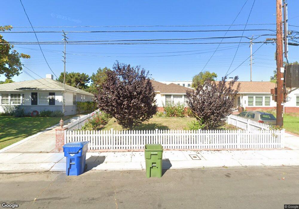
7721 Mcconnell Ave Los Angeles, CA 90045
Westchester NeighborhoodEstimated Value: $1,485,000 - $1,690,000
2
Beds
2
Baths
1,316
Sq Ft
$1,183/Sq Ft
Est. Value
About This Home
This home is located at 7721 Mcconnell Ave, Los Angeles, CA 90045 and is currently estimated at $1,556,283, approximately $1,182 per square foot. 7721 Mcconnell Ave is a home located in Los Angeles County with nearby schools including Cowan Avenue Elementary School, Wright Middle School STEAM Magnet, and Westchester Enriched Sciences Magnets.
Ownership History
Date
Name
Owned For
Owner Type
Purchase Details
Closed on
Nov 7, 2014
Sold by
Kokelaar Pieter R
Bought by
Kokelaar Trust
Current Estimated Value
Purchase Details
Closed on
Sep 21, 1994
Sold by
Delyea Alice M
Bought by
Kokelaar Pieter R
Home Financials for this Owner
Home Financials are based on the most recent Mortgage that was taken out on this home.
Original Mortgage
$212,000
Interest Rate
8.7%
Create a Home Valuation Report for This Property
The Home Valuation Report is an in-depth analysis detailing your home's value as well as a comparison with similar homes in the area
Home Values in the Area
Average Home Value in this Area
Purchase History
| Date | Buyer | Sale Price | Title Company |
|---|---|---|---|
| Kokelaar Trust | -- | None Available | |
| Kokelaar Pieter R | $265,000 | Gateway Title Company |
Source: Public Records
Mortgage History
| Date | Status | Borrower | Loan Amount |
|---|---|---|---|
| Previous Owner | Kokelaar Pieter R | $212,000 |
Source: Public Records
Tax History Compared to Growth
Tax History
| Year | Tax Paid | Tax Assessment Tax Assessment Total Assessment is a certain percentage of the fair market value that is determined by local assessors to be the total taxable value of land and additions on the property. | Land | Improvement |
|---|---|---|---|---|
| 2025 | $5,471 | $445,088 | $314,425 | $130,663 |
| 2024 | $5,471 | $436,361 | $308,260 | $128,101 |
| 2023 | $5,371 | $427,806 | $302,216 | $125,590 |
| 2022 | $5,130 | $419,419 | $296,291 | $123,128 |
| 2021 | $5,060 | $411,196 | $290,482 | $120,714 |
| 2019 | $4,911 | $399,002 | $281,867 | $117,135 |
| 2018 | $4,829 | $391,180 | $276,341 | $114,839 |
| 2016 | $4,612 | $375,992 | $265,611 | $110,381 |
| 2015 | $4,546 | $370,345 | $261,622 | $108,723 |
| 2014 | $4,567 | $363,092 | $256,498 | $106,594 |
Source: Public Records
Map
Nearby Homes
- 7809 Mcconnell Ave
- 7841 Stewart Ave
- 7403 Stewart Ave
- 7501 Agnew Ave
- 7456 Denrock Ave
- 7833 Denrock Ave
- 8000 Westlawn Ave
- 12655 Bluff Creek Dr Unit 129
- 5904 Village Dr
- 12923 Bluff Creek Dr
- 6021 Dawn Creek Unit 12
- 6020 Celedon Creek Unit 4
- 8136 Holy Cross Place
- 7920 Anise Ave Unit 1
- 6010 Celedon Creek Unit 10
- 7831 Beland Ave
- 8309 Regis Way
- 12920 W Runway Rd Unit 360
- 6099 S Seabluff Dr
- 6020 S Seabluff Dr Unit 122
- 7717 Mcconnell Ave
- 7727 Mcconnell Ave
- 7711 Mcconnell Ave
- 7731 Mcconnell Ave
- 7707 Mcconnell Ave
- 7801 Mcconnell Ave
- 7718 Mcconnell Ave
- 7712 Mcconnell Ave
- 7701 Mcconnell Ave
- 7702 Mcconnell Ave
- 7800 Mcconnell Ave
- 7815 Mcconnell Ave
- 7587 Mcconnell Ave
- 6954 W 77th St
- 7810 Kenyon Ave
- 6952 W 77th St
- 7815 Kenyon Ave
- 7812 Mcconnell Ave
- 7819 Mcconnell Ave
- 7584 Mcconnell Ave