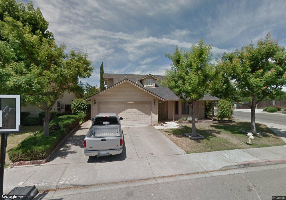
78 Obsidian Dr Oakdale, CA 95361
Estimated Value: $535,000 - $549,000
4
Beds
4
Baths
1,832
Sq Ft
$295/Sq Ft
Est. Value
About This Home
This home is located at 78 Obsidian Dr, Oakdale, CA 95361 and is currently estimated at $540,304, approximately $294 per square foot. 78 Obsidian Dr is a home located in Stanislaus County with nearby schools including Fair Oaks Elementary School, Oakdale Junior High School, and East Stanislaus High School.
Ownership History
Date
Name
Owned For
Owner Type
Purchase Details
Closed on
Nov 2, 2006
Sold by
Cartus Financial Corp
Bought by
Tallman Ronny and Tallman Regina
Current Estimated Value
Home Financials for this Owner
Home Financials are based on the most recent Mortgage that was taken out on this home.
Original Mortgage
$276,000
Interest Rate
6.11%
Mortgage Type
Purchase Money Mortgage
Purchase Details
Closed on
Jul 18, 2006
Sold by
Leask James G
Bought by
Cartus Financial Corp
Purchase Details
Closed on
May 8, 2000
Sold by
Sloan Dale R Trs & Delores Ja
Bought by
Leask James G
Home Financials for this Owner
Home Financials are based on the most recent Mortgage that was taken out on this home.
Original Mortgage
$134,800
Interest Rate
8.08%
Purchase Details
Closed on
Nov 9, 1998
Sold by
Sloan Dale R and Sloan Delores J
Bought by
Sloan Dale R and Sloan Delores Jean
Create a Home Valuation Report for This Property
The Home Valuation Report is an in-depth analysis detailing your home's value as well as a comparison with similar homes in the area
Home Values in the Area
Average Home Value in this Area
Purchase History
| Date | Buyer | Sale Price | Title Company |
|---|---|---|---|
| Tallman Ronny | $345,000 | Cornerstone Title Co | |
| Cartus Financial Corp | $345,000 | Cornerstone Title Co | |
| Leask James G | $168,500 | Fidelity National Title Co | |
| Sloan Dale R | -- | -- |
Source: Public Records
Mortgage History
| Date | Status | Borrower | Loan Amount |
|---|---|---|---|
| Previous Owner | Tallman Ronny | $276,000 | |
| Previous Owner | Leask James G | $134,800 |
Source: Public Records
Tax History
| Year | Tax Paid | Tax Assessment Tax Assessment Total Assessment is a certain percentage of the fair market value that is determined by local assessors to be the total taxable value of land and additions on the property. | Land | Improvement |
|---|---|---|---|---|
| 2025 | $5,081 | $462,215 | $227,756 | $234,459 |
| 2024 | $4,817 | $453,153 | $223,291 | $229,862 |
| 2023 | $4,714 | $444,268 | $218,913 | $225,355 |
| 2022 | $4,632 | $435,558 | $214,621 | $220,937 |
| 2021 | $4,304 | $404,000 | $175,000 | $229,000 |
| 2020 | $3,618 | $341,000 | $110,000 | $231,000 |
| 2019 | $3,635 | $341,000 | $110,000 | $231,000 |
| 2018 | $3,564 | $332,500 | $130,000 | $202,500 |
| 2017 | $3,352 | $312,500 | $110,000 | $202,500 |
| 2016 | $3,106 | $289,500 | $110,000 | $179,500 |
| 2015 | $3,258 | $302,500 | $58,500 | $244,000 |
| 2014 | $2,802 | $258,500 | $50,000 | $208,500 |
Source: Public Records
Map
Nearby Homes
- 2134 Navajo Ct
- 2337 Rainwood Ln
- 1957 Blue Spruce Dr
- 1810 Silvio Way
- 1879 Silvio Way
- 366 Romano Way
- 0 Odessa Way Unit 226014449
- 206 S Lee Ave
- 225 Ash Ave
- 2153 Saddlebrook Way
- 549 Fresian Dr
- 1500 Walnut St
- 2532 Laurel Ridge Ct
- 174 Warrington Ave
- 2848 Westport Cir
- 2370 Shire Way
- 2908 Westport Cir
- 1766 Churchill Downs Cir
- 562 Ranger St
- 332 Hinkley Ave
- 76 Obsidian Dr
- 2143 Pontiac St
- 2142 Nutshell Cir
- 2120 Nutshell Cir
- 2110 Pontiac St
- 79 Obsidian Dr
- 77 Obsidian Dr
- 2164 Nutshell Cir
- 2181 Pontiac St
- 2074 Pontiac St
- 75 Obsidian Dr
- 2200 Lana Ct
- 73 Obsidian Dr
- 2219 Pontiac St
- 2222 Lana Ct
- 72 Willowood Dr
- 68 Willowood Dr
- 2031 Rapunzel Ct
- 71 Obsidian Dr
- 2188 Nutshell Cir
Your Personal Tour Guide
Ask me questions while you tour the home.