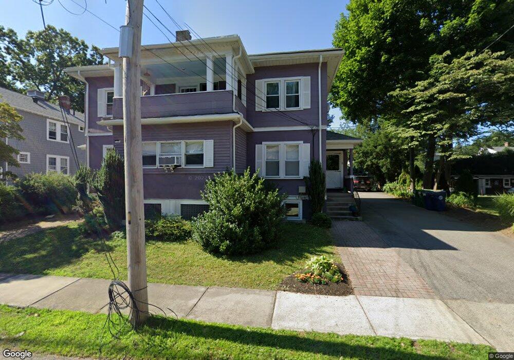
78 Warwick Rd Unit 2 West Newton, MA 02465
West Newton NeighborhoodEstimated Value: $1,388,000 - $1,632,266
3
Beds
2
Baths
1,601
Sq Ft
$943/Sq Ft
Est. Value
About This Home
This home is located at 78 Warwick Rd Unit 2, West Newton, MA 02465 and is currently estimated at $1,509,067, approximately $942 per square foot. 78 Warwick Rd Unit 2 is a home located in Middlesex County with nearby schools including Franklin Elementary School, Horace Mann Elementary School, and F.A. Day Middle School.
Ownership History
Date
Name
Owned For
Owner Type
Purchase Details
Closed on
May 16, 2022
Sold by
Deluty Rt
Bought by
Deluty Ft
Current Estimated Value
Purchase Details
Closed on
Dec 9, 2013
Sold by
Deluty Rt and Deluty Marica B
Bought by
Deluty Marcia B
Home Financials for this Owner
Home Financials are based on the most recent Mortgage that was taken out on this home.
Original Mortgage
$150,000
Interest Rate
4.17%
Mortgage Type
New Conventional
Purchase Details
Closed on
Dec 21, 1979
Bought by
Deluty Rt
Create a Home Valuation Report for This Property
The Home Valuation Report is an in-depth analysis detailing your home's value as well as a comparison with similar homes in the area
Home Values in the Area
Average Home Value in this Area
Purchase History
| Date | Buyer | Sale Price | Title Company |
|---|---|---|---|
| Deluty Ft | -- | None Available | |
| Deluty Marcia B | -- | -- | |
| Deluty Rt | -- | -- |
Source: Public Records
Mortgage History
| Date | Status | Borrower | Loan Amount |
|---|---|---|---|
| Previous Owner | Deluty Marcia B | $150,000 |
Source: Public Records
Tax History Compared to Growth
Tax History
| Year | Tax Paid | Tax Assessment Tax Assessment Total Assessment is a certain percentage of the fair market value that is determined by local assessors to be the total taxable value of land and additions on the property. | Land | Improvement |
|---|---|---|---|---|
| 2025 | $13,366 | $1,363,900 | $742,900 | $621,000 |
| 2024 | $12,924 | $1,324,200 | $721,300 | $602,900 |
| 2023 | $12,310 | $1,209,200 | $580,200 | $629,000 |
| 2022 | $11,778 | $1,119,600 | $537,200 | $582,400 |
| 2021 | $11,053 | $1,027,200 | $492,800 | $534,400 |
| 2020 | $10,724 | $1,027,200 | $492,800 | $534,400 |
| 2019 | $10,032 | $960,000 | $460,600 | $499,400 |
| 2018 | $10,139 | $937,100 | $434,400 | $502,700 |
| 2017 | $9,560 | $859,700 | $398,500 | $461,200 |
| 2016 | $8,371 | $735,600 | $365,600 | $370,000 |
| 2015 | $7,996 | $688,700 | $341,700 | $347,000 |
Source: Public Records
Map
Nearby Homes
- 321 Albemarle Rd
- 53-55 N Gate Park
- 27 Cross St Unit 27
- 4 Wiswall St
- 12 Wiswall St
- 43 Walker St
- 354 Linwood Ave Unit 1
- 41 Kilburn Rd
- 57 Walnut St
- 611 Watertown St Unit 14
- 97 North St
- 76 Harding St
- 287 Cherry St Unit 2
- 32-34 Rossmere St
- 123 Mount Vernon St Unit 2
- 33 Joseph Rd
- 76 Taft Ave Unit 1
- 76 Taft Ave
- 76 Taft Ave Unit 2
- 75 Cherry St
- 78 Warwick Rd Unit 80
- 80 Warwick Rd Unit 1
- 80 Warwick Rd Unit 80
- 80 Warwick Rd
- 88 Warwick Rd
- 88 Warwick Rd Unit 1
- 86 Warwick Rd Unit 88
- 86 Warwick Rd Unit 88
- 86 Warwick Rd Unit 2
- 72 Warwick Rd Unit 74
- 111 Fairway Dr
- 81 Warwick Rd Unit 1
- 79 Warwick Rd Unit 81
- 105 Fairway Dr
- 90 Warwick Rd
- 92 Warwick Rd
- 90 Warwick Rd Unit 90
- 90 Warwick Rd Unit 2
- 115 Fairway Dr
- 83 Warwick Rd Unit 85