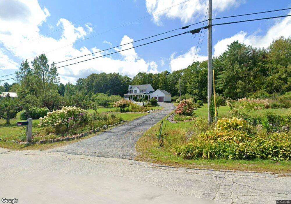
781 Center Rd Lyndeborough, NH 03082
Estimated Value: $558,478 - $647,000
3
Beds
3
Baths
2,846
Sq Ft
$213/Sq Ft
Est. Value
About This Home
This home is located at 781 Center Rd, Lyndeborough, NH 03082 and is currently estimated at $606,826, approximately $213 per square foot. 781 Center Rd is a home located in Hillsborough County with nearby schools including Lyndeborough Central School, Wilton-Lyndeborough Cooperative Middle School, and Wilton-Lyndeborough Cooperative High School.
Ownership History
Date
Name
Owned For
Owner Type
Purchase Details
Closed on
Feb 12, 2013
Sold by
Aubin Maria L
Bought by
Maria L Aubin Ret and Aubin Maria L
Current Estimated Value
Purchase Details
Closed on
Apr 25, 2001
Sold by
Buchanan Construction
Bought by
Aubin Maria L
Home Financials for this Owner
Home Financials are based on the most recent Mortgage that was taken out on this home.
Original Mortgage
$150,000
Interest Rate
6.88%
Create a Home Valuation Report for This Property
The Home Valuation Report is an in-depth analysis detailing your home's value as well as a comparison with similar homes in the area
Home Values in the Area
Average Home Value in this Area
Purchase History
| Date | Buyer | Sale Price | Title Company |
|---|---|---|---|
| Maria L Aubin Ret | -- | -- | |
| Aubin Maria L | $239,900 | -- |
Source: Public Records
Mortgage History
| Date | Status | Borrower | Loan Amount |
|---|---|---|---|
| Previous Owner | Aubin Maria L | $150,000 |
Source: Public Records
Tax History
| Year | Tax Paid | Tax Assessment Tax Assessment Total Assessment is a certain percentage of the fair market value that is determined by local assessors to be the total taxable value of land and additions on the property. | Land | Improvement |
|---|---|---|---|---|
| 2025 | $8,236 | $485,300 | $162,400 | $322,900 |
| 2024 | $8,490 | $328,300 | $90,900 | $237,400 |
| 2023 | $7,804 | $328,300 | $90,900 | $237,400 |
| 2022 | $7,255 | $328,300 | $90,900 | $237,400 |
| 2021 | $7,255 | $328,300 | $90,900 | $237,400 |
| 2020 | $7,006 | $328,300 | $90,900 | $237,400 |
| 2019 | $7,821 | $268,400 | $92,500 | $175,900 |
| 2018 | $7,349 | $260,500 | $92,500 | $168,000 |
| 2017 | $7,226 | $260,500 | $92,500 | $168,000 |
| 2016 | $7,226 | $260,500 | $92,500 | $168,000 |
| 2015 | $6,588 | $260,500 | $92,500 | $168,000 |
| 2013 | $6,509 | $271,200 | $96,300 | $174,900 |
Source: Public Records
Map
Nearby Homes
- 41 Cooper Ln
- 6 Mottau Dr
- 77 Salisbury Rd
- 25 Burns Hill Rd
- 13 Dow Rd
- 7 Dow Rd
- 58-2 Davisville Rd
- 143 Falcon Ridge Rd Unit 23
- 58-6-2 Duggin Rd
- 33 Falcon Ridge Rd Unit 33
- 4 Trow Rd
- 16 Cortland Rd
- F88-9 McGettigan Rd
- F/88-5 McGettigan Rd
- F/88-4 McGettigan Rd
- 2-47 Old Amherst Rd
- 113 Gulf Rd
- 545 Elm St Unit 10
- 85 Intervale Rd
- 342 Lyndeborough Rd
- 765 Center Rd
- 774 Center Rd
- 790 Center Rd
- 801 Center Rd
- 755 Center Rd
- 760 Center Rd
- 810 Center Rd
- 744 Center Rd
- 20 Rose Farm Rd
- 234-1 Rose Farm Rd
- 25 Rose Farm Rd
- 733 Center Rd
- 734 Center Rd
- 36 Rose Farm Rd
- 845 Center Rd
- 726 Center Rd
- 714 Center Rd
- n/a Curtis Brook Rd
- n/a Corner of Center and Curtis Brook Rd
- 8 Curtis Brook Rd
Your Personal Tour Guide
Ask me questions while you tour the home.