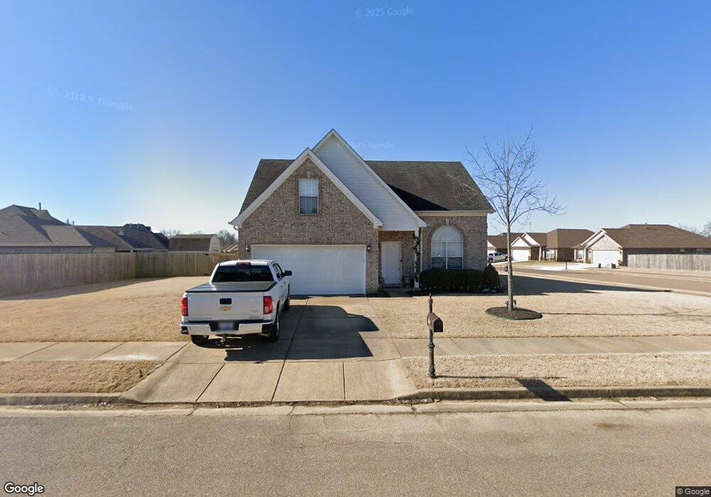
7875 Allen Ridge Ln Olive Branch, MS 38654
Estimated Value: $231,479 - $280,000
3
Beds
--
Bath
1,648
Sq Ft
$156/Sq Ft
Est. Value
About This Home
This home is located at 7875 Allen Ridge Ln, Olive Branch, MS 38654 and is currently estimated at $256,370, approximately $155 per square foot. 7875 Allen Ridge Ln is a home located in DeSoto County with nearby schools including Olive Branch Elementary School, Chickasaw Elementary School, and Olive Branch Middle School.
Ownership History
Date
Name
Owned For
Owner Type
Purchase Details
Closed on
Mar 30, 2007
Sold by
Coleman Bartley Enterprises Llc
Bought by
Anderson Tricia A
Current Estimated Value
Home Financials for this Owner
Home Financials are based on the most recent Mortgage that was taken out on this home.
Original Mortgage
$17,812
Interest Rate
6.15%
Mortgage Type
Stand Alone Second
Create a Home Valuation Report for This Property
The Home Valuation Report is an in-depth analysis detailing your home's value as well as a comparison with similar homes in the area
Home Values in the Area
Average Home Value in this Area
Purchase History
| Date | Buyer | Sale Price | Title Company |
|---|---|---|---|
| Anderson Tricia A | -- | None Available |
Source: Public Records
Mortgage History
| Date | Status | Borrower | Loan Amount |
|---|---|---|---|
| Closed | Anderson Tricia A | $17,812 | |
| Open | Anderson Tricia A | $95,001 |
Source: Public Records
Tax History Compared to Growth
Tax History
| Year | Tax Paid | Tax Assessment Tax Assessment Total Assessment is a certain percentage of the fair market value that is determined by local assessors to be the total taxable value of land and additions on the property. | Land | Improvement |
|---|---|---|---|---|
| 2024 | $1,153 | $10,649 | $1,800 | $8,849 |
| 2023 | $1,153 | $10,649 | $0 | $0 |
| 2022 | $1,153 | $10,649 | $1,800 | $8,849 |
| 2021 | $1,153 | $10,649 | $1,800 | $8,849 |
| 2020 | $1,052 | $9,908 | $1,800 | $8,108 |
| 2019 | $1,052 | $9,908 | $1,800 | $8,108 |
| 2017 | $1,025 | $17,520 | $9,660 | $7,860 |
| 2016 | $1,025 | $9,660 | $1,800 | $7,860 |
| 2015 | $1,325 | $17,520 | $9,660 | $7,860 |
| 2014 | $1,059 | $9,907 | $0 | $0 |
| 2013 | $1,020 | $9,907 | $0 | $0 |
Source: Public Records
Map
Nearby Homes
- Plan 1930 at Allendale
- 7888 Allenwood Ln
- 7880 Allenwood Ln
- 7826 Ferndale Dr
- 7905 Gardendale Dr
- 7843 Ferndale Dr
- 7899 Gardendale Dr
- 7881 Gardendale Dr
- 7759 Ferndale Dr
- 7736 Ferndale Dr
- 7875 Gardendale Dr
- 7721 Ferndale Dr
- 7867 Gardendale Dr
- 7859 Gardendale Dr
- 7975 Crescent Cir
- 8017 Camptown Ln
- 7885 Hunters Bend Cove
- 8390 Ms-178
- 7356 Mockingbird Ln
- 4435 Bolivar Trail S
- 7880 Allen Ridge Ln
- 7864 Allen Ridge Ln
- 7888 Allen Ridge Ln
- 7960 Allenwood Ln
- 7959 Ridgedale Dr
- 7967 Ridgedale Dr
- 7896 Allen Ridge Ln
- 7872 Allen Ridge Ln
- 7952 Allenwood Ln
- 7951 Ridgedale Dr
- 7856 Allen Ridge Ln
- 7847 Allen Ridge Ln
- 7943 Ridgedale Dr
- 7944 Allenwood Ln
- 7972 Ridgedale Dr
- 7848 Allen Ridge Ln
- 7839 Allen Ridge Ln
- 7965 Allenwood Ln
- 7935 Ridgedale Dr
- 7956 Ridgedale Dr