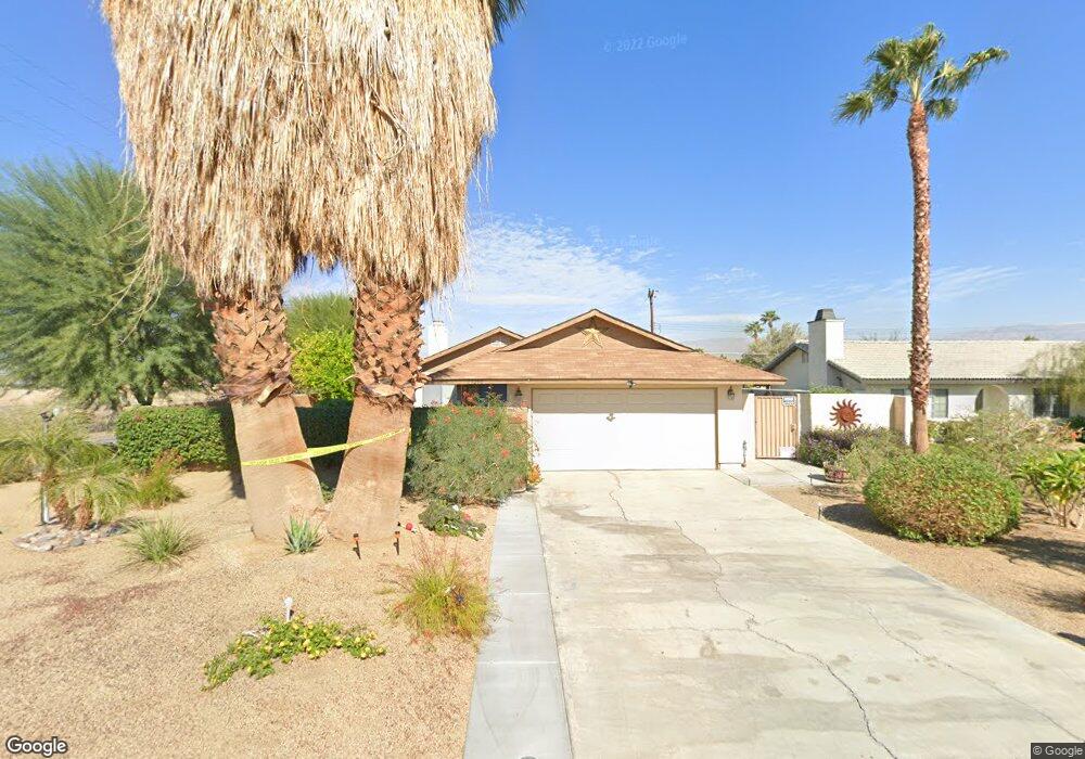
79250 Spalding Dr Bermuda Dunes, CA 92203
Estimated Value: $373,000 - $512,844
3
Beds
2
Baths
1,240
Sq Ft
$368/Sq Ft
Est. Value
About This Home
This home is located at 79250 Spalding Dr, Bermuda Dunes, CA 92203 and is currently estimated at $455,961, approximately $367 per square foot. 79250 Spalding Dr is a home located in Riverside County with nearby schools including James Monroe Elementary School, Colonel Mitchell Paige Middle School, and Palm Desert High School.
Ownership History
Date
Name
Owned For
Owner Type
Purchase Details
Closed on
Sep 29, 2017
Sold by
Henss Shirley Ann
Bought by
Henss Shirley A and The Henss Family Trust
Current Estimated Value
Purchase Details
Closed on
Jun 26, 2017
Sold by
Osborn William L
Bought by
Henss Henry Ray and Henss Shirley Ann
Home Financials for this Owner
Home Financials are based on the most recent Mortgage that was taken out on this home.
Original Mortgage
$263,000
Outstanding Balance
$218,928
Interest Rate
3.96%
Mortgage Type
VA
Estimated Equity
$237,033
Purchase Details
Closed on
Mar 12, 2013
Sold by
Osborn William L
Bought by
Osborn William L
Home Financials for this Owner
Home Financials are based on the most recent Mortgage that was taken out on this home.
Original Mortgage
$116,405
Interest Rate
3.53%
Mortgage Type
New Conventional
Purchase Details
Closed on
Jan 7, 2011
Sold by
Federal Home Loan Mortgage Corporation
Bought by
Osborn William L
Home Financials for this Owner
Home Financials are based on the most recent Mortgage that was taken out on this home.
Original Mortgage
$119,900
Interest Rate
4.35%
Mortgage Type
New Conventional
Purchase Details
Closed on
Jan 6, 2011
Sold by
Osborn Kelli M
Bought by
Osborn William L
Home Financials for this Owner
Home Financials are based on the most recent Mortgage that was taken out on this home.
Original Mortgage
$119,900
Interest Rate
4.35%
Mortgage Type
New Conventional
Purchase Details
Closed on
Aug 11, 2010
Sold by
Lillie Leland A
Bought by
Federal Home Loan Mortgage Corporation
Purchase Details
Closed on
May 13, 2004
Sold by
Serwatka Joseph
Bought by
Lillie Leland A
Home Financials for this Owner
Home Financials are based on the most recent Mortgage that was taken out on this home.
Original Mortgage
$184,800
Interest Rate
5.87%
Mortgage Type
Purchase Money Mortgage
Create a Home Valuation Report for This Property
The Home Valuation Report is an in-depth analysis detailing your home's value as well as a comparison with similar homes in the area
Home Values in the Area
Average Home Value in this Area
Purchase History
| Date | Buyer | Sale Price | Title Company |
|---|---|---|---|
| Henss Shirley A | -- | None Available | |
| Henss Henry Ray | $263,000 | Title365 Company | |
| Osborn William L | -- | First American Title | |
| Osborn William L | $150,000 | First American Title Ins Co | |
| Osborn William L | -- | First American Title Ins Co | |
| Federal Home Loan Mortgage Corporation | $127,000 | Landsafe Default | |
| Lillie Leland A | $231,000 | Old Republic Title Company |
Source: Public Records
Mortgage History
| Date | Status | Borrower | Loan Amount |
|---|---|---|---|
| Open | Henss Henry Ray | $263,000 | |
| Previous Owner | Osborn William L | $116,405 | |
| Previous Owner | Osborn William L | $119,900 | |
| Previous Owner | Lillie Leland A | $184,800 | |
| Closed | Lillie Leland A | $46,200 |
Source: Public Records
Tax History
| Year | Tax Paid | Tax Assessment Tax Assessment Total Assessment is a certain percentage of the fair market value that is determined by local assessors to be the total taxable value of land and additions on the property. | Land | Improvement |
|---|---|---|---|---|
| 2025 | $3,541 | $299,242 | $74,809 | $224,433 |
| 2023 | $3,541 | $287,624 | $71,905 | $215,719 |
| 2022 | $3,401 | $281,986 | $70,496 | $211,490 |
| 2021 | $3,334 | $276,458 | $69,114 | $207,344 |
| 2020 | $3,269 | $273,624 | $68,406 | $205,218 |
| 2019 | $3,204 | $268,260 | $67,065 | $201,195 |
| 2018 | $3,140 | $263,000 | $65,750 | $197,250 |
| 2017 | $1,952 | $165,466 | $41,365 | $124,101 |
| 2016 | $1,901 | $162,222 | $40,554 | $121,668 |
| 2015 | $1,905 | $159,788 | $39,946 | $119,842 |
| 2014 | $1,871 | $156,660 | $39,164 | $117,496 |
Source: Public Records
Map
Nearby Homes
- 79271 Spalding Dr
- 41868 Volare Ct
- 41867 Volare Ct
- 41879 Volare Ct
- 41856 Volare Ct
- 41880 Volare Ct
- 41796 Volare Ct
- 79281 Spalding Dr
- 41750 Hermitage Dr
- 79221 Port Royal Ave
- 79361 Port Royal Ave
- 79040 Cliff St
- 79211 Bermuda Dunes Dr
- 79070 Bermuda Dunes Dr
- 42350 Adams St
- 0 Adams St Unit SW25056920
- 0 Adams St Unit 25578457PS
- 0 Adams St Unit 25578377PS
- 42518 Capri Dr
- 42505 Adams St
- 79260 Spalding Dr
- 0 Hopewell Unit SB15122971
- 0 Hopewell Unit 219117354DA
- 0 Hopewell Unit 21433127DA
- 0 Hopewell Unit 21375100DA
- 41650 Hopewell Ave
- 79261 Bowden Dr
- 79270 Spalding Dr
- 79251 Spalding Dr
- 79271 Bowden Dr
- 79261 Spalding Dr
- 79280 Spalding Dr
- 79281 Bowden Dr
- 41740 Hopewell Ave
- 79290 Spalding Dr
- 41843 Volare Ct Unit 36486350
- 41843 Volare Ct Unit 36490296
- 41843 Volare Ct Unit 36486302
- 41843 Volare Ct Unit 36476129
- 41843 Volare Ct Unit 36435351
Your Personal Tour Guide
Ask me questions while you tour the home.