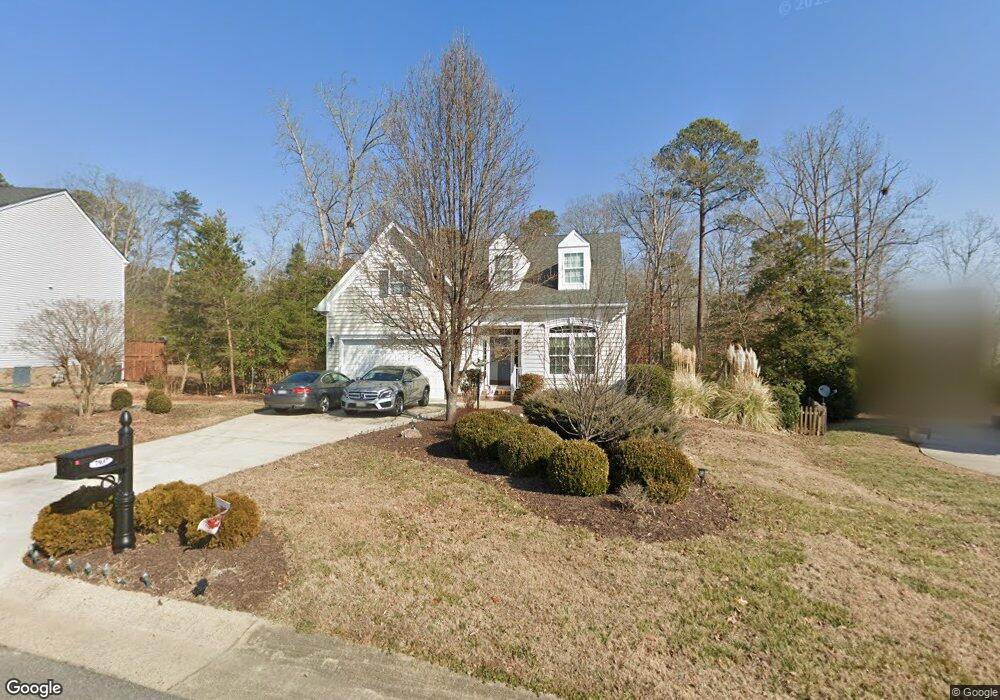
7937 Eagle Cir New Kent, VA 23124
Estimated Value: $484,000 - $538,000
4
Beds
3
Baths
2,954
Sq Ft
$174/Sq Ft
Est. Value
About This Home
This home is located at 7937 Eagle Cir, New Kent, VA 23124 and is currently estimated at $513,808, approximately $173 per square foot. 7937 Eagle Cir is a home located in New Kent County with nearby schools including New Kent High School.
Ownership History
Date
Name
Owned For
Owner Type
Purchase Details
Closed on
May 1, 2009
Sold by
Nvr Inc
Bought by
Quinn Michael P
Current Estimated Value
Home Financials for this Owner
Home Financials are based on the most recent Mortgage that was taken out on this home.
Original Mortgage
$280,690
Outstanding Balance
$177,442
Interest Rate
4.86%
Mortgage Type
New Conventional
Estimated Equity
$336,366
Purchase Details
Closed on
Mar 3, 2009
Sold by
Nkp Lb4 Llc
Bought by
Nvr Inc
Home Financials for this Owner
Home Financials are based on the most recent Mortgage that was taken out on this home.
Original Mortgage
$280,690
Outstanding Balance
$177,442
Interest Rate
4.86%
Mortgage Type
New Conventional
Estimated Equity
$336,366
Create a Home Valuation Report for This Property
The Home Valuation Report is an in-depth analysis detailing your home's value as well as a comparison with similar homes in the area
Home Values in the Area
Average Home Value in this Area
Purchase History
| Date | Buyer | Sale Price | Title Company |
|---|---|---|---|
| Quinn Michael P | $350,863 | -- | |
| Nvr Inc | $53,000 | -- |
Source: Public Records
Mortgage History
| Date | Status | Borrower | Loan Amount |
|---|---|---|---|
| Open | Nvr Inc | $280,690 |
Source: Public Records
Tax History
| Year | Tax Paid | Tax Assessment Tax Assessment Total Assessment is a certain percentage of the fair market value that is determined by local assessors to be the total taxable value of land and additions on the property. | Land | Improvement |
|---|---|---|---|---|
| 2025 | $2,937 | $489,500 | $102,300 | $387,200 |
| 2024 | $2,888 | $489,500 | $102,300 | $387,200 |
| 2023 | $2,698 | $402,700 | $94,300 | $308,400 |
| 2022 | $2,698 | $402,700 | $94,300 | $308,400 |
| 2021 | $3,069 | $388,500 | $68,800 | $319,700 |
| 2020 | $3,069 | $388,500 | $68,800 | $319,700 |
| 2019 | $2,884 | $351,700 | $51,200 | $300,500 |
| 2018 | $2,884 | $351,700 | $51,200 | $300,500 |
| 2017 | $2,603 | $313,600 | $44,600 | $269,000 |
| 2016 | $2,603 | $313,600 | $44,600 | $269,000 |
| 2015 | $2,582 | $307,400 | $44,600 | $262,800 |
| 2014 | -- | $307,400 | $44,600 | $262,800 |
Source: Public Records
Map
Nearby Homes
- 7370 Fougere Place
- 7761 Sedge Dr
- 7664 Lovegrass Terrace
- 7040 Spike Rush Ct
- 7038 Spike Rush Ct
- 7024 Spike Rush Ct
- 7039 Spike Rush Ct
- 7012 Spike Rush Ct
- 7037 Spike Rush Ct
- 7707 Arbor Marsh Terrace
- 7023 Spike Rush Ct
- 7709 Arbor Marsh Terrace
- 7713 Arbor Marsh Terrace
- 7571 Southamptonshire Way
- 7995 Arbor Marsh Terrace
- 7719 Arbor Marsh Terrace
- 7595 Broomsedge Ct
- 7430 E Danube Loop
- 7725 Arbor Marsh Terrace
- 7726 Arbor Marsh Terrace
- 7927 Eagle Cir
- 7947 Eagle Cir
- 7917 Eagle Cir
- 7938 Eagle Cir
- 7957 Eagle Cir
- 0000 Eagle St
- LOT 74 Eagle Cir
- 74 Eagle Cir
- 7981 Arbor Ponds Terrace
- 7991 Arbor Ponds Terrace
- 8001 Arbor Ponds Terrace
- 7975 Arbor Ponds Terrace
- 8009 Arbor Ponds Terrace
- 7907 Eagle Cir
- 7879 Uplands Dr
- 7968 Eagle Cir
- 7967 Eagle Cir
- 7904 Eagle Cir
- 7967 Arbor Ponds Terrace
- 8019 Arbor Ponds Terrace
Your Personal Tour Guide
Ask me questions while you tour the home.