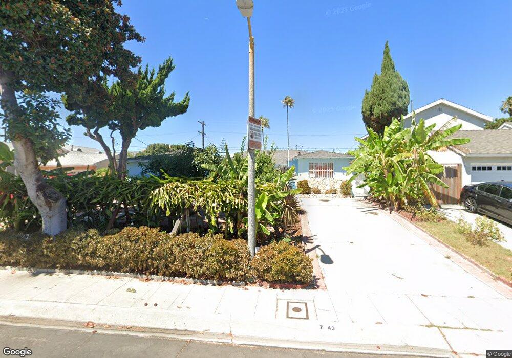
7943 Reading Ave Los Angeles, CA 90045
Westchester NeighborhoodEstimated Value: $1,306,000 - $1,713,000
4
Beds
3
Baths
1,755
Sq Ft
$879/Sq Ft
Est. Value
About This Home
This home is located at 7943 Reading Ave, Los Angeles, CA 90045 and is currently estimated at $1,542,288, approximately $878 per square foot. 7943 Reading Ave is a home located in Los Angeles County with nearby schools including Westport Heights Elementary, Wright Middle School STEAM Magnet, and Westchester Enriched Sciences Magnets.
Ownership History
Date
Name
Owned For
Owner Type
Purchase Details
Closed on
Jun 4, 2013
Sold by
Do Linh Thanh
Bought by
Do Loan Kim and Dominic Binh Thanh
Current Estimated Value
Purchase Details
Closed on
Oct 11, 2000
Sold by
Trust Bancud Marietta Tr Marietta Bancud
Bought by
Do Linh Thanh
Home Financials for this Owner
Home Financials are based on the most recent Mortgage that was taken out on this home.
Original Mortgage
$246,000
Outstanding Balance
$89,970
Interest Rate
7.96%
Estimated Equity
$1,452,318
Create a Home Valuation Report for This Property
The Home Valuation Report is an in-depth analysis detailing your home's value as well as a comparison with similar homes in the area
Home Values in the Area
Average Home Value in this Area
Purchase History
| Date | Buyer | Sale Price | Title Company |
|---|---|---|---|
| Do Loan Kim | -- | None Available | |
| Do Linh Thanh | $307,500 | Southland Title |
Source: Public Records
Mortgage History
| Date | Status | Borrower | Loan Amount |
|---|---|---|---|
| Open | Do Linh Thanh | $246,000 |
Source: Public Records
Tax History
| Year | Tax Paid | Tax Assessment Tax Assessment Total Assessment is a certain percentage of the fair market value that is determined by local assessors to be the total taxable value of land and additions on the property. | Land | Improvement |
|---|---|---|---|---|
| 2025 | $5,706 | $463,333 | $357,868 | $105,465 |
| 2024 | $5,706 | $454,249 | $350,851 | $103,398 |
| 2023 | $5,601 | $445,343 | $343,972 | $101,371 |
| 2022 | $5,350 | $436,612 | $337,228 | $99,384 |
| 2021 | $5,275 | $428,052 | $330,616 | $97,436 |
| 2019 | $5,120 | $415,357 | $320,810 | $94,547 |
| 2018 | $5,033 | $407,214 | $314,520 | $92,694 |
| 2016 | $4,802 | $391,403 | $302,307 | $89,096 |
| 2015 | $4,732 | $385,525 | $297,767 | $87,758 |
| 2014 | $4,754 | $377,974 | $291,935 | $86,039 |
Source: Public Records
Map
Nearby Homes
- 7931 Reading Ave
- 8130 Grimsby Ave
- 7801 Flight Ave
- 8324 Barnsley Ave
- 8418 Belford Ave
- 8436 Ramsgate Ave
- 7735 Isis Ave
- 8512 Belford Ave
- 5516 W 82nd St
- 5444 W 77th St
- 8421 Kittyhawk Ave
- 8620 Belford Ave Unit 106
- 8620 Belford Ave Unit 604
- 8420 Glider Ave
- 7361 Flight Ave
- 5429 W 76th St
- 8716 Ramsgate Ave
- 5400 W 82nd St
- 7559 Midfield Ave
- 8650 Belford Ave Unit 116A
- 8001 Reading Ave
- 7937 Reading Ave
- 7944 Ramsgate Ave
- 7950 Ramsgate Ave
- 8007 Reading Ave
- 7938 Ramsgate Ave
- 7956 Ramsgate Ave
- 7944 Reading Ave
- 7938 Reading Ave
- 8000 Reading Ave
- 7932 Ramsgate Ave
- 8013 Reading Ave
- 7925 Reading Ave
- 7932 Reading Ave
- 7962 Ramsgate Ave
- 8006 Reading Ave
- 7926 Ramsgate Ave
- 7924 Reading Ave
- 8019 Reading Ave
- 7919 Reading Ave
Your Personal Tour Guide
Ask me questions while you tour the home.