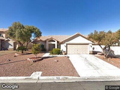
7959 Aspendale Dr Las Vegas, NV 89123
Silverado Ranch NeighborhoodEstimated Value: $454,000 - $482,000
3
Beds
2
Baths
1,708
Sq Ft
$272/Sq Ft
Est. Value
About This Home
This home is located at 7959 Aspendale Dr, Las Vegas, NV 89123 and is currently estimated at $464,575, approximately $271 per square foot. 7959 Aspendale Dr is a home located in Clark County with nearby schools including Louis Wiener Jr Elementary School, Charlotte Hill Elementary School, and Jack Lund Schofield Middle School.
Ownership History
Date
Name
Owned For
Owner Type
Purchase Details
Closed on
Aug 9, 2021
Sold by
Whyte Michael S and Whyte Colleen
Bought by
Whyte Michael S and Whyte Colleen
Current Estimated Value
Home Financials for this Owner
Home Financials are based on the most recent Mortgage that was taken out on this home.
Original Mortgage
$115,800
Interest Rate
2.2%
Mortgage Type
New Conventional
Create a Home Valuation Report for This Property
The Home Valuation Report is an in-depth analysis detailing your home's value as well as a comparison with similar homes in the area
Home Values in the Area
Average Home Value in this Area
Purchase History
| Date | Buyer | Sale Price | Title Company |
|---|---|---|---|
| Whyte Michael S | -- | Acme Title And Escrow Ser |
Source: Public Records
Mortgage History
| Date | Status | Borrower | Loan Amount |
|---|---|---|---|
| Closed | Whyte Michael S | $115,800 | |
| Closed | Whyte Michael S | $100,000 | |
| Closed | Whyte Michael S | $35,000 | |
| Closed | Whyte Michael S | $79,700 | |
| Closed | Whyte Michael S | $83,994 | |
| Closed | Whyte Colleen A | $99,261 |
Source: Public Records
Tax History Compared to Growth
Tax History
| Year | Tax Paid | Tax Assessment Tax Assessment Total Assessment is a certain percentage of the fair market value that is determined by local assessors to be the total taxable value of land and additions on the property. | Land | Improvement |
|---|---|---|---|---|
| 2025 | $1,959 | $96,821 | $35,700 | $61,121 |
| 2024 | $1,902 | $96,821 | $35,700 | $61,121 |
| 2023 | $1,552 | $89,814 | $31,150 | $58,664 |
| 2022 | $1,847 | $81,150 | $26,880 | $54,270 |
| 2021 | $1,793 | $77,167 | $25,200 | $51,967 |
| 2020 | $1,738 | $77,159 | $25,200 | $51,959 |
| 2019 | $1,687 | $74,248 | $22,750 | $51,498 |
| 2018 | $1,638 | $69,342 | $19,250 | $50,092 |
| 2017 | $2,014 | $68,686 | $17,500 | $51,186 |
| 2016 | $1,552 | $65,496 | $13,650 | $51,846 |
| 2015 | $1,548 | $62,605 | $11,550 | $51,055 |
| 2014 | $1,503 | $52,498 | $10,500 | $41,998 |
Source: Public Records
Map
Nearby Homes
- 8010 Coffee Tree Ct
- 1536 Leatherleaf Dr
- 7808 Brook Valley Dr
- 8024 Hackberry Dr
- 8072 Hackberry Dr
- 7724 Clearwood Ave
- 1163 Regal Lily Way
- 1673 Golden Vista Dr
- 8250 Lincoln Valley St
- 7754 Pink Ginger St
- 8266 Lincoln Valley St
- 7670 Descanso Ln
- 7970 Counterpoint Ln
- 1171 Middleriver Ct
- 1081 Overture Dr
- 8150 Beaverbrook Way
- 7898 Wishing Well Rd
- 8389 Charlton Valley Ct
- 8272 Beaverbrook Way
- 7559 Chambery Cove Ct
- 7959 Aspendale Dr
- 7967 Aspendale Dr
- 7951 Aspendale Dr
- 7975 Aspendale Dr
- 7943 Aspendale Dr
- 1538 Laurel Oak Dr
- 7968 Aspendale Dr
- 7983 Aspendale Dr
- 7935 Aspendale Dr
- 7976 Aspendale Dr
- 1554 Laurel Oak Dr
- 1539 Yellowwood Dr
- 7984 Aspendale Dr
- 7991 Aspendale Dr
- 7969 Snowberry Ct
- 7927 Aspendale Dr
- 1555 Yellowwood Dr
- 7977 Snowberry Ct
- 7992 Aspendale Dr
- 7999 Aspendale Dr