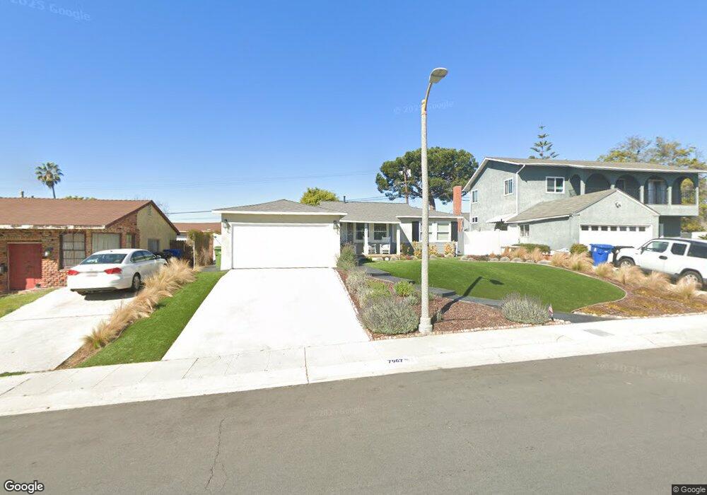
7967 Ramsgate Ave Los Angeles, CA 90045
Westchester NeighborhoodEstimated Value: $1,129,000 - $1,266,000
3
Beds
1
Bath
936
Sq Ft
$1,269/Sq Ft
Est. Value
About This Home
This home is located at 7967 Ramsgate Ave, Los Angeles, CA 90045 and is currently estimated at $1,187,502, approximately $1,268 per square foot. 7967 Ramsgate Ave is a home located in Los Angeles County with nearby schools including Westport Heights Elementary, Wright Middle School STEAM Magnet, and Westchester Enriched Sciences Magnets.
Ownership History
Date
Name
Owned For
Owner Type
Purchase Details
Closed on
Jun 23, 2015
Sold by
Rodriguez Rosalinda
Bought by
Rodriguez Rosalinda and Rosalinda Rodriguez Revocable Trust Of 2
Current Estimated Value
Purchase Details
Closed on
Jan 28, 2010
Sold by
Gray Jason
Bought by
Rodriguez Rosalinda
Home Financials for this Owner
Home Financials are based on the most recent Mortgage that was taken out on this home.
Original Mortgage
$417,000
Interest Rate
4.94%
Mortgage Type
New Conventional
Purchase Details
Closed on
Jan 3, 2002
Sold by
Keeling John
Bought by
Gray Jason and Gray Natalie
Home Financials for this Owner
Home Financials are based on the most recent Mortgage that was taken out on this home.
Original Mortgage
$248,000
Interest Rate
7.11%
Purchase Details
Closed on
Feb 11, 1999
Sold by
Brannum Glenn F
Bought by
Brannum Glenn F and Brannum Adaline W
Create a Home Valuation Report for This Property
The Home Valuation Report is an in-depth analysis detailing your home's value as well as a comparison with similar homes in the area
Home Values in the Area
Average Home Value in this Area
Purchase History
| Date | Buyer | Sale Price | Title Company |
|---|---|---|---|
| Rodriguez Rosalinda | -- | None Available | |
| Rodriguez Rosalinda | $465,000 | Fidelity National Title Co | |
| Gray Jason | $310,000 | American Title Co | |
| Brannum Glenn F | -- | -- |
Source: Public Records
Mortgage History
| Date | Status | Borrower | Loan Amount |
|---|---|---|---|
| Previous Owner | Rodriguez Rosalinda | $417,000 | |
| Previous Owner | Gray Jason | $248,000 | |
| Closed | Gray Jason | $62,000 |
Source: Public Records
Tax History
| Year | Tax Paid | Tax Assessment Tax Assessment Total Assessment is a certain percentage of the fair market value that is determined by local assessors to be the total taxable value of land and additions on the property. | Land | Improvement |
|---|---|---|---|---|
| 2025 | $7,250 | $600,220 | $480,179 | $120,041 |
| 2024 | $7,250 | $588,452 | $470,764 | $117,688 |
| 2023 | $7,114 | $576,915 | $461,534 | $115,381 |
| 2022 | $6,789 | $565,604 | $452,485 | $113,119 |
| 2021 | $6,703 | $554,514 | $443,613 | $110,901 |
| 2019 | $6,503 | $538,068 | $430,456 | $107,612 |
| 2018 | $6,425 | $527,518 | $422,016 | $105,502 |
| 2016 | $6,145 | $507,036 | $405,630 | $101,406 |
| 2015 | $6,055 | $499,421 | $399,538 | $99,883 |
| 2014 | -- | $489,639 | $391,712 | $97,927 |
Source: Public Records
Map
Nearby Homes
- 7931 Reading Ave
- 7801 Flight Ave
- 8324 Barnsley Ave
- 8130 Grimsby Ave
- 8436 Ramsgate Ave
- 8512 Belford Ave
- 7735 Isis Ave
- 8421 Kittyhawk Ave
- 8420 Glider Ave
- 5444 W 77th St
- 5516 W 82nd St
- 8620 Belford Ave Unit 106
- 8620 Belford Ave Unit 604
- 7361 Flight Ave
- 8716 Ramsgate Ave
- 5429 W 76th St
- 8650 Belford Ave Unit 116A
- 8650 Belford Ave
- 7912 Croydon Ave
- 6007 W 86th Place
- 7961 Ramsgate Ave
- 8001 Ramsgate Ave
- 7918 Kittyhawk Ave
- 7924 Kittyhawk Ave
- 7955 Ramsgate Ave
- 8007 Ramsgate Ave
- 7912 Kittyhawk Ave
- 8000 Kittyhawk Ave
- 7968 Ramsgate Ave
- 7962 Ramsgate Ave
- 7906 Kittyhawk Ave
- 8000 Ramsgate Ave
- 7949 Ramsgate Ave
- 7956 Ramsgate Ave
- 8013 Ramsgate Ave
- 7900 Kittyhawk Ave
- 7950 Ramsgate Ave
- 8006 Ramsgate Ave
- 7943 Ramsgate Ave
- 8019 Ramsgate Ave
Your Personal Tour Guide
Ask me questions while you tour the home.