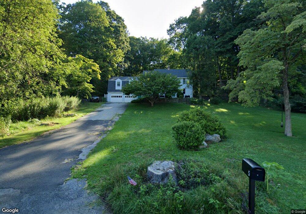
7A Maple St Weston, CT 06883
Estimated Value: $879,000 - $940,674
4
Beds
4
Baths
1,768
Sq Ft
$516/Sq Ft
Est. Value
About This Home
This home is located at 7A Maple St, Weston, CT 06883 and is currently estimated at $912,919, approximately $516 per square foot. 7A Maple St is a home located in Fairfield County with nearby schools including Hurlbutt Elementary School, Weston Intermediate School, and Weston Middle School.
Ownership History
Date
Name
Owned For
Owner Type
Purchase Details
Closed on
Apr 12, 2021
Sold by
Chikuni Michael and Wright Nadine T
Bought by
Gao Haiyong and Liu Min
Current Estimated Value
Purchase Details
Closed on
Aug 30, 1993
Sold by
Thresher Mark and Thresher Deborah
Bought by
Chikuni Michael and Chikuni Nadine
Purchase Details
Closed on
Jun 16, 1988
Sold by
Hasenauer William
Bought by
Thresher Mark
Create a Home Valuation Report for This Property
The Home Valuation Report is an in-depth analysis detailing your home's value as well as a comparison with similar homes in the area
Home Values in the Area
Average Home Value in this Area
Purchase History
| Date | Buyer | Sale Price | Title Company |
|---|---|---|---|
| Gao Haiyong | $655,000 | None Available | |
| Chikuni Michael | $240,000 | -- | |
| Thresher Mark | $315,000 | -- |
Source: Public Records
Mortgage History
| Date | Status | Borrower | Loan Amount |
|---|---|---|---|
| Previous Owner | Thresher Mark | $228,554 | |
| Previous Owner | Thresher Mark | $264,572 |
Source: Public Records
Tax History
| Year | Tax Paid | Tax Assessment Tax Assessment Total Assessment is a certain percentage of the fair market value that is determined by local assessors to be the total taxable value of land and additions on the property. | Land | Improvement |
|---|---|---|---|---|
| 2025 | $13,302 | $556,570 | $179,550 | $377,020 |
| 2024 | $13,063 | $556,570 | $179,550 | $377,020 |
| 2023 | $13,185 | $398,820 | $179,550 | $219,270 |
| 2022 | $13,149 | $398,820 | $179,550 | $219,270 |
| 2021 | $13,129 | $398,820 | $179,550 | $219,270 |
| 2020 | $11,358 | $350,870 | $179,550 | $171,320 |
| 2019 | $11,358 | $350,870 | $179,550 | $171,320 |
| 2018 | $10,310 | $350,800 | $210,000 | $140,800 |
| 2017 | $10,142 | $350,800 | $210,000 | $140,800 |
| 2016 | $10,019 | $350,800 | $210,000 | $140,800 |
| 2015 | $10,089 | $350,800 | $210,000 | $140,800 |
| 2014 | $9,907 | $350,800 | $210,000 | $140,800 |
Source: Public Records
Map
Nearby Homes
- 0 Old Mill Rd
- 852 Danbury Rd
- 0 Mountain Rd
- 96 Georgetown Rd
- 64 Portland Ave
- 00 Old Mill Rd
- 20 Mountain Rd
- 26 Wilridge Rd
- 38 Honey Hill Rd
- 349 Mountain Rd
- 123A Peaceable St
- 17 Tall Oaks Rd
- 131 Indian Hill Rd
- 78 Pin Oak Ln
- 22 Ledgewood Rd
- 299 Redding Rd
- 15 Laurel Hill Rd
- 12 Godfrey Rd W
- 74 Seventy Acre Rd
- 475 Danbury Rd
Your Personal Tour Guide
Ask me questions while you tour the home.