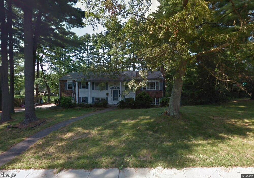
8 Flynn Rd Franklin, MA 02038
Estimated Value: $659,000 - $710,000
3
Beds
3
Baths
1,374
Sq Ft
$496/Sq Ft
Est. Value
About This Home
This home is located at 8 Flynn Rd, Franklin, MA 02038 and is currently estimated at $681,918, approximately $496 per square foot. 8 Flynn Rd is a home located in Norfolk County with nearby schools including Oak Street Elementary School, Horace Mann Middle School, and Franklin High School.
Ownership History
Date
Name
Owned For
Owner Type
Purchase Details
Closed on
Oct 29, 1996
Sold by
Hines Kevin P and Hines Shannon L
Bought by
Spinazola James G and Spinazola Krista E
Current Estimated Value
Home Financials for this Owner
Home Financials are based on the most recent Mortgage that was taken out on this home.
Original Mortgage
$158,300
Interest Rate
8.22%
Mortgage Type
Purchase Money Mortgage
Purchase Details
Closed on
Mar 30, 1993
Sold by
Ash Barbara
Bought by
Hines Kevin P and Hines Shannon L
Home Financials for this Owner
Home Financials are based on the most recent Mortgage that was taken out on this home.
Original Mortgage
$148,629
Interest Rate
7.73%
Mortgage Type
Purchase Money Mortgage
Create a Home Valuation Report for This Property
The Home Valuation Report is an in-depth analysis detailing your home's value as well as a comparison with similar homes in the area
Home Values in the Area
Average Home Value in this Area
Purchase History
| Date | Buyer | Sale Price | Title Company |
|---|---|---|---|
| Spinazola James G | $175,900 | -- | |
| Hines Kevin P | $150,000 | -- |
Source: Public Records
Mortgage History
| Date | Status | Borrower | Loan Amount |
|---|---|---|---|
| Open | Hines Kevin P | $165,300 | |
| Closed | Hines Kevin P | $158,300 | |
| Previous Owner | Hines Kevin P | $148,629 |
Source: Public Records
Tax History Compared to Growth
Tax History
| Year | Tax Paid | Tax Assessment Tax Assessment Total Assessment is a certain percentage of the fair market value that is determined by local assessors to be the total taxable value of land and additions on the property. | Land | Improvement |
|---|---|---|---|---|
| 2025 | $7,145 | $614,900 | $326,200 | $288,700 |
| 2024 | $6,941 | $588,700 | $326,200 | $262,500 |
| 2023 | $6,859 | $545,200 | $283,200 | $262,000 |
| 2022 | $6,259 | $445,500 | $214,600 | $230,900 |
| 2021 | $6,200 | $423,200 | $238,500 | $184,700 |
| 2020 | $5,779 | $398,300 | $222,700 | $175,600 |
| 2019 | $5,723 | $390,400 | $214,800 | $175,600 |
| 2018 | $5,396 | $368,300 | $210,900 | $157,400 |
| 2017 | $5,169 | $354,500 | $197,100 | $157,400 |
| 2016 | $4,887 | $337,000 | $199,800 | $137,200 |
| 2015 | $4,925 | $331,900 | $194,700 | $137,200 |
| 2014 | $4,451 | $308,000 | $170,800 | $137,200 |
Source: Public Records
Map
Nearby Homes
- 2 Noanet Brook Ln
- 208 Irondequoit Rd
- 1805 Franklin Crossing Rd
- 2211 Franklin Crossing Rd Unit 2211
- 159 Highwood Dr
- 214 Conlyn Ave
- 605 Franklin Crossing Rd
- 66 Highwood Dr
- 83 Highwood Dr Unit 83
- 60 Southgate Rd
- 336 Maple St
- 31 Highwood Dr
- 41 Kimberlee Ave
- 2 Kayla Dr
- 57 Raymond St Unit 2
- 33 Stone Ridge Rd Unit 33
- 109 Stone Ridge Rd Unit 109
- 6 Buena Vista Dr
- 16 Danforth Way
- 151 Stone Ridge Rd