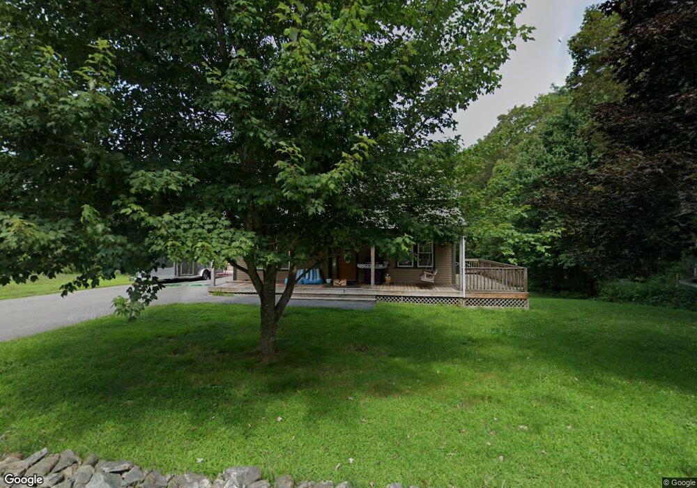
8 Mann Rd Shapleigh, ME 04076
Estimated Value: $301,611 - $408,000
3
Beds
1
Bath
864
Sq Ft
$408/Sq Ft
Est. Value
About This Home
This home is located at 8 Mann Rd, Shapleigh, ME 04076 and is currently estimated at $352,903, approximately $408 per square foot. 8 Mann Rd is a home with nearby schools including Massabesic High School.
Ownership History
Date
Name
Owned For
Owner Type
Purchase Details
Closed on
Sep 27, 2018
Sold by
Morissette Barbara L
Bought by
Morissette John P
Current Estimated Value
Purchase Details
Closed on
Dec 23, 2013
Sold by
Cross Brian and Cross Brian G
Bought by
Morissette Barbara L and Morissette John P
Create a Home Valuation Report for This Property
The Home Valuation Report is an in-depth analysis detailing your home's value as well as a comparison with similar homes in the area
Home Values in the Area
Average Home Value in this Area
Purchase History
| Date | Buyer | Sale Price | Title Company |
|---|---|---|---|
| Morissette John P | -- | -- | |
| Morissette John P | -- | -- | |
| Morissette Barbara L | -- | -- |
Source: Public Records
Tax History
| Year | Tax Paid | Tax Assessment Tax Assessment Total Assessment is a certain percentage of the fair market value that is determined by local assessors to be the total taxable value of land and additions on the property. | Land | Improvement |
|---|---|---|---|---|
| 2025 | $2,566 | $194,382 | $44,160 | $150,222 |
| 2024 | $2,342 | $194,382 | $44,160 | $150,222 |
| 2023 | $2,060 | $194,382 | $44,160 | $150,222 |
| 2022 | $2,002 | $194,382 | $44,160 | $150,222 |
| 2021 | $1,992 | $194,382 | $44,160 | $150,222 |
| 2020 | $926 | $194,382 | $44,160 | $150,222 |
| 2019 | $1,973 | $194,382 | $44,160 | $150,222 |
| 2018 | $831 | $178,273 | $30,824 | $147,449 |
| 2017 | $1,904 | $178,273 | $30,824 | $147,449 |
| 2016 | $2,920 | $178,273 | $30,824 | $147,449 |
| 2015 | $1,783 | $178,273 | $30,824 | $147,449 |
| 2014 | $1,720 | $178,273 | $30,824 | $147,449 |
Source: Public Records
Map
Nearby Homes
- 59 Main St
- 281 Gile Rd
- 220 Bond Spring Rd
- 367 Shady Nook Rd
- Lot 5 St Laurent Way
- 233 Cedar Dr
- 590 Newfield Rd
- Lot 35A Norton Ridge Rd
- 0 Mowry 0 Row Mowry Ln
- 422 Buzzell Rd
- 319 Asbury Ln
- Lot 3C Bridge St
- 3 Forest View Ln Unit 3
- 63 Dandy Rd
- 002-031-B Shapleigh Corner Rd
- 163 Buzzell Rd
- 00 Libby Rd Unit Lot 9
- 725 Water St
- 19 White Tail Ln
- Parcel #1 Sanborn Rd
Your Personal Tour Guide
Ask me questions while you tour the home.