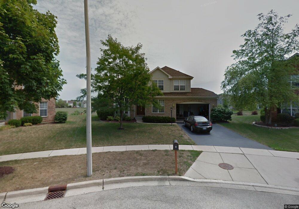
8 Sheffield Ct Algonquin, IL 60102
Estimated Value: $468,798 - $526,000
4
Beds
--
Bath
2,597
Sq Ft
$195/Sq Ft
Est. Value
About This Home
This home is located at 8 Sheffield Ct, Algonquin, IL 60102 and is currently estimated at $505,700, approximately $194 per square foot. 8 Sheffield Ct is a home located in Kane County with nearby schools including Westfield Community School and Harry D Jacobs High School.
Ownership History
Date
Name
Owned For
Owner Type
Purchase Details
Closed on
Jan 20, 2022
Sold by
Dattilo Anthony F and Dattilo Lisa K
Bought by
Anthony F Dattilo And Lisa K Dattilo Land Tru and Dattilo Lisa D
Current Estimated Value
Purchase Details
Closed on
Dec 15, 1997
Sold by
Willoughby Farms Third New Ltd Prtnrshp
Bought by
Dattilo Anthony F and Dattilo Lisa K
Home Financials for this Owner
Home Financials are based on the most recent Mortgage that was taken out on this home.
Original Mortgage
$196,800
Interest Rate
7.36%
Create a Home Valuation Report for This Property
The Home Valuation Report is an in-depth analysis detailing your home's value as well as a comparison with similar homes in the area
Home Values in the Area
Average Home Value in this Area
Purchase History
| Date | Buyer | Sale Price | Title Company |
|---|---|---|---|
| Anthony F Dattilo And Lisa K Dattilo Land Tru | -- | Lucas Law | |
| Dattilo Anthony F | $240,500 | Stewart Title Company |
Source: Public Records
Mortgage History
| Date | Status | Borrower | Loan Amount |
|---|---|---|---|
| Previous Owner | Dattilo Anthony F | $196,800 |
Source: Public Records
Tax History Compared to Growth
Tax History
| Year | Tax Paid | Tax Assessment Tax Assessment Total Assessment is a certain percentage of the fair market value that is determined by local assessors to be the total taxable value of land and additions on the property. | Land | Improvement |
|---|---|---|---|---|
| 2024 | $9,489 | $140,802 | $28,016 | $112,786 |
| 2023 | $9,009 | $126,689 | $25,208 | $101,481 |
| 2022 | $9,283 | $122,074 | $25,208 | $96,866 |
| 2021 | $8,990 | $115,262 | $23,801 | $91,461 |
| 2020 | $8,808 | $112,671 | $23,266 | $89,405 |
| 2019 | $8,520 | $106,960 | $22,087 | $84,873 |
| 2018 | $9,113 | $104,843 | $21,650 | $83,193 |
| 2017 | $8,754 | $98,076 | $20,253 | $77,823 |
| 2016 | $8,738 | $92,544 | $19,610 | $72,934 |
| 2015 | -- | $81,601 | $17,040 | $64,561 |
| 2014 | -- | $78,241 | $16,569 | $61,672 |
| 2013 | -- | $80,636 | $17,076 | $63,560 |
Source: Public Records
Map
Nearby Homes
- 2219 Barrett Dr
- 110 Newburgh Ln
- 1141 Waterford St
- 1111 Waterford St
- Adams Plan at Algonquin Meadows - Single Family
- Sequoia Plan at Algonquin Meadows - Single Family
- Bryce Plan at Algonquin Meadows - Single Family
- Rainier Plan at Algonquin Meadows - Single Family
- Santa Rosa Plan at Algonquin Meadows - Single Family
- Biscayne Plan at Algonquin Meadows - Single Family
- 1090 Glenmont St
- 1247 Glenmont St
- 1255 Glenmont St
- 1250 Glenmont St
- 1251 Glenmont St
- 1257 Glenmont St
- 1111 Glenmont St
- 1243 Glenmont St
- 1241 Glenmont St
- 1080 Glenmont St
- 6 Sheffield Ct
- 7 Sheffield Ct
- 4 Sheffield Ct
- 5 Sheffield Ct
- 2228 Moser Ln
- 2224 Moser Ln
- 3 Sheffield Ct
- 2232 Moser Ln
- 2231 Barrett Dr Unit 1
- 2229 Barrett Dr
- 2220 Moser Ln
- 2240 Moser Ln
- 2236 Moser Ln
- 2244 Moser Ln
- 2227 Barrett Dr
- 1 Sheffield Ct
- 2248 Moser Ln
- 2216 Moser Ln Unit 1
- 2225 Barrett Dr
- 2252 Moser Ln