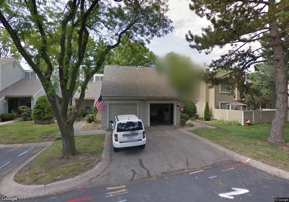
8011 Monrovia St Lenexa, KS 66215
Estimated Value: $241,000 - $266,134
3
Beds
2
Baths
1,188
Sq Ft
$211/Sq Ft
Est. Value
About This Home
This home is located at 8011 Monrovia St, Lenexa, KS 66215 and is currently estimated at $250,784, approximately $211 per square foot. 8011 Monrovia St is a home located in Johnson County with nearby schools including Rising Star Elementary School, Trailridge Middle School, and Shawnee Mission Northwest High School.
Ownership History
Date
Name
Owned For
Owner Type
Purchase Details
Closed on
Aug 26, 2022
Sold by
Fly Donald L and Fly Gloria
Bought by
Fly Donald L and Mccarty Gloria
Current Estimated Value
Home Financials for this Owner
Home Financials are based on the most recent Mortgage that was taken out on this home.
Original Mortgage
$108,000
Outstanding Balance
$91,886
Interest Rate
4.58%
Mortgage Type
New Conventional
Estimated Equity
$158,898
Purchase Details
Closed on
Apr 17, 2007
Sold by
Howell Gary R and Howell Sandra L
Bought by
Ewing Ryan
Purchase Details
Closed on
Jun 27, 2003
Sold by
Lovell Sunnye J
Bought by
Fly Donald L
Home Financials for this Owner
Home Financials are based on the most recent Mortgage that was taken out on this home.
Original Mortgage
$125,970
Interest Rate
5.27%
Mortgage Type
VA
Create a Home Valuation Report for This Property
The Home Valuation Report is an in-depth analysis detailing your home's value as well as a comparison with similar homes in the area
Home Values in the Area
Average Home Value in this Area
Purchase History
| Date | Buyer | Sale Price | Title Company |
|---|---|---|---|
| Fly Donald L | -- | New Title Company Name | |
| Ewing Ryan | -- | Chicago Title Insurance Co | |
| Fly Donald L | -- | Midwest Title Company |
Source: Public Records
Mortgage History
| Date | Status | Borrower | Loan Amount |
|---|---|---|---|
| Open | Fly Donald L | $108,000 | |
| Previous Owner | Fly Donald L | $125,970 |
Source: Public Records
Tax History Compared to Growth
Tax History
| Year | Tax Paid | Tax Assessment Tax Assessment Total Assessment is a certain percentage of the fair market value that is determined by local assessors to be the total taxable value of land and additions on the property. | Land | Improvement |
|---|---|---|---|---|
| 2024 | $2,400 | $21,988 | $3,795 | $18,193 |
| 2023 | $2,347 | $20,792 | $3,450 | $17,342 |
| 2022 | $2,256 | $19,953 | $3,002 | $16,951 |
| 2021 | $2,111 | $17,515 | $2,726 | $14,789 |
| 2020 | $2,027 | $16,629 | $2,474 | $14,155 |
| 2019 | $2,038 | $16,721 | $2,474 | $14,247 |
| 2018 | $1,848 | $14,984 | $2,248 | $12,736 |
| 2017 | $1,724 | $13,524 | $1,955 | $11,569 |
| 2016 | $1,623 | $12,547 | $1,955 | $10,592 |
| 2015 | $1,634 | $12,731 | $1,955 | $10,776 |
| 2013 | -- | $12,949 | $1,955 | $10,994 |
Source: Public Records
Map
Nearby Homes
- 7913 Colony Ln
- 12212 W 79th Terrace
- 7805 Long Ave
- 7917 Westgate Dr
- 12557 W 82nd Terrace
- 7818 Westgate Dr
- 7736 Westgate Dr
- 7904 Rosehill Rd
- 8277 Monrovia St
- 11926 W 82nd Terrace
- 11924 W 82nd Terrace
- 8215 Rosehill Rd
- 8011 Gillette St
- 12808 W 82nd St
- 7526 Monrovia St
- 7502 Monrovia St
- 11324 W 77th Terrace
- 8545 Westgate St
- 13136 W 84th St
- 13212 W 84th St
- 8009 Monrovia St
- 8007 Monrovia St
- 8030 Colony Ln
- 8005 Monrovia St
- 8032 Colony Ln
- 8013 Monrovia St
- 8034 Colony Ln
- 8003 Monrovia St
- 8017 Monrovia St
- 8036 Colony Ln
- 8019 Monrovia St
- 8001 Monrovia St
- 8021 Monrovia St
- 8038 Colony Ln
- 8026 Colony Ln
- 8023 Monrovia St
- 8024 Colony Ln
- 8022 Colony Ln
- 8040 Colony Ln
- 12201 W 79th Terrace