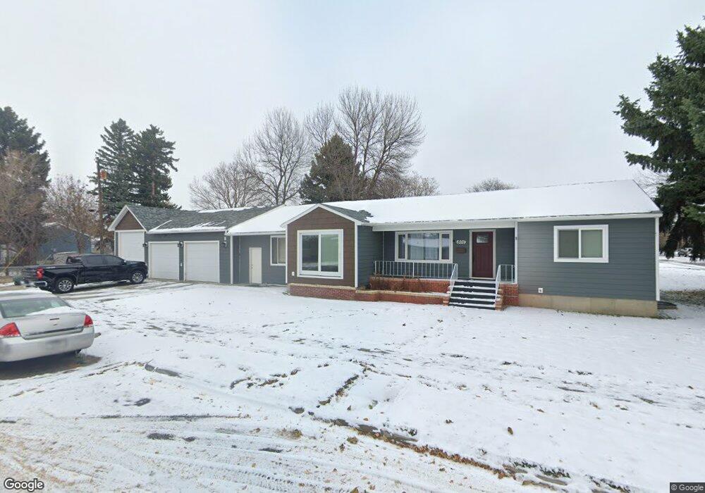
805 22nd St W Billings, MT 59102
West End NeighborhoodEstimated Value: $355,000 - $384,000
3
Beds
2
Baths
2,764
Sq Ft
$133/Sq Ft
Est. Value
About This Home
This home is located at 805 22nd St W, Billings, MT 59102 and is currently estimated at $367,187, approximately $132 per square foot. 805 22nd St W is a home located in Yellowstone County with nearby schools including Burlington School, Will James Junior High School, and Billings West High School.
Ownership History
Date
Name
Owned For
Owner Type
Purchase Details
Closed on
Dec 10, 2015
Sold by
Klein Family Land Co Llc
Bought by
Charbonneau Troy
Current Estimated Value
Home Financials for this Owner
Home Financials are based on the most recent Mortgage that was taken out on this home.
Original Mortgage
$188,000
Outstanding Balance
$149,121
Interest Rate
3.96%
Mortgage Type
New Conventional
Estimated Equity
$218,066
Purchase Details
Closed on
Feb 27, 2014
Sold by
Swords Joan T
Bought by
Klein Family Land Co Llc
Create a Home Valuation Report for This Property
The Home Valuation Report is an in-depth analysis detailing your home's value as well as a comparison with similar homes in the area
Home Values in the Area
Average Home Value in this Area
Purchase History
| Date | Buyer | Sale Price | Title Company |
|---|---|---|---|
| Charbonneau Troy | -- | Chicago Title | |
| Klein Family Land Co Llc | -- | None Available |
Source: Public Records
Mortgage History
| Date | Status | Borrower | Loan Amount |
|---|---|---|---|
| Open | Charbonneau Troy | $188,000 |
Source: Public Records
Tax History Compared to Growth
Tax History
| Year | Tax Paid | Tax Assessment Tax Assessment Total Assessment is a certain percentage of the fair market value that is determined by local assessors to be the total taxable value of land and additions on the property. | Land | Improvement |
|---|---|---|---|---|
| 2025 | $3,470 | $375,600 | $49,423 | $326,177 |
| 2024 | $3,470 | $363,200 | $45,463 | $317,737 |
| 2023 | $3,466 | $363,200 | $45,463 | $317,737 |
| 2022 | $3,002 | $275,200 | $43,346 | $231,854 |
| 2021 | $2,857 | $275,200 | $0 | $0 |
| 2020 | $2,763 | $253,200 | $0 | $0 |
| 2019 | $2,636 | $253,200 | $0 | $0 |
| 2018 | $2,400 | $224,800 | $0 | $0 |
| 2017 | $2,331 | $224,800 | $0 | $0 |
| 2016 | $2,198 | $214,400 | $0 | $0 |
| 2015 | $2,146 | $214,100 | $0 | $0 |
| 2014 | $1,835 | $96,354 | $0 | $0 |
Source: Public Records
Map
Nearby Homes
- 2300 Clark Ave
- 2124 Lewis Ave
- 2131 Hewitt Dr
- 2119 Hewitt Dr
- 0 Wyatt Cir Unit 356590
- 2013 Clark Ave
- 1119 21st St W
- 2305 Miles Ave
- 2422 Miles Ave
- 2540 Yellowstone Ave
- 2537 Clark Ave
- 2546 Burlington Ave
- 2620 Yellowstone Ave
- 1147 18th St W Unit 3
- 1823 Alderson Ave
- 2207 Central Ave
- 621 Nelson Dr
- 1720 Lewis Ave
- 1811 Alderson Ave
- 2636 Custer Ave
- 2137 Wyoming Ave
- 2127 Wyoming Ave
- 808 22nd St W
- 2203 Wyoming Ave
- 817 22nd St W
- 812 22nd St W
- 2132 Yellowstone Ave
- 717 22nd St W
- 2132 Wyoming Ave
- 816 22nd St W
- 2121 Wyoming Ave
- 2126 Yellowstone Ave
- 2204 Wyoming Ave
- 2128 Wyoming Ave
- 822 22nd St W
- 2124 Yellowstone Ave
- 2124 Wyoming Ave
- 2211 Wyoming Ave
- 714 22nd St W
- 2119 Wyoming Ave