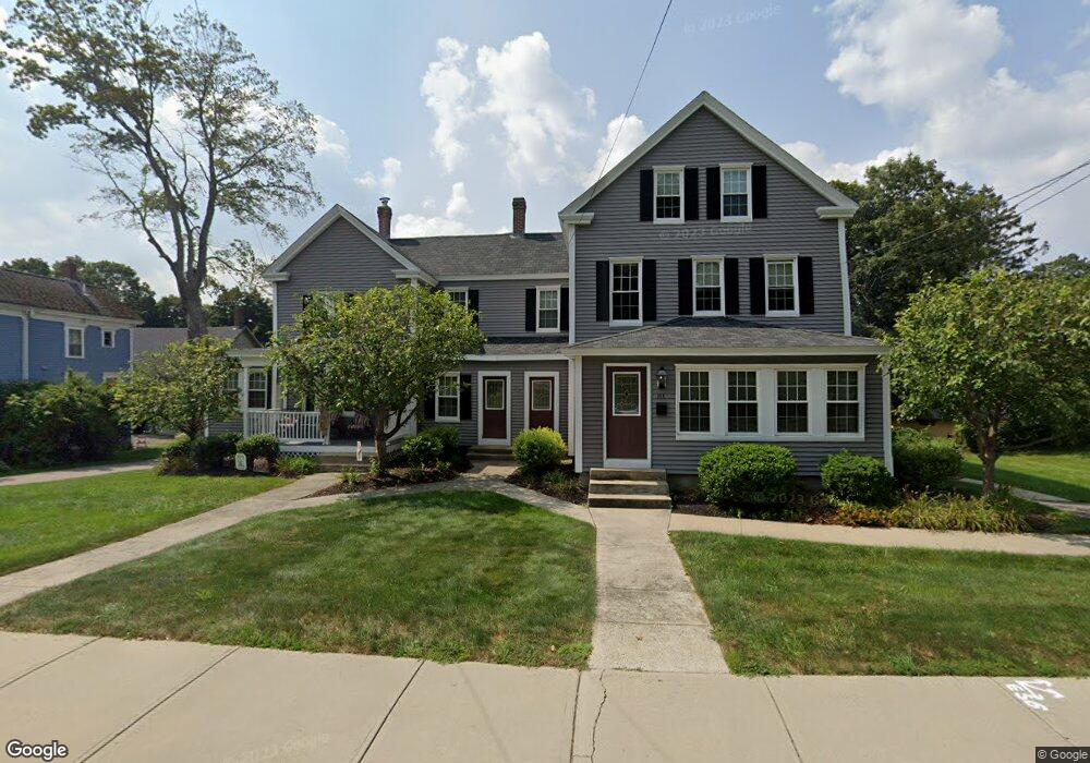
81 Union St Unit 81 Franklin, MA 02038
Downtown Franklin NeighborhoodEstimated Value: $821,297 - $952,000
3
Beds
2
Baths
2,200
Sq Ft
$399/Sq Ft
Est. Value
About This Home
This home is located at 81 Union St Unit 81, Franklin, MA 02038 and is currently estimated at $877,824, approximately $399 per square foot. 81 Union St Unit 81 is a home located in Norfolk County with nearby schools including Helen Keller Elementary School, Annie Sullivan Middle School, and Franklin High School.
Ownership History
Date
Name
Owned For
Owner Type
Purchase Details
Closed on
Apr 2, 2024
Sold by
Anthony Robert Realty Llc
Bought by
Odonnell Patrick
Current Estimated Value
Home Financials for this Owner
Home Financials are based on the most recent Mortgage that was taken out on this home.
Original Mortgage
$675,500
Outstanding Balance
$659,585
Interest Rate
6.63%
Mortgage Type
Purchase Money Mortgage
Estimated Equity
$218,239
Purchase Details
Closed on
Mar 14, 2024
Sold by
David Dale Realty Llc
Bought by
Silverman David and Silverman Silvana D
Home Financials for this Owner
Home Financials are based on the most recent Mortgage that was taken out on this home.
Original Mortgage
$675,500
Outstanding Balance
$659,585
Interest Rate
6.63%
Mortgage Type
Purchase Money Mortgage
Estimated Equity
$218,239
Purchase Details
Closed on
Aug 5, 2014
Sold by
Quinn David
Bought by
David Dale Realty Llc
Purchase Details
Closed on
May 29, 2013
Sold by
Pare Donna
Bought by
Quinn David
Home Financials for this Owner
Home Financials are based on the most recent Mortgage that was taken out on this home.
Original Mortgage
$243,750
Interest Rate
3.45%
Mortgage Type
New Conventional
Purchase Details
Closed on
Aug 14, 2007
Sold by
Pare Dorothy
Bought by
Pare Donna and Pare Dorothy M
Create a Home Valuation Report for This Property
The Home Valuation Report is an in-depth analysis detailing your home's value as well as a comparison with similar homes in the area
Home Values in the Area
Average Home Value in this Area
Purchase History
We collect this data history from publicly available records. To have your information removed, we recommend requesting removal directly through your county’s website.
| Date | Buyer | Sale Price | Title Company |
|---|---|---|---|
| Odonnell Patrick | $855,000 | None Available | |
| Silverman David | $965,000 | None Available | |
| Silverman David | $965,000 | None Available | |
| Silverman David | $965,000 | None Available | |
| David Dale Realty Llc | -- | -- | |
| David Dale Realty Llc | -- | -- | |
| David Dale Realty Llc | -- | -- | |
| Quinn David | $250,000 | -- | |
| Quinn David D | $250,000 | -- | |
| Quinn David | $250,000 | -- | |
| Pare Donna | -- | -- | |
| Pare Donna M | -- | -- | |
| Pare Donna | -- | -- |
Source: Public Records
Mortgage History
We collect this data history from publicly available records. To have your information removed, we recommend requesting removal directly through your county’s website.
| Date | Status | Borrower | Loan Amount |
|---|---|---|---|
| Open | Silverman David | $675,500 | |
| Closed | Silverman David | $675,500 | |
| Previous Owner | Quinn David | $243,750 |
Source: Public Records
Tax History
| Year | Tax Paid | Tax Assessment Tax Assessment Total Assessment is a certain percentage of the fair market value that is determined by local assessors to be the total taxable value of land and additions on the property. | Land | Improvement |
|---|---|---|---|---|
| 2025 | $9,068 | $780,400 | $245,800 | $534,600 |
| 2024 | $6,518 | $552,800 | $245,800 | $307,000 |
| 2023 | $6,535 | $519,500 | $268,300 | $251,200 |
| 2022 | $5,505 | $391,800 | $204,800 | $187,000 |
| 2021 | $5,615 | $383,300 | $213,300 | $170,000 |
| 2020 | $5,331 | $367,400 | $215,200 | $152,200 |
| 2019 | $4,828 | $329,300 | $188,800 | $140,500 |
| 2018 | $4,376 | $298,700 | $192,500 | $106,200 |
| 2017 | $4,464 | $306,200 | $188,800 | $117,400 |
| 2016 | $4,185 | $288,600 | $195,300 | $93,300 |
| 2015 | $3,921 | $264,200 | $176,500 | $87,700 |
| 2014 | $3,452 | $238,900 | $171,300 | $67,600 |
Source: Public Records
Map
Nearby Homes
- 14 Lexington St
- 55 Dean Ave
- 26 Mccarthy St
- 59 Cottage St
- 3 Edwards St
- 360 W Central St
- 87 Alpine Place Unit 2
- 33 Winter St Unit 2
- 90 E Central St Unit 304
- 17 Longhill Rd
- 38 Highwood Dr
- 23 Highwood Dr
- 119 Highwood Dr
- 3 Washington St
- 1 Washington St
- 7 Longobardi Dr
- 72 Uncas Ave Unit 1
- 2412 Franklin Crossing Rd Unit 2412
- 1811 Franklin Crossing Rd Unit 1811
- 6 Edmunds Way
- 81 Union St
- 83 Union St Unit 83
- 83 Union St Unit 1
- 89 Union St
- 73 Union St
- 84 Union St
- 80 Union St
- 95 Union St
- 82 Union St
- 90 Union St
- 65 Union St
- 65 Union St Unit 2
- 65-67 Union St
- 99 Union St
- 99 Union St Unit 2
- 101 Union St Unit 1F
- 99 Union St Unit 99
- 0 Upper Union St Unit 71490065
- 0 Upper Union St Unit 71592673
- 0 Upper Union St Unit 71898018
Your Personal Tour Guide
Ask me questions while you tour the home.