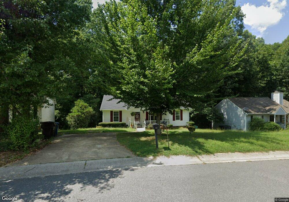
811 Riverbark Ln Durham, NC 27703
Eastern Durham NeighborhoodEstimated Value: $270,000 - $300,000
3
Beds
2
Baths
1,112
Sq Ft
$258/Sq Ft
Est. Value
About This Home
This home is located at 811 Riverbark Ln, Durham, NC 27703 and is currently estimated at $287,289, approximately $258 per square foot. 811 Riverbark Ln is a home located in Durham County with nearby schools including Bethesda Elementary School, John W Neal Middle School, and Southern School of Energy & Sustainability.
Ownership History
Date
Name
Owned For
Owner Type
Purchase Details
Closed on
Aug 6, 1999
Sold by
Eugene Meyer Eric and Eugene Amy A
Bought by
Winston Levone R
Current Estimated Value
Home Financials for this Owner
Home Financials are based on the most recent Mortgage that was taken out on this home.
Original Mortgage
$93,150
Outstanding Balance
$22,828
Interest Rate
5.75%
Estimated Equity
$264,461
Create a Home Valuation Report for This Property
The Home Valuation Report is an in-depth analysis detailing your home's value as well as a comparison with similar homes in the area
Home Values in the Area
Average Home Value in this Area
Purchase History
| Date | Buyer | Sale Price | Title Company |
|---|---|---|---|
| Winston Levone R | $104,000 | -- |
Source: Public Records
Mortgage History
| Date | Status | Borrower | Loan Amount |
|---|---|---|---|
| Open | Winston Levone R | $93,150 |
Source: Public Records
Tax History Compared to Growth
Tax History
| Year | Tax Paid | Tax Assessment Tax Assessment Total Assessment is a certain percentage of the fair market value that is determined by local assessors to be the total taxable value of land and additions on the property. | Land | Improvement |
|---|---|---|---|---|
| 2025 | $2,459 | $248,058 | $70,301 | $177,757 |
| 2024 | $2,181 | $156,354 | $30,153 | $126,201 |
| 2023 | $2,048 | $156,354 | $30,153 | $126,201 |
| 2022 | $2,001 | $156,354 | $30,153 | $126,201 |
| 2021 | $1,992 | $156,354 | $30,153 | $126,201 |
| 2020 | $1,945 | $156,354 | $30,153 | $126,201 |
| 2019 | $1,945 | $156,354 | $30,153 | $126,201 |
| 2018 | $1,602 | $118,081 | $21,192 | $96,889 |
| 2017 | $1,590 | $118,081 | $21,192 | $96,889 |
| 2016 | $1,536 | $118,081 | $21,192 | $96,889 |
| 2015 | $1,616 | $116,722 | $24,436 | $92,286 |
| 2014 | $1,616 | $116,722 | $24,436 | $92,286 |
Source: Public Records
Map
Nearby Homes
- 3533 Gibson Rd
- 3330 Nantuckett Ave
- 3323 Nantuckett Ave
- 3503 Grimes Ave
- 806 Kendall Dr
- 506 Currin St
- 1015 Sora Way
- 1218 Kendall Dr
- 210 Stoney Creek Cir
- 102 Harvest Oaks Ln Unit 38
- 3211 Ivey Wood Ln
- 806 Lindley Dr
- 2072 Tanners Mill Dr
- 1006 Spacious Skies Ln
- 2036 October Dr
- 1525 S Mineral Springs Rd
- 650 Ganyard Farm Way Unit 6
- 650 Ganyard Farm Way Unit 5
- 1030 Thoughtful Spot Ln
- 335 Pleasant Dr
- 807 Riverbark Ln
- 805 Riverbark Ln
- 819 Riverbark Ln
- 806 Riverbark Ln
- 812 Riverbark Ln
- 821 Riverbark Ln
- 816 Riverbark Ln
- 3309 Gibson Rd
- 3401 Gibson Rd
- 3307 Gibson Rd
- 818 Riverbark Ln
- 3405 Redgate Dr
- 820 Riverbark Ln
- 823 Riverbark Ln
- 822 Riverbark Ln
- 0 Gibson Rd
- 3115 Gibson Rd
- 3409 Gibson Rd
- 918 Riverbark Ln
- 3403 Redgate Dr