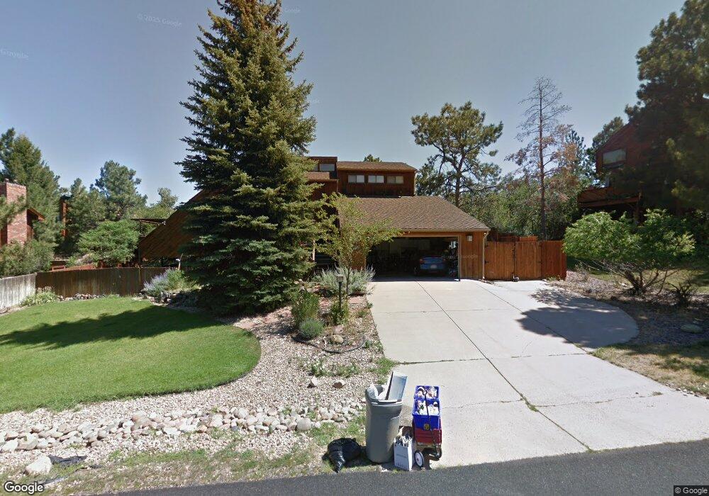
8129 E Lt William Clark Rd Parker, CO 80134
The Pinery NeighborhoodEstimated Value: $733,047 - $834,000
4
Beds
3
Baths
4,108
Sq Ft
$188/Sq Ft
Est. Value
About This Home
This home is located at 8129 E Lt William Clark Rd, Parker, CO 80134 and is currently estimated at $773,762, approximately $188 per square foot. 8129 E Lt William Clark Rd is a home located in Douglas County with nearby schools including Mountain View Elementary School, Northeast Elementary School, and Sagewood Middle School.
Ownership History
Date
Name
Owned For
Owner Type
Purchase Details
Closed on
Jun 6, 2013
Sold by
Miller Jeffrey W and Miller Katherine L
Bought by
Munsey James and Munsey Brandie
Current Estimated Value
Home Financials for this Owner
Home Financials are based on the most recent Mortgage that was taken out on this home.
Original Mortgage
$280,000
Outstanding Balance
$196,421
Interest Rate
3.41%
Mortgage Type
New Conventional
Estimated Equity
$577,341
Purchase Details
Closed on
Apr 24, 1995
Sold by
Haagenson Gary W and Haagenson Sally Ann
Bought by
Miller Jeffrey W and Miller Katherine L
Home Financials for this Owner
Home Financials are based on the most recent Mortgage that was taken out on this home.
Original Mortgage
$189,000
Interest Rate
8.33%
Purchase Details
Closed on
Aug 29, 1983
Sold by
Ward William T and Ward Carolyn A
Bought by
Haagenson Gary W and Haagenson Sally Ann
Create a Home Valuation Report for This Property
The Home Valuation Report is an in-depth analysis detailing your home's value as well as a comparison with similar homes in the area
Home Values in the Area
Average Home Value in this Area
Purchase History
| Date | Buyer | Sale Price | Title Company |
|---|---|---|---|
| Munsey James | $360,000 | Homestead Title & Escrow | |
| Miller Jeffrey W | $210,000 | -- | |
| Haagenson Gary W | $164,000 | -- |
Source: Public Records
Mortgage History
| Date | Status | Borrower | Loan Amount |
|---|---|---|---|
| Open | Munsey James | $280,000 | |
| Previous Owner | Miller Jeffrey W | $189,000 |
Source: Public Records
Tax History
| Year | Tax Paid | Tax Assessment Tax Assessment Total Assessment is a certain percentage of the fair market value that is determined by local assessors to be the total taxable value of land and additions on the property. | Land | Improvement |
|---|---|---|---|---|
| 2025 | $4,540 | $44,370 | $10,200 | $34,170 |
| 2024 | $4,540 | $58,080 | $10,430 | $47,650 |
| 2023 | $4,590 | $58,080 | $10,430 | $47,650 |
| 2022 | $3,107 | $38,520 | $6,050 | $32,470 |
| 2021 | $3,236 | $38,520 | $6,050 | $32,470 |
| 2020 | $3,078 | $37,530 | $5,760 | $31,770 |
| 2019 | $3,090 | $37,530 | $5,760 | $31,770 |
| 2018 | $2,787 | $33,260 | $5,440 | $27,820 |
| 2017 | $2,579 | $33,260 | $5,440 | $27,820 |
| 2016 | $2,595 | $32,760 | $4,780 | $27,980 |
| 2015 | $2,661 | $32,760 | $4,780 | $27,980 |
| 2014 | $2,342 | $25,780 | $3,180 | $22,600 |
Source: Public Records
Map
Nearby Homes
- 8350 E Lightening View Dr
- 5765 N Thunderhill Rd
- 5577 N Quinlin Ct
- 6363 N Donner Cir
- 5602 Silver Bluff Ct
- 7863 E Windfont Row
- 8517 Piute Row
- 7787 E Windfont Row
- 5953 Angie Ct
- 6591 N Windmont Ave
- 8056 E Windwood Way
- 7457 Gooseberry Ct
- 5588 Ponderosa Dr
- 8915 E Mad River Rd
- 7532 E Lakecliff Way
- 6920 N Hillside Way
- 8668 Windhaven Dr
- 5172 Horned Owl Way
- 5694 Hidden Oaks Way
- 6218 Northstar Ridge Ln
- 8149 E Lt William Clark Rd
- 8111 E Lt William Clark Rd
- 5835 N Irish Pat Murphy Dr
- 8130 E Lt William Clark Rd
- 8179 E Lt William Clark Rd
- 5839 N Irish Pat Murphy Dr
- 8146 E Lt William Clark Rd
- 8091 E Lt William Clark Rd
- 8108 E Lt William Clark Rd
- 5811 N Irish Pat Murphy Dr
- 8083 E Lt William Clark Rd
- 5841 N Irish Pat Murphy Dr
- 8152 E Lt William Clark Rd
- 5795 N Irish Pat Murphy Dr
- 8088 E Lt William Clark Rd
- 8112 E Lt William Clark Rd
- 5855 N Irish Pat Murphy Dr
- 8067 E Lt William Clark Rd
- 8156 E Lt William Clark Rd
- 8095 E Meriweather Lewis Dr
Your Personal Tour Guide
Ask me questions while you tour the home.