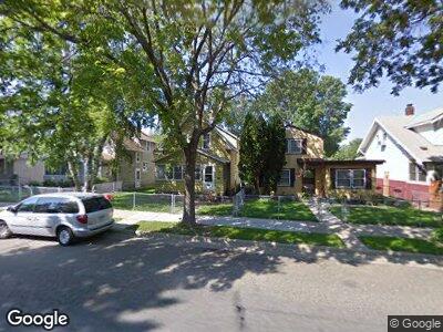
817 817 Minnehaha Ave W St. Paul, MN 55104
Frogtown NeighborhoodEstimated Value: $204,000 - $231,000
3
Beds
1
Bath
1,078
Sq Ft
$202/Sq Ft
Est. Value
About This Home
This home is located at 817 817 Minnehaha Ave W, St. Paul, MN 55104 and is currently estimated at $218,235, approximately $202 per square foot. 817 817 Minnehaha Ave W is a home located in Ramsey County with nearby schools including Maxfield Magnet Elementary School, Hidden River Middle School, and Central Senior High School.
Ownership History
Date
Name
Owned For
Owner Type
Purchase Details
Closed on
Dec 22, 2014
Sold by
U S Bank National Association
Bought by
Hemenway Michael
Current Estimated Value
Purchase Details
Closed on
Dec 19, 2013
Sold by
Goslar Michael J
Bought by
U S Bank National Association
Purchase Details
Closed on
Apr 29, 2008
Sold by
Hsbc Bank Usa Na
Bought by
Goslar Michael J
Purchase Details
Closed on
Feb 25, 1998
Sold by
Lehn Michael L and Lehn Sina L
Bought by
Mcdougall Monte D and Mcdougall Amy E
Create a Home Valuation Report for This Property
The Home Valuation Report is an in-depth analysis detailing your home's value as well as a comparison with similar homes in the area
Home Values in the Area
Average Home Value in this Area
Purchase History
| Date | Buyer | Sale Price | Title Company |
|---|---|---|---|
| Hemenway Michael | $61,000 | Trimverate Title Llc | |
| U S Bank National Association | $134,279 | None Available | |
| Goslar Michael J | $125,000 | -- | |
| Mcdougall Monte D | $63,300 | -- |
Source: Public Records
Mortgage History
| Date | Status | Borrower | Loan Amount |
|---|---|---|---|
| Open | Hemenway Michael | $106,500 |
Source: Public Records
Tax History Compared to Growth
Tax History
| Year | Tax Paid | Tax Assessment Tax Assessment Total Assessment is a certain percentage of the fair market value that is determined by local assessors to be the total taxable value of land and additions on the property. | Land | Improvement |
|---|---|---|---|---|
| 2023 | $3,262 | $205,500 | $18,000 | $187,500 |
| 2022 | $2,926 | $192,500 | $18,000 | $174,500 |
| 2021 | $2,584 | $177,700 | $20,000 | $157,700 |
| 2020 | $2,912 | $162,200 | $10,100 | $152,100 |
| 2019 | $2,282 | $159,800 | $10,100 | $149,700 |
| 2018 | $1,904 | $130,800 | $10,100 | $120,700 |
| 2017 | $1,620 | $111,500 | $10,100 | $101,400 |
| 2016 | $1,558 | $0 | $0 | $0 |
| 2015 | $1,432 | $91,400 | $10,100 | $81,300 |
| 2014 | $1,706 | $0 | $0 | $0 |
Source: Public Records
Map
Nearby Homes
- 839 Englewood Ave
- 785 Pierce Butler Route
- 857 Lafond Ave
- 917 Thomas Ave
- 751 Edmund Ave
- 665 Van Buren Ave
- 818 Edmund Ave
- 925 Thomas Ave
- 852 Edmund Ave
- 842 Edmund Ave
- 760 Edmund Ave
- 825 Charles Ave
- 646 Van Buren Ave
- 1000 Hubbard Ave
- 818 Sherburne Ave
- 1012 Hubbard Ave
- 679 Charles Ave
- 588 Van Buren Ave
- 945 Sherburne Ave
- 834 University Ave W
- 817 817 Minnehaha Ave W
- 817 Minnehaha Ave W
- 821 Minnehaha Ave W
- 813 Minnehaha Ave W
- 825 Minnehaha Ave W
- 809 Minnehaha Ave W
- 831 Minnehaha Ave W
- 818 Englewood Ave
- 822 Englewood Ave
- 814 Englewood Ave
- 805 805 Minnehaha Ave W
- 805 Minnehaha Ave W
- 824 Englewood Ave
- 810 Englewood Ave
- 828 Englewood Ave
- 806 Englewood Ave
- 818 Minnehaha Ave W
- 837 Minnehaha Ave W
- 822 Minnehaha Ave W
- 814 Minnehaha Ave W