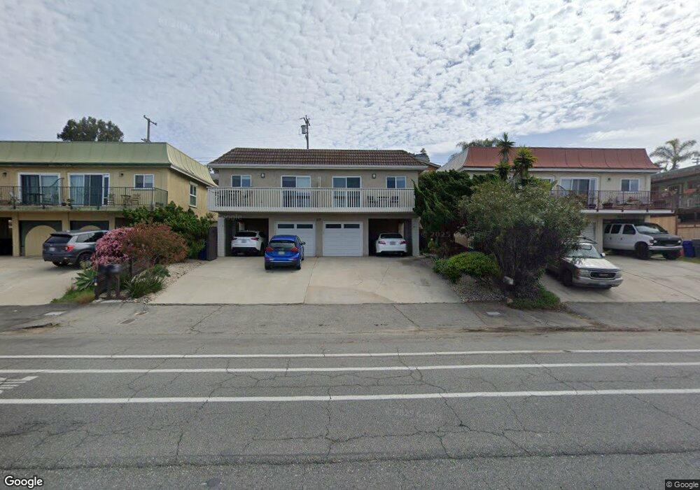
817 S Vulcan Ave Unit 19 Encinitas, CA 92024
Central Encinitas NeighborhoodEstimated Value: $2,305,218 - $2,973,000
4
Beds
2
Baths
2,180
Sq Ft
$1,198/Sq Ft
Est. Value
About This Home
This home is located at 817 S Vulcan Ave Unit 19, Encinitas, CA 92024 and is currently estimated at $2,611,305, approximately $1,197 per square foot. 817 S Vulcan Ave Unit 19 is a home located in San Diego County with nearby schools including Paul Ecke-Central Elementary, Oak Crest Middle School, and La Costa Canyon High School.
Ownership History
Date
Name
Owned For
Owner Type
Purchase Details
Closed on
Jan 10, 2020
Sold by
Georgeson A John A and Georgeson Elisabeth Ann
Bought by
Georgeson Elisabeth Ann
Current Estimated Value
Purchase Details
Closed on
Nov 27, 2019
Sold by
Georgeson Elisabeth Ann
Bought by
Georgeson Elisabeth A and Elisabeth Georgeson Trust
Purchase Details
Closed on
Aug 8, 1986
Purchase Details
Closed on
Jan 17, 1983
Create a Home Valuation Report for This Property
The Home Valuation Report is an in-depth analysis detailing your home's value as well as a comparison with similar homes in the area
Home Values in the Area
Average Home Value in this Area
Purchase History
| Date | Buyer | Sale Price | Title Company |
|---|---|---|---|
| Georgeson Elisabeth Ann | -- | None Available | |
| Georgeson Elisabeth A | -- | None Available | |
| -- | $188,000 | -- | |
| -- | $145,000 | -- |
Source: Public Records
Tax History
| Year | Tax Paid | Tax Assessment Tax Assessment Total Assessment is a certain percentage of the fair market value that is determined by local assessors to be the total taxable value of land and additions on the property. | Land | Improvement |
|---|---|---|---|---|
| 2025 | $4,365 | $367,006 | $139,202 | $227,804 |
| 2024 | $4,365 | $359,811 | $136,473 | $223,338 |
| 2023 | $4,212 | $352,757 | $133,798 | $218,959 |
| 2022 | $4,132 | $345,841 | $131,175 | $214,666 |
| 2021 | $4,061 | $339,060 | $128,603 | $210,457 |
| 2020 | $4,159 | $335,585 | $127,285 | $208,300 |
| 2019 | $4,083 | $329,006 | $124,790 | $204,216 |
| 2018 | $4,086 | $322,556 | $122,344 | $200,212 |
| 2017 | $4,045 | $316,233 | $119,946 | $196,287 |
| 2016 | $3,931 | $310,034 | $117,595 | $192,439 |
| 2015 | $3,844 | $305,378 | $115,829 | $189,549 |
| 2014 | $3,871 | $299,397 | $113,561 | $185,836 |
Source: Public Records
Map
Nearby Homes
- 687 S Coast Highway 101 Unit 223
- 937 3rd St
- 922 Sealane Dr Unit B
- 806 4th St
- 823 Stratford Dr
- 554 & 556 Stratford Dr
- 538 4th St
- 1180 Devonshire Dr
- 407 Requeza St Unit E9
- 90 N Coast Highway 101
- 231 5th St
- 201 4th St Unit A & B
- 103 Mangano Cir
- 100 5th St
- 1009 Arcadia Rd
- 215 N Vulcan Ave
- 545 Quail Pointe Ln
- 548 Quail Pointe Ln
- 200 Neptune Ave Unit 2
- 664 Sea Ridge Ct
- 811 S Vulcan Ave Unit 13
- 825 S Vulcan Ave Unit 27
- 805 S Vulcan Ave Unit 7
- 835 S Vulcan Ave Unit 37
- 818 Dewitt Ave
- 826 Dewitt Ave
- 810 Dewitt Ave
- 843 S Vulcan Ave
- 834 Dewitt Ave Unit 36
- 802 Dewitt Ave
- 836 Dewitt Ave
- 848 Dewitt Ave
- 851 S Vulcan Ave
- 854 Dewitt Ave
- 852 Dewitt Ave
- 753 S Vulcan Ave
- 5 E H St Unit 5
- 857 S Vulcan Ave
- 758 Dewitt Ave Unit 60
- 858 Dewitt Ave
Your Personal Tour Guide
Ask me questions while you tour the home.