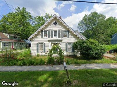
82 Bridge St Hillsborough, NH 03244
Hillsboro NeighborhoodEstimated Value: $285,000 - $380,000
3
Beds
2
Baths
2,263
Sq Ft
$150/Sq Ft
Est. Value
About This Home
This home is located at 82 Bridge St, Hillsborough, NH 03244 and is currently estimated at $338,478, approximately $149 per square foot. 82 Bridge St is a home with nearby schools including Hillsboro-Deering Elementary School and Hillsboro Christian School.
Ownership History
Date
Name
Owned For
Owner Type
Purchase Details
Closed on
Mar 28, 2019
Sold by
Great Brook Handle Shop
Bought by
Mas Amanda
Current Estimated Value
Home Financials for this Owner
Home Financials are based on the most recent Mortgage that was taken out on this home.
Original Mortgage
$147,170
Outstanding Balance
$130,438
Interest Rate
4.3%
Mortgage Type
New Conventional
Estimated Equity
$208,040
Purchase Details
Closed on
Jul 20, 2000
Sold by
Spiegal Toni J
Bought by
Knee Richard D and Knee Sandra L Bentle
Home Financials for this Owner
Home Financials are based on the most recent Mortgage that was taken out on this home.
Original Mortgage
$88,200
Interest Rate
8.28%
Mortgage Type
Purchase Money Mortgage
Create a Home Valuation Report for This Property
The Home Valuation Report is an in-depth analysis detailing your home's value as well as a comparison with similar homes in the area
Home Values in the Area
Average Home Value in this Area
Purchase History
| Date | Buyer | Sale Price | Title Company |
|---|---|---|---|
| Mas Amanda | $160,000 | -- | |
| Knee Richard D | $77,500 | -- |
Source: Public Records
Mortgage History
| Date | Status | Borrower | Loan Amount |
|---|---|---|---|
| Open | Mas Amanda | $147,170 | |
| Previous Owner | Knee Richard D | $88,200 |
Source: Public Records
Tax History Compared to Growth
Tax History
| Year | Tax Paid | Tax Assessment Tax Assessment Total Assessment is a certain percentage of the fair market value that is determined by local assessors to be the total taxable value of land and additions on the property. | Land | Improvement |
|---|---|---|---|---|
| 2024 | $6,263 | $187,300 | $39,100 | $148,200 |
| 2023 | $5,848 | $187,300 | $39,100 | $148,200 |
| 2022 | $4,999 | $187,300 | $39,100 | $148,200 |
| 2021 | $5,417 | $187,300 | $39,100 | $148,200 |
| 2020 | $5,381 | $187,300 | $39,100 | $148,200 |
| 2018 | $5,266 | $178,500 | $28,500 | $150,000 |
| 2017 | $5,439 | $178,500 | $28,500 | $150,000 |
| 2016 | $5,021 | $170,100 | $21,500 | $148,600 |
| 2015 | $4,941 | $170,100 | $21,500 | $148,600 |
| 2014 | $4,688 | $170,100 | $21,500 | $148,600 |
| 2013 | $4,773 | $170,100 | $21,500 | $148,600 |
Source: Public Records
Map
Nearby Homes
- 1 W Main St
- 32 Central St
- 5 Wyman Rd
- 20 Old Henniker Rd Unit 36
- 20 Keyes Farm Rd
- 20 Wyman Rd
- 23 Hubbard Rd
- 81 Center Rd
- 34 Boulder Rd
- 5 Beard Rd
- 6 Beard Rd
- 11B -425 W Main St
- 36 Bradford Cir
- 258 Old Henniker Rd
- 0 Red Fox Crossing Unit 4858470
- 000 Gibson Mountain Rd
- Lot 14 Old Mill Farm Rd
- 0 Raccoon Alley Unit 4855473
- 371 Center Rd
- 0 Midnight Walk Unit 4914126